Radyr elevation
Radyr (Wales, Cardiff), United Kingdom elevation is 68 meters and Radyr elevation in feet is 223 ft above sea level [src 1]. Radyr is a populated place (feature code) with elevation that is 4 meters (13 ft) smaller than average city elevation in United Kingdom.
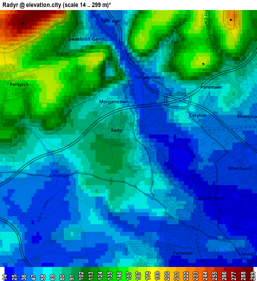
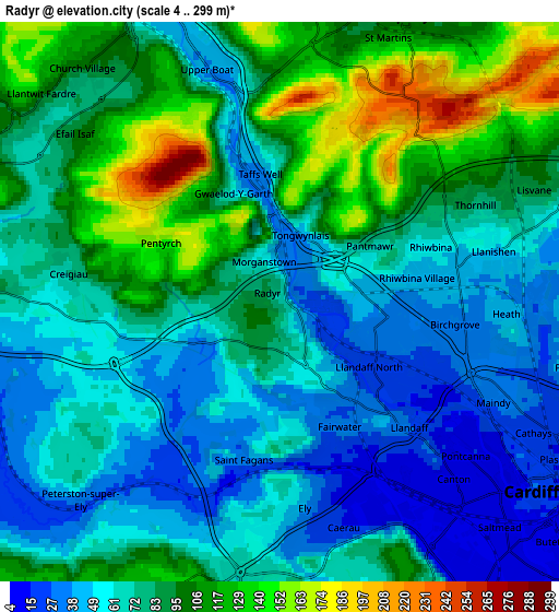
Below is the Elevation map of Radyr, which displays elevation range with different colors. Scale of the first map is from 14 to 299 m (46 to 981 ft) with average elevation of 75 meters (=246 ft) [note 1]
These maps also provides idea of topography and contour of this city, they are displayed at different zoom levels. More info about maps, scale and edge coordinates you can find below images.
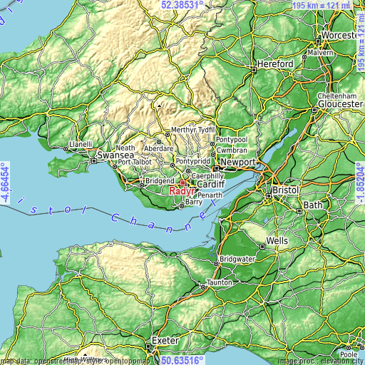
| \ | Map #1 | Map #2 | Topo.Map |
| Scale [m] | 14..299 m | 4..299 m | × |
| Scale [ft] | 46..981 ft | 13..981 ft | × |
| Average | 75 m = 246 ft | 78.8 m = 259 ft | × |
| Width | 6.08 km = 3.8 mi | 12.16 km = 7.6 mi | 194.6 km = 120.9 mi |
| Height | 6.08 km = 3.8 mi | 12.16 km = 7.6 mi | 194.6 km = 120.9 mi |
| ↑Max Latitude | 51.545977° | 51.573298° | 52.38531° |
| Latitude at center | 51.51864° | 51.51864° | 51.51864° |
| ↓Min Latitude | 51.491286° | 51.463916° | 50.63516° |
| ← Min Longitude | -3.302235° | -3.346181° | -4.66454° |
| Longitude center | -3.25829° | -3.25829° | -3.25829° |
| →Max Longitude | -3.214345° | -3.170399° | -1.85204° |
Nearby cities:
Cities around Radyr sort by population:
• Cardiff elevation 17 m
6.9 km,  128°
128°
• Caerphilly 94 m
6.8 km,  24°
24°
• Llantrisant 101 m
8.4 km,  286°
286°
• Bedwas 67 m
9.1 km,  26°
26°
• Beddau 116 m
7.9 km,  299°
299°
• Dinas Powys 15 m
9.8 km,  161°
161°
• Abertridwr 145 m
8.6 km,  355°
355°
• Pontyclun 49 m
9.2 km,  272°
272°
• Llantwit Fardre 76 m
6.5 km,  307°
307°
• Llanbradach 95 m
9.9 km,  11°
11°
• Pentyrch 142 m
2.8 km, 294°
• Wenvoe 52 m
7.9 km,  182°
182°
Multilingual:
 En español:
Radyr elevación 68 m.
 En France:
Radyr élévation 68 m.


Sources and notes:
- [note 1] Map square and city borders are not equal. Map elevation data is calculated only from area inside that square.
- [src 1] Elevation data from geonames database provided with same terms of usage.
- [src 2] The elevation map of Radyr is generated using elevation data from NASA's 3 arcsec (90m) resolution SRTM data.
- [src 3] Base (background) map © OpenStreetMap contributors tiles are generated by Geofabrik and OpenTopoMap.
Copyright & License:
This Radyr Elevation Map is licensed under CC BY-SA. You may reuse any part from this page, if you give a proper credit by linking to this URL:
 More info on terms of use page.