Beddau elevation
Beddau (Wales, Rhondda Cynon Taf), United Kingdom elevation is 116 meters and Beddau elevation in feet is 381 ft above sea level [src 1]. Beddau is a populated place (feature code) with elevation that is 44 meters (144 ft) bigger than average city elevation in United Kingdom.
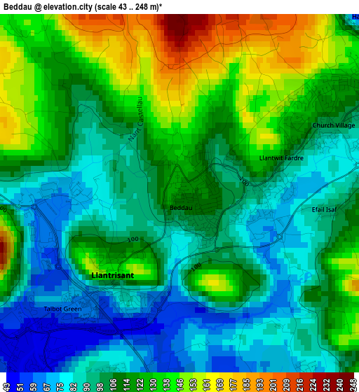
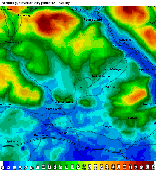
Below is the Elevation map of Beddau, which displays elevation range with different colors. Scale of the first map is from 43 to 248 m (141 to 814 ft) with average elevation of 111.3 meters (=365 ft) [note 1]
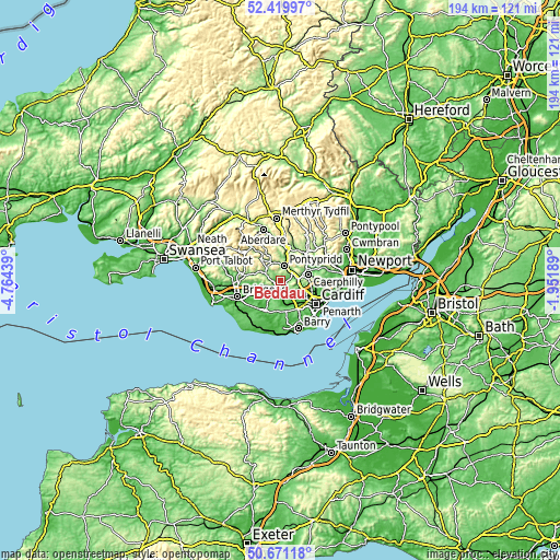
These maps also provides idea of topography and contour of this city, they are displayed at different zoom levels. More info about maps, scale and edge coordinates you can find below images.
| \ | Map #1 | Map #2 | Topo.Map |
| Scale [m] | 43..248 m | 18..379 m | × |
| Scale [ft] | 141..814 ft | 59..1243 ft | × |
| Average | 111.3 m = 365 ft | 128.7 m = 422 ft | × |
| Width | 6.08 km = 3.8 mi | 12.15 km = 7.5 mi | 194.4 km = 120.8 mi |
| Height | 6.08 km = 3.8 mi | 12.15 km = 7.5 mi | 194.4 km = 120.8 mi |
| ↑Max Latitude | 51.581296° | 51.608596° | 52.41997° |
| Latitude at center | 51.55398° | 51.55398° | 51.55398° |
| ↓Min Latitude | 51.526648° | 51.499299° | 50.67118° |
| ← Min Longitude | -3.402085° | -3.446031° | -4.76439° |
| Longitude center | -3.35814° | -3.35814° | -3.35814° |
| →Max Longitude | -3.314195° | -3.270249° | -1.95189° |
Nearby cities:
Cities around Beddau sort by population:
• Pontypridd elevation 68 m
5.5 km,  11°
11°
• Llantrisant 101 m
1.9 km,  215°
215°
• Tonyrefail 143 m
6 km,  303°
303°
• Brynna 80 m
7.5 km,  256°
256°
• Abertridwr 145 m
7.8 km,  53°
53°
• Pontyclun 49 m
4.3 km,  212°
212°
• Llanharan 76 m
5.9 km,  252°
252°
• Radyr 68 m
7.9 km,  119°
119°
• Llantwit Fardre 76 m
1.8 km,  87°
87°
• Llanharry 90 m
6.8 km,  229°
229°
• Pentyrch 142 m
5.2 km, 122°
• Porth 147 m
7.3 km,  334°
334°
Multilingual:
 En español:
Beddau elevación 116 m.
 En France:
Beddau élévation 116 m.


Sources and notes:
- [note 1] Map square and city borders are not equal. Map elevation data is calculated only from area inside that square.
- [src 1] Elevation data from geonames database provided with same terms of usage.
- [src 2] The elevation map of Beddau is generated using elevation data from NASA's 3 arcsec (90m) resolution SRTM data.
- [src 3] Base (background) map © OpenStreetMap contributors tiles are generated by Geofabrik and OpenTopoMap.
Copyright & License:
This Beddau Elevation Map is licensed under CC BY-SA. You may reuse any part from this page, if you give a proper credit by linking to this URL:
 More info on terms of use page.