Stourport-on-Severn elevation
Stourport-on-Severn (England, Worcestershire), United Kingdom elevation is 34 meters and Stourport-on-Severn elevation in feet is 112 ft above sea level [src 1]. Stourport-on-Severn is a seat of a fourth-order administrative division (feature code) with elevation that is 38 meters (125 ft) smaller than average city elevation in United Kingdom.
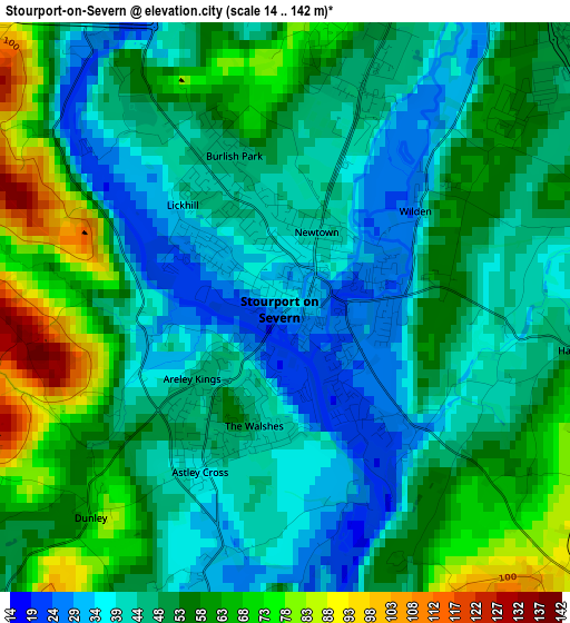
Below is the Elevation map of Stourport-on-Severn, which displays elevation range with different colors. Scale of the first map is from 14 to 142 m (46 to 466 ft) with average elevation of 50.8 meters (=167 ft) [note 1]
These maps also provides idea of topography and contour of this city, they are displayed at different zoom levels. More info about maps, scale and edge coordinates you can find below images.
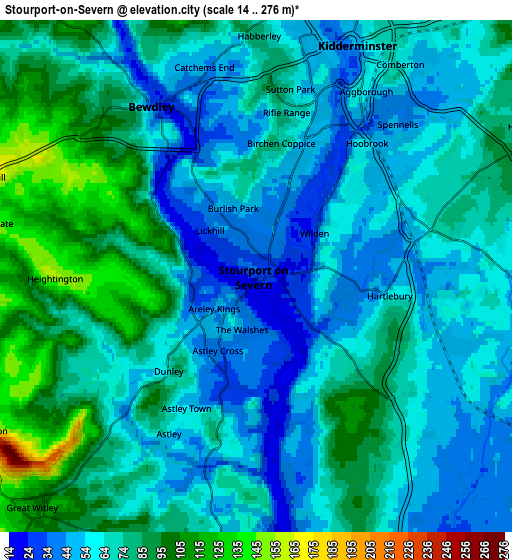
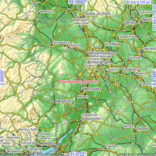
| \ | Map #1 | Map #2 | Topo.Map |
| Scale [m] | 14..142 m | 14..276 m | × |
| Scale [ft] | 46..466 ft | 46..906 ft | × |
| Average | 50.8 m = 167 ft | 69.1 m = 227 ft | × |
| Width | 5.97 km = 3.7 mi | 11.94 km = 7.4 mi | 191.1 km = 118.7 mi |
| Height | 5.97 km = 3.7 mi | 11.94 km = 7.4 mi | 191.1 km = 118.7 mi |
| ↑Max Latitude | 52.366601° | 52.393427° | 53.19062° |
| Latitude at center | 52.33976° | 52.33976° | 52.33976° |
| ↓Min Latitude | 52.312902° | 52.286028° | 51.4722° |
| ← Min Longitude | -2.324285° | -2.368231° | -3.68659° |
| Longitude center | -2.28034° | -2.28034° | -2.28034° |
| →Max Longitude | -2.236395° | -2.192449° | -0.87409° |
Nearby cities:
Cities around Stourport-on-Severn sort by population:
• Kidderminster elevation 37 m
5.8 km,  20°
20°
• Droitwich 42 m
12 km,  132°
132°
• Bewdley 40 m
4.8 km,  327°
327°
• Kinvere 64 m
12.7 km,  14°
14°
• Fernhill Heath 51 m
13.5 km,  154°
154°
• Highley 108 m
14 km, 330°
• Hartlebury 71 m
3.3 km,  102°
102°
• Lower Broadheath 65 m
14 km,  179°
179°
• Wychbold 56 m
12.5 km,  116°
116°
• Belbroughton 116 m
12.4 km,  62°
62°
• Hallow 45 m
13.1 km,  172°
172°
• Romsley 133 m
12.5 km,  348°
348°
Multilingual:
 En español:
Stourport-on-Severn elevación 34 m.
 En France:
Stourport-on-Severn élévation 34 m.
 Auf Deutsch:
Stourport-on-Severn höhe über dem Meeresspiegel ist 34 m.
 На русском:
Stourport-on-Severn высота над уровнем моря 34 м
Sources and notes:
- [note 1] Map square and city borders are not equal. Map elevation data is calculated only from area inside that square.
- [src 1] Elevation data from geonames database provided with same terms of usage.
- [src 2] The elevation map of Stourport-on-Severn is generated using elevation data from NASA's 3 arcsec (90m) resolution SRTM data.
- [src 3] Base (background) map © OpenStreetMap contributors tiles are generated by Geofabrik and OpenTopoMap.
Copyright & License:
This Stourport-on-Severn Elevation Map is licensed under CC BY-SA. You may reuse any part from this page, if you give a proper credit by linking to this URL:
 More info on terms of use page.