Lower Broadheath elevation
Lower Broadheath (England, Worcestershire), United Kingdom elevation is 65 meters and Lower Broadheath elevation in feet is 213 ft above sea level [src 1]. Lower Broadheath is a populated place (feature code) with elevation that is 7 meters (23 ft) smaller than average city elevation in United Kingdom.
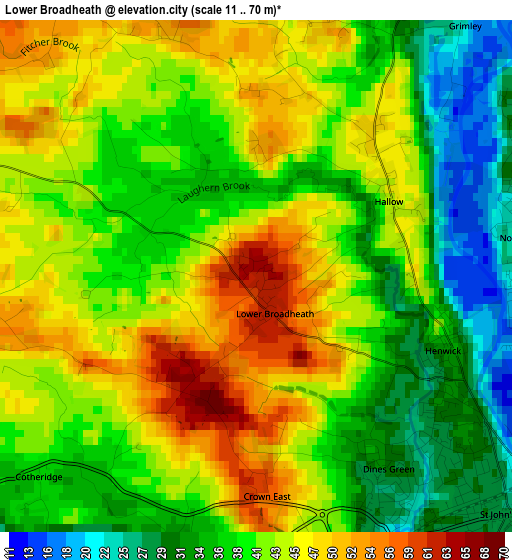
Below is the Elevation map of Lower Broadheath, which displays elevation range with different colors. Scale of the first map is from 11 to 70 m (36 to 230 ft) with average elevation of 40.8 meters (=134 ft) [note 1]
These maps also provides idea of topography and contour of this city, they are displayed at different zoom levels. More info about maps, scale and edge coordinates you can find below images.
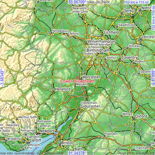
| \ | Map #1 | Topo.Map |
| Scale [m] | 11..70 m | × |
| Scale [ft] | 36..230 ft | × |
| Average | 40.8 m = 134 ft | × |
| Width | 5.99 km = 3.7 mi | 191.6 km = 119.1 mi |
| Height | 5.99 km = 3.7 mi | 191.6 km = 119.1 mi |
| ↑Max Latitude | 52.240708° | 53.06709° |
| Latitude at center | 52.21379° | 52.21379° |
| ↓Min Latitude | 52.186856° | 51.34378° |
| ← Min Longitude | -2.321185° | -3.68349° |
| Longitude center | -2.27724° | -2.27724° |
| →Max Longitude | -2.233295° | -0.87099° |
Nearby cities:
Cities around Lower Broadheath sort by population:
• Worcester elevation 29 m
4.8 km,  124°
124°
• Great Malvern 118 m
11.8 km,  196°
196°
• Droitwich 42 m
10.5 km,  55°
55°
• Stourport-on-Severn 34 m
14 km,  359°
359°
• Bromyard 128 m
16 km,  260°
260°
• Fernhill Heath 51 m
5.8 km,  71°
71°
• Kempsey 18 m
9.2 km,  153°
153°
• Stoke Prior 62 m
16.5 km,  54°
54°
• Hartlebury 71 m
13.6 km,  12°
12°
• Wychbold 56 m
13.9 km, 52°
• Hallow 45 m
1.9 km, 55°
• Evesbatch 146 m
14.8 km,  232°
232°
Multilingual:
 En español:
Lower Broadheath elevación 65 m.
 En France:
Lower Broadheath élévation 65 m.
 Auf Deutsch:
Lower Broadheath höhe über dem Meeresspiegel ist 65 m.

Sources and notes:
- [note 1] Map square and city borders are not equal. Map elevation data is calculated only from area inside that square.
- [src 1] Elevation data from geonames database provided with same terms of usage.
- [src 2] The elevation map of Lower Broadheath is generated using elevation data from NASA's 3 arcsec (90m) resolution SRTM data.
- [src 3] Base (background) map © OpenStreetMap contributors tiles are generated by Geofabrik and OpenTopoMap.
Copyright & License:
This Lower Broadheath Elevation Map is licensed under CC BY-SA. You may reuse any part from this page, if you give a proper credit by linking to this URL:
 More info on terms of use page.