Withington elevation
Withington (England, Shropshire), United Kingdom elevation is 48 meters and Withington elevation in feet is 157 ft above sea level [src 1]. Withington is a seat of a third-order administrative division (feature code) with elevation that is 24 meters (79 ft) smaller than average city elevation in United Kingdom.
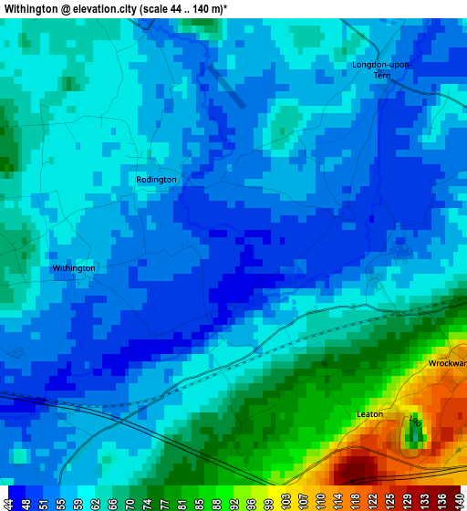
Below is the Elevation map of Withington, which displays elevation range with different colors. Scale of the first map is from 44 to 140 m (144 to 459 ft) with average elevation of 62.6 meters (=205 ft) [note 1]
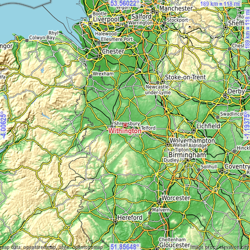
These maps also provides idea of topography and contour of this city, they are displayed at different zoom levels. More info about maps, scale and edge coordinates you can find below images.
| \ | Map #1 | Topo.Map |
| Scale [m] | 44..140 m | × |
| Scale [ft] | 144..459 ft | × |
| Average | 62.6 m = 205 ft | × |
| Width | 5.92 km = 3.7 mi | 189.4 km = 117.7 mi |
| Height | 5.92 km = 3.7 mi | 189.4 km = 117.7 mi |
| ↑Max Latitude | 52.743282° | 53.56022° |
| Latitude at center | 52.71667° | 52.71667° |
| ↓Min Latitude | 52.690042° | 51.85648° |
| ← Min Longitude | -2.643945° | -4.00625° |
| Longitude center | -2.6° | -2.6° |
| →Max Longitude | -2.556055° | -1.19375° |
Nearby cities:
Cities around Withington sort by population:
• Telford elevation 163 m
11.1 km,  113°
113°
• Shrewsbury 75 m
10.3 km,  265°
265°
• Wellington 101 m
5.9 km, 108°
• Hadley 107 m
8.1 km,  103°
103°
• Oakengates 120 m
10.4 km, 103°
• Bayston Hill 88 m
11.8 km,  247°
247°
• Shawbury 73 m
9.3 km,  333°
333°
• Ironbridge 71 m
12.6 km,  141°
141°
• Harley 95 m
13 km,  180°
180°
• Berrington 65 m
10 km,  222°
222°
• Astley 71 m
8.7 km,  309°
309°
• Eyton upon the Weald Moors 55 m
5.9 km,  71°
71°
Multilingual:
 En español:
Withington elevación 48 m.
 En France:
Withington élévation 48 m.
 Auf Deutsch:
Withington höhe über dem Meeresspiegel ist 48 m.

Sources and notes:
- [note 1] Map square and city borders are not equal. Map elevation data is calculated only from area inside that square.
- [src 1] Elevation data from geonames database provided with same terms of usage.
- [src 2] The elevation map of Withington is generated using elevation data from NASA's 3 arcsec (90m) resolution SRTM data.
- [src 3] Base (background) map © OpenStreetMap contributors tiles are generated by Geofabrik and OpenTopoMap.
Copyright & License:
This Withington Elevation Map is licensed under CC BY-SA. You may reuse any part from this page, if you give a proper credit by linking to this URL:
 More info on terms of use page.