Shrewsbury elevation
Shrewsbury (England, Shropshire), United Kingdom elevation is 75 meters and Shrewsbury elevation in feet is 246 ft above sea level [src 1]. Shrewsbury is a seat of a second-order administrative division (feature code) with elevation that is 3 meters (10 ft) bigger than average city elevation in United Kingdom.
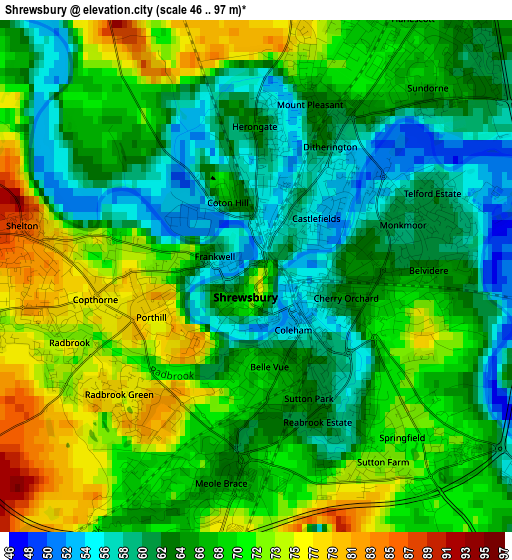
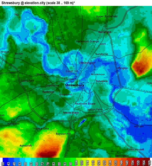
Below is the Elevation map of Shrewsbury, which displays elevation range with different colors. Scale of the first map is from 46 to 97 m (151 to 318 ft) with average elevation of 66.4 meters (=218 ft) [note 1]
These maps also provides idea of topography and contour of this city, they are displayed at different zoom levels. More info about maps, scale and edge coordinates you can find below images.
| \ | Map #1 | Map #2 | Topo.Map |
| Scale [m] | 46..97 m | 38..169 m | × |
| Scale [ft] | 151..318 ft | 125..554 ft | × |
| Average | 66.4 m = 218 ft | 76.7 m = 252 ft | × |
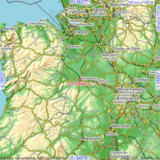
| Width | 5.92 km = 3.7 mi | 11.84 km = 7.4 mi | 189.5 km = 117.7 mi |
| Height | 5.92 km = 3.7 mi | 11.84 km = 7.4 mi | 189.4 km = 117.7 mi |
| ↑Max Latitude | 52.736706° | 52.763306° | 53.55377° |
| Latitude at center | 52.71009° | 52.71009° | 52.71009° |
| ↓Min Latitude | 52.683458° | 52.656809° | 51.84978° |
| ← Min Longitude | -2.796025° | -2.839971° | -4.15833° |
| Longitude center | -2.75208° | -2.75208° | -2.75208° |
| →Max Longitude | -2.708135° | -2.664189° | -1.34583° |
Nearby cities:
Cities around Shrewsbury sort by population:
• Bayston Hill elevation 88 m
3.9 km,  189°
189°
• Shawbury 73 m
10.9 km,  34°
34°
• Pontesbury 108 m
11.6 km,  233°
233°
• Baschurch 84 m
11 km,  322°
322°
• Great Hanwood 76 m
5.3 km,  235°
235°
• Ford 70 m
7.9 km,  275°
275°
• Clive 124 m
11.6 km,  9°
9°
• Bicton 77 m
4.8 km,  295°
295°
• Great Ness 91 m
11.1 km, 302°
• Withington 48 m
10.3 km,  85°
85°
• Berrington 65 m
7.5 km,  152°
152°
• Astley 71 m
7.2 km, 29°
Multilingual:
 En español:
Shrewsbury elevación 75 m.
 En France:
Shrewsbury élévation 75 m.
 Auf Deutsch:
Shrewsbury höhe über dem Meeresspiegel ist 75 m.

Sources and notes:
- [note 1] Map square and city borders are not equal. Map elevation data is calculated only from area inside that square.
- [src 1] Elevation data from geonames database provided with same terms of usage.
- [src 2] The elevation map of Shrewsbury is generated using elevation data from NASA's 3 arcsec (90m) resolution SRTM data.
- [src 3] Base (background) map © OpenStreetMap contributors tiles are generated by Geofabrik and OpenTopoMap.
Copyright & License:
This Shrewsbury Elevation Map is licensed under CC BY-SA. You may reuse any part from this page, if you give a proper credit by linking to this URL:
 More info on terms of use page.