Les Trois-Lucs elevation
Les Trois-Lucs (Provence-Alpes-Côte d'Azur, Département des Bouches-du-Rhône), France elevation is 180 meters and Les Trois-Lucs elevation in feet is 591 ft above sea level [src 1]. Les Trois-Lucs is a section of populated place (feature code) with elevation that is 6 meters (20 ft) bigger than average city elevation in France.
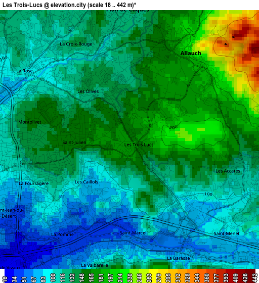
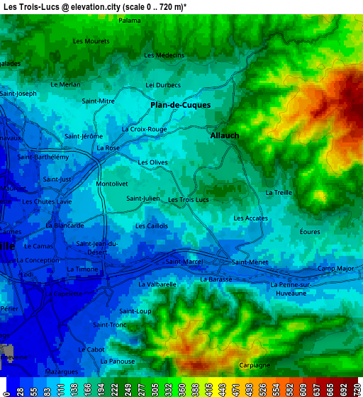
Below is the Elevation map of Les Trois-Lucs, which displays elevation range with different colors. Scale of the first map is from 18 to 442 m (59 to 1450 ft) with average elevation of 132.2 meters (=434 ft) [note 1]
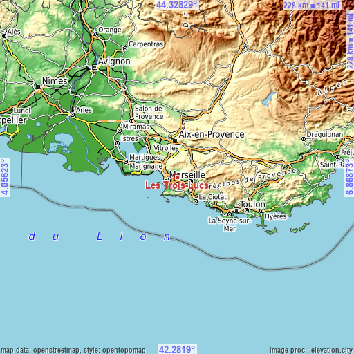
These maps also provides idea of topography and contour of this city, they are displayed at different zoom levels. More info about maps, scale and edge coordinates you can find below images.
| \ | Map #1 | Map #2 | Topo.Map |
| Scale [m] | 18..442 m | 0..720 m | × |
| Scale [ft] | 59..1450 ft | 0..2362 ft | × |
| Average | 132.2 m = 434 ft | 190.1 m = 624 ft | × |
| Width | 7.11 km = 4.4 mi | 14.22 km = 8.8 mi | 227.5 km = 141.4 mi |
| Height | 7.11 km = 4.4 mi | 14.22 km = 8.8 mi | 227.5 km = 141.4 mi |
| ↑Max Latitude | 43.345677° | 43.377626° | 44.32829° |
| Latitude at center | 43.31371° | 43.31371° | 43.31371° |
| ↓Min Latitude | 43.281727° | 43.249726° | 42.2819° |
| ← Min Longitude | 5.418535° | 5.374589° | 4.05623° |
| Longitude center | 5.46248° | 5.46248° | 5.46248° |
| →Max Longitude | 5.506425° | 5.550371° | 6.86873° |
Nearby cities:
Cities around Les Trois-Lucs sort by population:
• Marseille 12 elevation 89 m
2.9 km,  227°
227°
• Marseille 11 49 m
3.2 km,  217°
217°
• Allauch 220 m
2.9 km,  32°
32°
• La Pomme 43 m
3.1 km,  212°
212°
• Les Olives 142 m
1.2 km,  343°
343°
• Saint-Marcel 63 m
2.9 km,  174°
174°
• Saint-Julien 164 m
1.1 km,  267°
267°
• Les Caillols 90 m
1.7 km, 222°
• La Fourragère 120 m
2.7 km,  246°
246°
• La Croix-Rouge 115 m
2.3 km, 342°
• La Valentine 82 m
2.5 km,  135°
135°
• Les Accates 118 m
3.2 km,  118°
118°
Multilingual:
 En español:
Les Trois-Lucs elevación 180 m.
 En France:
Les Trois-Lucs élévation 180 m.
 Auf Deutsch:
Les Trois-Lucs höhe über dem Meeresspiegel ist 180 m.

Sources and notes:
- [note 1] Map square and city borders are not equal. Map elevation data is calculated only from area inside that square.
- [src 1] Elevation data from geonames database provided with same terms of usage.
- [src 2] The elevation map of Les Trois-Lucs is generated using elevation data from NASA's 3 arcsec (90m) resolution SRTM data.
- [src 3] Base (background) map © OpenStreetMap contributors tiles are generated by Geofabrik and OpenTopoMap.
Copyright & License:
This Les Trois-Lucs Elevation Map is licensed under CC BY-SA. You may reuse any part from this page, if you give a proper credit by linking to this URL:
 More info on terms of use page.