Les Olives elevation
Les Olives (Provence-Alpes-Côte d'Azur, Département des Bouches-du-Rhône), France elevation is 142 meters and Les Olives elevation in feet is 466 ft above sea level [src 1]. Les Olives is a section of populated place (feature code) with elevation that is 32 meters (105 ft) smaller than average city elevation in France.
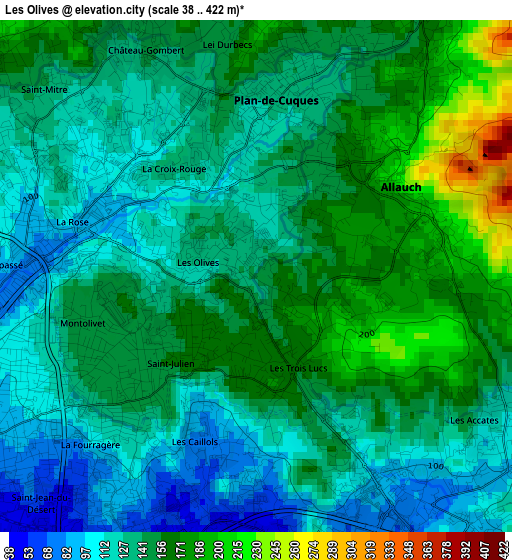
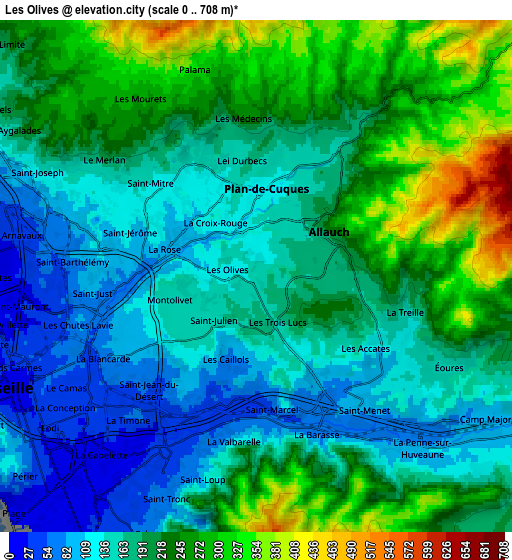
Below is the Elevation map of Les Olives, which displays elevation range with different colors. Scale of the first map is from 38 to 422 m (125 to 1385 ft) with average elevation of 142.1 meters (=466 ft) [note 1]
These maps also provides idea of topography and contour of this city, they are displayed at different zoom levels. More info about maps, scale and edge coordinates you can find below images.
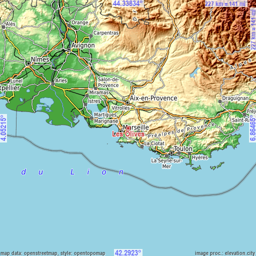
| \ | Map #1 | Map #2 | Topo.Map |
| Scale [m] | 38..422 m | 0..708 m | × |
| Scale [ft] | 125..1385 ft | 0..2323 ft | × |
| Average | 142.1 m = 466 ft | 194.5 m = 638 ft | × |
| Width | 7.11 km = 4.4 mi | 14.22 km = 8.8 mi | 227.5 km = 141.4 mi |
| Height | 7.11 km = 4.4 mi | 14.22 km = 8.8 mi | 227.5 km = 141.4 mi |
| ↑Max Latitude | 43.355891° | 43.387836° | 44.33834° |
| Latitude at center | 43.32393° | 43.32393° | 43.32393° |
| ↓Min Latitude | 43.291952° | 43.259957° | 42.2923° |
| ← Min Longitude | 5.414455° | 5.370509° | 4.05215° |
| Longitude center | 5.4584° | 5.4584° | 5.4584° |
| →Max Longitude | 5.502345° | 5.546291° | 6.86465° |
Nearby cities:
Cities around Les Olives sort by population:
• Allauch elevation 220 m
2.3 km,  55°
55°
• La Rose 102 m
2.5 km,  282°
282°
• Montolivet 140 m
2.9 km,  255°
255°
• Malpassé 100 m
3.5 km,  265°
265°
• Plan-de-Cuques 133 m
2.7 km,  9°
9°
• Saint-Jérôme 97 m
3.5 km,  288°
288°
• Saint-Julien 164 m
1.4 km,  211°
211°
• Les Caillols 90 m
2.6 km,  199°
199°
• La Fourragère 120 m
3.1 km,  224°
224°
• La Croix-Rouge 115 m
1.1 km,  341°
341°
• Les Trois-Lucs 180 m
1.2 km,  163°
163°
• Les Médecins 162 m
3.4 km,  355°
355°
Multilingual:
 En español:
Les Olives elevación 142 m.
 En France:
Les Olives élévation 142 m.
 Auf Deutsch:
Les Olives höhe über dem Meeresspiegel ist 142 m.

Sources and notes:
- [note 1] Map square and city borders are not equal. Map elevation data is calculated only from area inside that square.
- [src 1] Elevation data from geonames database provided with same terms of usage.
- [src 2] The elevation map of Les Olives is generated using elevation data from NASA's 3 arcsec (90m) resolution SRTM data.
- [src 3] Base (background) map © OpenStreetMap contributors tiles are generated by Geofabrik and OpenTopoMap.
Copyright & License:
This Les Olives Elevation Map is licensed under CC BY-SA. You may reuse any part from this page, if you give a proper credit by linking to this URL:
 More info on terms of use page.