Captieux elevation
Captieux (Nouvelle-Aquitaine, Gironde), France elevation is 97 meters and Captieux elevation in feet is 318 ft above sea level [src 1]. Captieux is a populated place (feature code) with elevation that is 77 meters (253 ft) smaller than average city elevation in France.
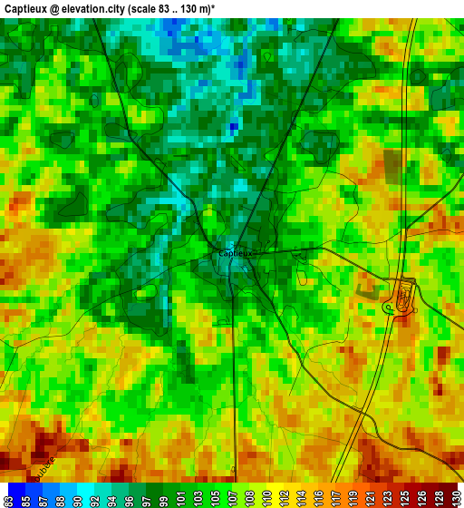
Below is the Elevation map of Captieux, which displays elevation range with different colors. Scale of the first map is from 83 to 130 m (272 to 427 ft) with average elevation of 105.9 meters (=347 ft) [note 1]
These maps also provides idea of topography and contour of this city, they are displayed at different zoom levels. More info about maps, scale and edge coordinates you can find below images.
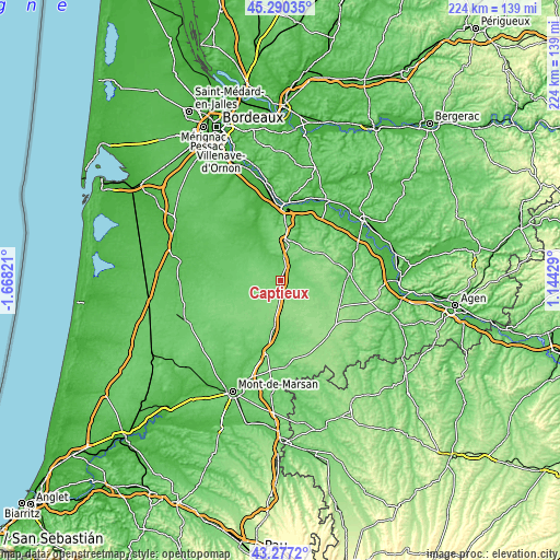
| \ | Map #1 | Topo.Map |
| Scale [m] | 83..130 m | × |
| Scale [ft] | 272..427 ft | × |
| Average | 105.9 m = 347 ft | × |
| Width | 6.99 km = 4.3 mi | 223.8 km = 139.1 mi |
| Height | 7 km = 4.3 mi | 223.8 km = 139.1 mi |
| ↑Max Latitude | 44.323847° | 45.29035° |
| Latitude at center | 44.2924° | 44.2924° |
| ↓Min Latitude | 44.260936° | 43.2772° |
| ← Min Longitude | -0.305905° | -1.66821° |
| Longitude center | -0.26196° | -0.26196° |
| →Max Longitude | -0.218015° | 1.14429° |
Nearby cities:
Cities around Captieux sort by population:
• Langon elevation 9 m
29 km,  1°
1°
• Bazas 89 m
16 km,  13°
13°
• Casteljaloux 66 m
27.8 km,  84°
84°
• Toulenne 34 m
29.4 km,  359°
359°
• Roquefort 63 m
29 km,  189°
189°
• Saint-Macaire 22 m
30.5 km, 5°
• Saint-Symphorien 57 m
23.7 km,  309°
309°
• Castets-en-Dorthe 35 m
31.2 km,  16°
16°
• Grignols 152 m
20.4 km,  58°
58°
• Noaillan 34 m
22.5 km,  338°
338°
• Préchac 55 m
13.9 km,  328°
328°
• Sarbazan 96 m
30.5 km, 187°
Multilingual:
 En español:
Captieux elevación 97 m.
 En France:
Captieux élévation 97 m.


Sources and notes:
- [note 1] Map square and city borders are not equal. Map elevation data is calculated only from area inside that square.
- [src 1] Elevation data from geonames database provided with same terms of usage.
- [src 2] The elevation map of Captieux is generated using elevation data from NASA's 3 arcsec (90m) resolution SRTM data.
- [src 3] Base (background) map © OpenStreetMap contributors tiles are generated by Geofabrik and OpenTopoMap.
Copyright & License:
This Captieux Elevation Map is licensed under CC BY-SA. You may reuse any part from this page, if you give a proper credit by linking to this URL:
 More info on terms of use page.