Bazas elevation
Bazas (Nouvelle-Aquitaine, Gironde), France elevation is 89 meters and Bazas elevation in feet is 292 ft above sea level [src 1]. Bazas is a populated place (feature code) with elevation that is 85 meters (279 ft) smaller than average city elevation in France.
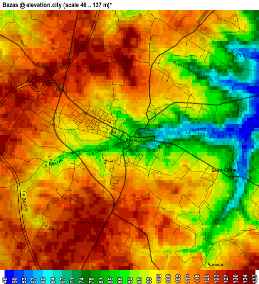
Below is the Elevation map of Bazas, which displays elevation range with different colors. Scale of the first map is from 46 to 137 m (151 to 449 ft) with average elevation of 104.9 meters (=344 ft) [note 1]
These maps also provides idea of topography and contour of this city, they are displayed at different zoom levels. More info about maps, scale and edge coordinates you can find below images.
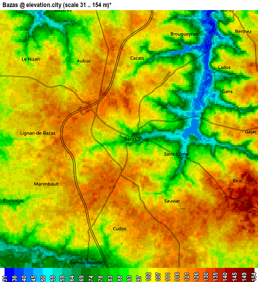
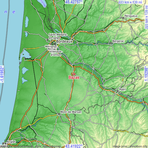
| \ | Map #1 | Map #2 | Topo.Map |
| Scale [m] | 46..137 m | 31..154 m | × |
| Scale [ft] | 151..449 ft | 102..505 ft | × |
| Average | 104.9 m = 344 ft | 102.1 m = 335 ft | × |
| Width | 6.98 km = 4.3 mi | 13.96 km = 8.7 mi | 223.3 km = 138.8 mi |
| Height | 6.98 km = 4.3 mi | 13.96 km = 8.7 mi | 223.3 km = 138.8 mi |
| ↑Max Latitude | 44.463392° | 44.494747° | 45.42757° |
| Latitude at center | 44.43202° | 44.43202° | 44.43202° |
| ↓Min Latitude | 44.400631° | 44.369225° | 43.41922° |
| ← Min Longitude | -0.257215° | -0.301161° | -1.61952° |
| Longitude center | -0.21327° | -0.21327° | -0.21327° |
| →Max Longitude | -0.169325° | -0.125379° | 1.19298° |
Nearby cities:
Cities around Bazas sort by population:
• Langon elevation 9 m
13.8 km,  347°
347°
• Toulenne 34 m
14.4 km,  344°
344°
• Preignac 16 m
18.1 km, 339°
• Saint-Macaire 22 m
14.8 km,  356°
356°
• Saint-Maixant 19 m
16.7 km, 347°
• Captieux 97 m
16 km,  193°
193°
• Saint-Pierre-d’Aurillac 21 m
15.6 km,  7°
7°
• Castets-en-Dorthe 35 m
15.2 km,  18°
18°
• Grignols 152 m
14.4 km,  109°
109°
• Gironde-sur-Dropt 16 m
19.7 km,  31°
31°
• Noaillan 34 m
13.3 km,  293°
293°
• Préchac 55 m
11.8 km,  251°
251°
Multilingual:
 En español:
Bazas elevación 89 m.
 En France:
Bazas élévation 89 m.


Sources and notes:
- [note 1] Map square and city borders are not equal. Map elevation data is calculated only from area inside that square.
- [src 1] Elevation data from geonames database provided with same terms of usage.
- [src 2] The elevation map of Bazas is generated using elevation data from NASA's 3 arcsec (90m) resolution SRTM data.
- [src 3] Base (background) map © OpenStreetMap contributors tiles are generated by Geofabrik and OpenTopoMap.
Copyright & License:
This Bazas Elevation Map is licensed under CC BY-SA. You may reuse any part from this page, if you give a proper credit by linking to this URL:
 More info on terms of use page.