Cheval-Blanc elevation
Cheval-Blanc (Provence-Alpes-Côte d'Azur, Département du Vaucluse), France elevation is 83 meters and Cheval-Blanc elevation in feet is 272 ft above sea level [src 1]. Cheval-Blanc is a populated place (feature code) with elevation that is 91 meters (299 ft) smaller than average city elevation in France.
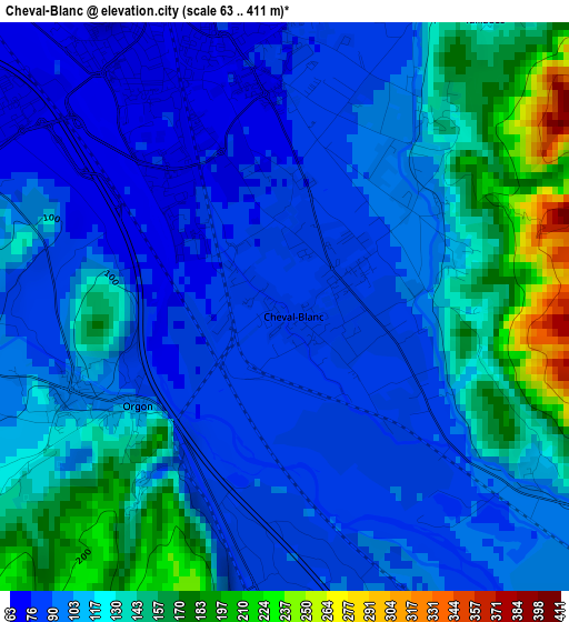
Below is the Elevation map of Cheval-Blanc, which displays elevation range with different colors. Scale of the first map is from 63 to 411 m (207 to 1348 ft) with average elevation of 113.1 meters (=371 ft) [note 1]
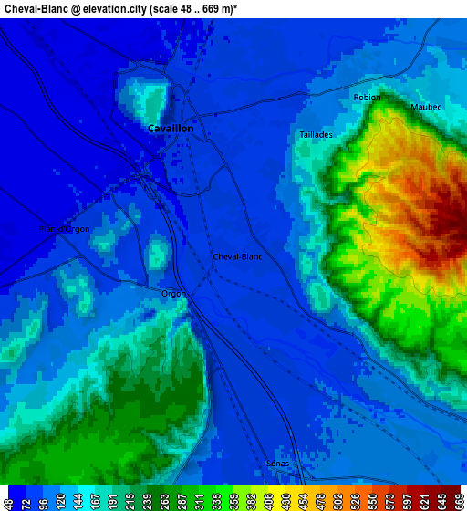
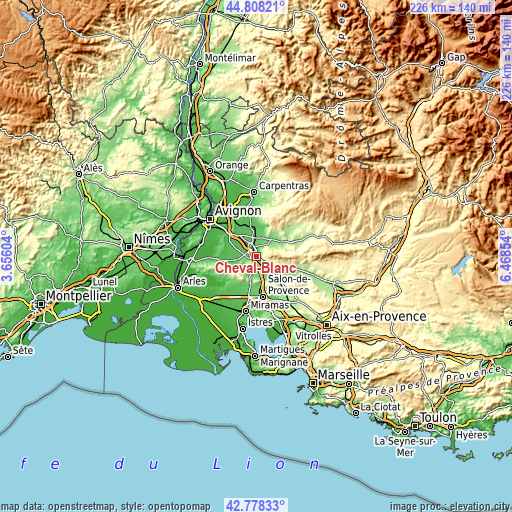
These maps also provides idea of topography and contour of this city, they are displayed at different zoom levels. More info about maps, scale and edge coordinates you can find below images.
| \ | Map #1 | Map #2 | Topo.Map |
| Scale [m] | 63..411 m | 48..669 m | × |
| Scale [ft] | 207..1348 ft | 157..2195 ft | × |
| Average | 113.1 m = 371 ft | 153.9 m = 505 ft | × |
| Width | 7.05 km = 4.4 mi | 14.11 km = 8.8 mi | 225.7 km = 140.2 mi |
| Height | 7.05 km = 4.4 mi | 14.11 km = 8.8 mi | 225.7 km = 140.2 mi |
| ↑Max Latitude | 43.833599° | 43.86529° | 44.80821° |
| Latitude at center | 43.80189° | 43.80189° | 43.80189° |
| ↓Min Latitude | 43.770165° | 43.738422° | 42.77833° |
| ← Min Longitude | 5.018345° | 4.974399° | 3.65604° |
| Longitude center | 5.06229° | 5.06229° | 5.06229° |
| →Max Longitude | 5.106235° | 5.150181° | 6.46854° |
Nearby cities:
Cities around Cheval-Blanc sort by population:
• Cavaillon elevation 71 m
3.9 km,  326°
326°
• Sénas 96 m
6.6 km,  168°
168°
• Cabannes 54 m
11 km,  306°
306°
• Robion 125 m
6.3 km,  37°
37°
• Orgon 97 m
2.2 km,  237°
237°
• Saint-Andiol 57 m
10.1 km,  291°
291°
• Mollégès 57 m
9.1 km,  273°
273°
• Eygalières 112 m
10.1 km, 243°
• Taillades 113 m
4.5 km,  28°
28°
• Maubec 134 m
7.7 km,  52°
52°
• Lagnes 111 m
11 km,  22°
22°
• Oppède le Vieux 242 m
8.5 km,  69°
69°
Multilingual:
 En español:
Cheval-Blanc elevación 83 m.
 En France:
Cheval-Blanc élévation 83 m.
 Auf Deutsch:
Cheval-Blanc höhe über dem Meeresspiegel ist 83 m.

Sources and notes:
- [note 1] Map square and city borders are not equal. Map elevation data is calculated only from area inside that square.
- [src 1] Elevation data from geonames database provided with same terms of usage.
- [src 2] The elevation map of Cheval-Blanc is generated using elevation data from NASA's 3 arcsec (90m) resolution SRTM data.
- [src 3] Base (background) map © OpenStreetMap contributors tiles are generated by Geofabrik and OpenTopoMap.
Copyright & License:
This Cheval-Blanc Elevation Map is licensed under CC BY-SA. You may reuse any part from this page, if you give a proper credit by linking to this URL:
 More info on terms of use page.