Cabannes elevation
Cabannes (Provence-Alpes-Côte d'Azur, Département des Bouches-du-Rhône), France elevation is 54 meters and Cabannes elevation in feet is 177 ft above sea level [src 1]. Cabannes is a populated place (feature code) with elevation that is 120 meters (394 ft) smaller than average city elevation in France.
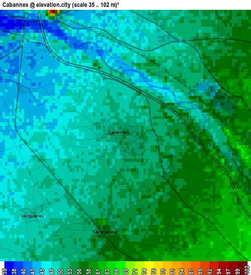
Below is the Elevation map of Cabannes, which displays elevation range with different colors. Scale of the first map is from 35 to 102 m (115 to 335 ft) with average elevation of 51.7 meters (=170 ft) [note 1]
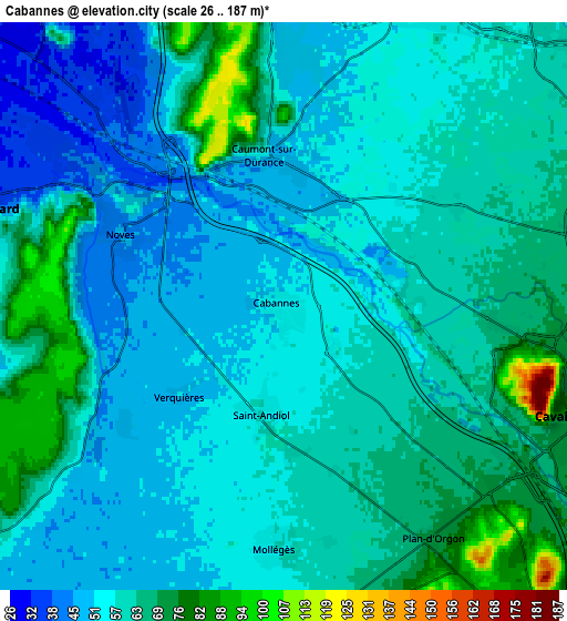
These maps also provides idea of topography and contour of this city, they are displayed at different zoom levels. More info about maps, scale and edge coordinates you can find below images.
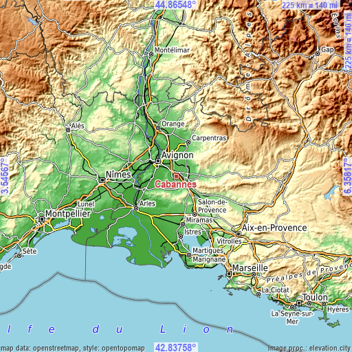
| \ | Map #1 | Map #2 | Topo.Map |
| Scale [m] | 35..102 m | 26..187 m | × |
| Scale [ft] | 115..335 ft | 85..614 ft | × |
| Average | 51.7 m = 170 ft | 58.7 m = 193 ft | × |
| Width | 7.05 km = 4.4 mi | 14.09 km = 8.8 mi | 225.5 km = 140.1 mi |
| Height | 7.05 km = 4.4 mi | 14.09 km = 8.8 mi | 225.5 km = 140.1 mi |
| ↑Max Latitude | 43.891828° | 43.923488° | 44.86548° |
| Latitude at center | 43.86015° | 43.86015° | 43.86015° |
| ↓Min Latitude | 43.828456° | 43.796744° | 42.83758° |
| ← Min Longitude | 4.907975° | 4.864029° | 3.54567° |
| Longitude center | 4.95192° | 4.95192° | 4.95192° |
| →Max Longitude | 4.995865° | 5.039811° | 6.35817° |
Nearby cities:
Cities around Cabannes sort by population:
• Cavaillon elevation 71 m
7.5 km,  115°
115°
• Châteaurenard 42 m
8.1 km,  287°
287°
• Montfavet 34 m
10.3 km,  322°
322°
• Le Thor 53 m
8.5 km,  24°
24°
• Morières-lès-Avignon 29 m
9.8 km,  335°
335°
• Noves 44 m
4.4 km,  295°
295°
• Caumont-sur-Durance 50 m
3.7 km,  354°
354°
• Eyragues 28 m
9 km,  256°
256°
• Châteauneuf-de-Gadagne 76 m
7.4 km,  355°
355°
• Saint-Andiol 57 m
2.9 km,  191°
191°
• Mollégès 57 m
5.9 km,  182°
182°
• Jonquerettes 82 m
9.7 km, 350°
Multilingual:
 En español:
Cabannes elevación 54 m.
 En France:
Cabannes élévation 54 m.


Sources and notes:
- [note 1] Map square and city borders are not equal. Map elevation data is calculated only from area inside that square.
- [src 1] Elevation data from geonames database provided with same terms of usage.
- [src 2] The elevation map of Cabannes is generated using elevation data from NASA's 3 arcsec (90m) resolution SRTM data.
- [src 3] Base (background) map © OpenStreetMap contributors tiles are generated by Geofabrik and OpenTopoMap.
Copyright & License:
This Cabannes Elevation Map is licensed under CC BY-SA. You may reuse any part from this page, if you give a proper credit by linking to this URL:
 More info on terms of use page.