Le Thor elevation
Le Thor (Provence-Alpes-Côte d'Azur, Département du Vaucluse), France elevation is 53 meters and Le Thor elevation in feet is 174 ft above sea level [src 1]. Le Thor is a populated place (feature code) with elevation that is 121 meters (397 ft) smaller than average city elevation in France.
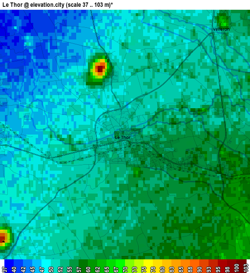
Below is the Elevation map of Le Thor, which displays elevation range with different colors. Scale of the first map is from 37 to 103 m (121 to 338 ft) with average elevation of 52 meters (=171 ft) [note 1]
These maps also provides idea of topography and contour of this city, they are displayed at different zoom levels. More info about maps, scale and edge coordinates you can find below images.
| \ | Map #1 | Map #2 | Topo.Map |
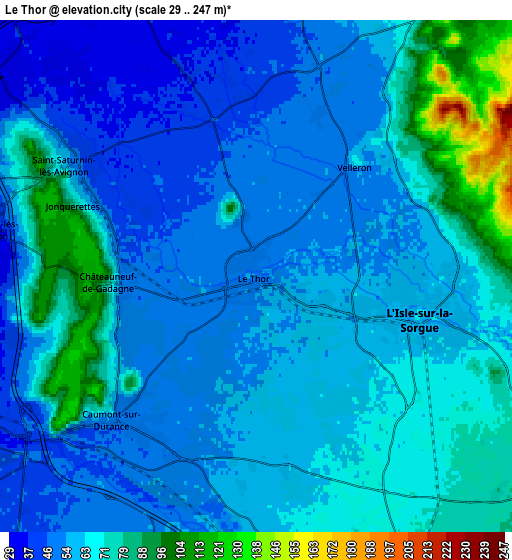
| Scale [m] | 37..103 m | 29..247 m | × |
| Scale [ft] | 121..338 ft | 95..810 ft | × |
| Average | 52 m = 171 ft | 62.5 m = 205 ft | × |
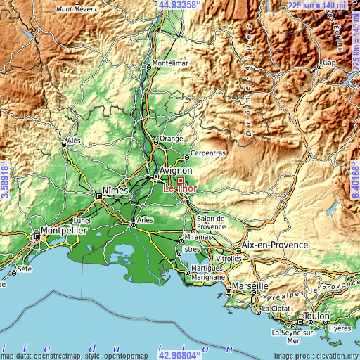
| Width | 7.04 km = 4.4 mi | 14.08 km = 8.7 mi | 225.2 km = 139.9 mi |
| Height | 7.04 km = 4.4 mi | 14.08 km = 8.7 mi | 225.2 km = 139.9 mi |
| ↑Max Latitude | 43.961071° | 43.992695° | 44.93358° |
| Latitude at center | 43.92943° | 43.92943° | 43.92943° |
| ↓Min Latitude | 43.897772° | 43.866098° | 42.90804° |
| ← Min Longitude | 4.951485° | 4.907539° | 3.58918° |
| Longitude center | 4.99543° | 4.99543° | 4.99543° |
| →Max Longitude | 5.039375° | 5.083321° | 6.40168° |
Nearby cities:
Cities around Le Thor sort by population:
• L’Isle-sur-la-Sorgue elevation 66 m
4.6 km,  103°
103°
• Pernes-les-Fontaines 102 m
9.2 km,  33°
33°
• Vedène 36 m
9 km,  306°
306°
• Morières-lès-Avignon 29 m
7.6 km,  279°
279°
• Noves 44 m
9.4 km,  232°
232°
• Caumont-sur-Durance 50 m
5.5 km,  223°
223°
• Cabannes 54 m
8.5 km,  204°
204°
• Saint-Saturnin-lès-Avignon 66 m
6.3 km,  296°
296°
• Châteauneuf-de-Gadagne 76 m
4.1 km,  265°
265°
• Velleron 65 m
4.1 km,  41°
41°
• Althen-des-Paluds 33 m
8.8 km,  340°
340°
• Jonquerettes 82 m
5.4 km,  290°
290°
Multilingual:
 En español:
Le Thor elevación 53 m.
 En France:
Le Thor élévation 53 m.


Sources and notes:
- [note 1] Map square and city borders are not equal. Map elevation data is calculated only from area inside that square.
- [src 1] Elevation data from geonames database provided with same terms of usage.
- [src 2] The elevation map of Le Thor is generated using elevation data from NASA's 3 arcsec (90m) resolution SRTM data.
- [src 3] Base (background) map © OpenStreetMap contributors tiles are generated by Geofabrik and OpenTopoMap.
Copyright & License:
This Le Thor Elevation Map is licensed under CC BY-SA. You may reuse any part from this page, if you give a proper credit by linking to this URL:
 More info on terms of use page.