Sénas elevation
Sénas (Provence-Alpes-Côte d'Azur, Département des Bouches-du-Rhône), France elevation is 96 meters and Sénas elevation in feet is 315 ft above sea level [src 1]. Sénas is a populated place (feature code) with elevation that is 78 meters (256 ft) smaller than average city elevation in France.
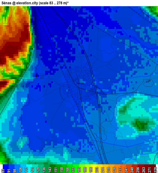
Below is the Elevation map of Sénas, which displays elevation range with different colors. Scale of the first map is from 83 to 278 m (272 to 912 ft) with average elevation of 111.3 meters (=365 ft) [note 1]
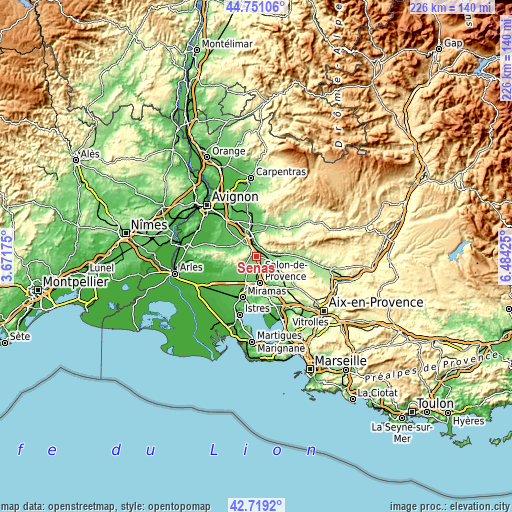
These maps also provides idea of topography and contour of this city, they are displayed at different zoom levels. More info about maps, scale and edge coordinates you can find below images.
| \ | Map #1 | Map #2 | Topo.Map |
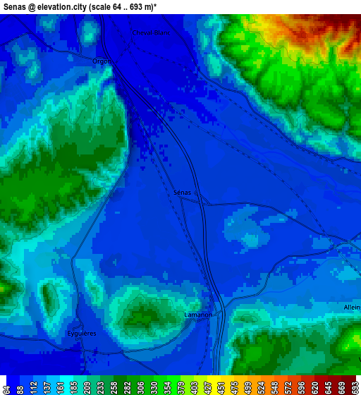
| Scale [m] | 83..278 m | 64..693 m | × |
| Scale [ft] | 272..912 ft | 210..2274 ft | × |
| Average | 111.3 m = 365 ft | 164.5 m = 540 ft | × |
| Width | 7.06 km = 4.4 mi | 14.12 km = 8.8 mi | 225.9 km = 140.4 mi |
| Height | 7.06 km = 4.4 mi | 14.12 km = 8.8 mi | 225.9 km = 140.4 mi |
| ↑Max Latitude | 43.775489° | 43.807212° | 44.75106° |
| Latitude at center | 43.74375° | 43.74375° | 43.74375° |
| ↓Min Latitude | 43.711994° | 43.680221° | 42.7192° |
| ← Min Longitude | 5.034055° | 4.990109° | 3.67175° |
| Longitude center | 5.078° | 5.078° | 5.078° |
| →Max Longitude | 5.121945° | 5.165891° | 6.48425° |
Nearby cities:
Cities around Sénas sort by population:
• Cavaillon elevation 71 m
10.3 km,  340°
340°
• Eyguières 98 m
6.6 km,  214°
214°
• Mallemort 132 m
8.3 km,  99°
99°
• Cheval-Blanc 83 m
6.6 km,  348°
348°
• Orgon 97 m
6.1 km,  329°
329°
• Alleins 163 m
8.1 km,  123°
123°
• Mérindol 161 m
10.2 km,  82°
82°
• Eygalières 112 m
10.5 km,  280°
280°
• Taillades 113 m
10.5 km,  5°
5°
• Lamanon 110 m
5 km,  170°
170°
• Aureille 138 m
11.2 km,  249°
249°
• Vernègues 302 m
9.9 km,  130°
130°
Multilingual:
 En español:
Sénas elevación 96 m.
 En France:
Sénas élévation 96 m.


Sources and notes:
- [note 1] Map square and city borders are not equal. Map elevation data is calculated only from area inside that square.
- [src 1] Elevation data from geonames database provided with same terms of usage.
- [src 2] The elevation map of Sénas is generated using elevation data from NASA's 3 arcsec (90m) resolution SRTM data.
- [src 3] Base (background) map © OpenStreetMap contributors tiles are generated by Geofabrik and OpenTopoMap.
Copyright & License:
This Sénas Elevation Map is licensed under CC BY-SA. You may reuse any part from this page, if you give a proper credit by linking to this URL:
 More info on terms of use page.