Évron elevation
Évron (Pays de la Loire, Mayenne), France elevation is 109 meters and Évron elevation in feet is 358 ft above sea level [src 1]. Évron is a populated place (feature code) with elevation that is 65 meters (213 ft) smaller than average city elevation in France.
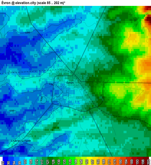
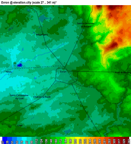
Below is the Elevation map of Évron, which displays elevation range with different colors. Scale of the first map is from 85 to 202 m (279 to 663 ft) with average elevation of 113 meters (=371 ft) [note 1]
These maps also provides idea of topography and contour of this city, they are displayed at different zoom levels. More info about maps, scale and edge coordinates you can find below images.
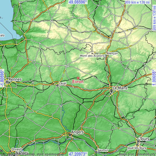
| \ | Map #1 | Map #2 | Topo.Map |
| Scale [m] | 85..202 m | 27..341 m | × |
| Scale [ft] | 279..663 ft | 89..1119 ft | × |
| Average | 113 m = 371 ft | 130.3 m = 427 ft | × |
| Width | 6.52 km = 4.1 mi | 13.04 km = 8.1 mi | 208.6 km = 129.6 mi |
| Height | 6.52 km = 4.1 mi | 13.04 km = 8.1 mi | 208.6 km = 129.6 mi |
| ↑Max Latitude | 48.185728° | 48.215018° | 49.08596° |
| Latitude at center | 48.15642° | 48.15642° | 48.15642° |
| ↓Min Latitude | 48.127096° | 48.097755° | 47.20973° |
| ← Min Longitude | -0.443645° | -0.487591° | -1.80595° |
| Longitude center | -0.3997° | -0.3997° | -0.3997° |
| →Max Longitude | -0.355755° | -0.311809° | 1.00655° |
Nearby cities:
Cities around Évron sort by population:
• Sillé-le-Guillaume elevation 161 m
20.5 km,  81°
81°
• Argentré 103 m
19.7 km,  245°
245°
• Montsûrs 75 m
11.7 km,  258°
258°
• Aron 128 m
19.7 km,  323°
323°
• Bais 186 m
11 km,  13°
13°
• Martigné-sur-Mayenne 162 m
20.4 km,  283°
283°
• Commer 134 m
18.2 km,  298°
298°
• Vaiges 99 m
14.1 km,  203°
203°
• Sainte-Suzanne 150 m
7.3 km,  152°
152°
• Courcité 181 m
20 km,  33°
33°
• Soulgé-sur-Ouette 116 m
15.9 km,  231°
231°
• Moulay 117 m
21.2 km,  307°
307°
Multilingual:
 En español:
Évron elevación 109 m.
 En France:
Évron élévation 109 m.


Sources and notes:
- [note 1] Map square and city borders are not equal. Map elevation data is calculated only from area inside that square.
- [src 1] Elevation data from geonames database provided with same terms of usage.
- [src 2] The elevation map of Évron is generated using elevation data from NASA's 3 arcsec (90m) resolution SRTM data.
- [src 3] Base (background) map © OpenStreetMap contributors tiles are generated by Geofabrik and OpenTopoMap.
Copyright & License:
This Évron Elevation Map is licensed under CC BY-SA. You may reuse any part from this page, if you give a proper credit by linking to this URL:
 More info on terms of use page.