Sainte-Suzanne elevation
Sainte-Suzanne (Pays de la Loire, Mayenne), France elevation is 150 meters and Sainte-Suzanne elevation in feet is 492 ft above sea level [src 1]. Sainte-Suzanne is a populated place (feature code) with elevation that is 24 meters (79 ft) smaller than average city elevation in France.
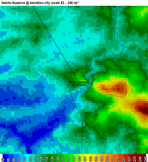
Below is the Elevation map of Sainte-Suzanne, which displays elevation range with different colors. Scale of the first map is from 82 to 246 m (269 to 807 ft) with average elevation of 123.8 meters (=406 ft) [note 1]
These maps also provides idea of topography and contour of this city, they are displayed at different zoom levels. More info about maps, scale and edge coordinates you can find below images.
| \ | Map #1 | Topo.Map |
| Scale [m] | 82..246 m | × |
| Scale [ft] | 269..807 ft | × |
| Average | 123.8 m = 406 ft | × |
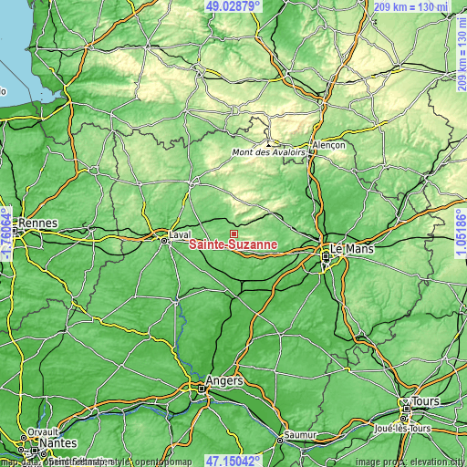
| Width | 6.53 km = 4.1 mi | 208.9 km = 129.8 mi |
| Height | 6.53 km = 4.1 mi | 208.8 km = 129.7 mi |
| ↑Max Latitude | 48.127521° | 49.02879° |
| Latitude at center | 48.09818° | 48.09818° |
| ↓Min Latitude | 48.068822° | 47.15042° |
| ← Min Longitude | -0.398335° | -1.76064° |
| Longitude center | -0.35439° | -0.35439° |
| →Max Longitude | -0.310445° | 1.05186° |
Nearby cities:
Cities around Sainte-Suzanne sort by population:
• Évron elevation 109 m
7.3 km,  332°
332°
• Sillé-le-Guillaume 161 m
19.3 km,  60°
60°
• Meslay-du-Maine 90 m
22.1 km,  222°
222°
• Argentré 103 m
21.4 km,  265°
265°
• Loué 77 m
18.7 km,  127°
127°
• Montsûrs 75 m
15.4 km,  285°
285°
• Bais 186 m
17.2 km,  357°
357°
• Auvers-le-Hamon 63 m
21.8 km,  179°
179°
• Brûlon 103 m
17.2 km,  148°
148°
• Vaiges 99 m
11 km,  234°
234°
• Tennie 96 m
20.7 km,  87°
87°
• Soulgé-sur-Ouette 116 m
16.2 km,  257°
257°
Multilingual:
 En español:
Sainte-Suzanne elevación 150 m.
 En France:
Sainte-Suzanne élévation 150 m.
 Auf Deutsch:
Sainte-Suzanne höhe über dem Meeresspiegel ist 150 m.

Sources and notes:
- [note 1] Map square and city borders are not equal. Map elevation data is calculated only from area inside that square.
- [src 1] Elevation data from geonames database provided with same terms of usage.
- [src 2] The elevation map of Sainte-Suzanne is generated using elevation data from NASA's 3 arcsec (90m) resolution SRTM data.
- [src 3] Base (background) map © OpenStreetMap contributors tiles are generated by Geofabrik and OpenTopoMap.
Copyright & License:
This Sainte-Suzanne Elevation Map is licensed under CC BY-SA. You may reuse any part from this page, if you give a proper credit by linking to this URL:
 More info on terms of use page.