Moulay elevation
Moulay (Pays de la Loire, Mayenne), France elevation is 117 meters and Moulay elevation in feet is 384 ft above sea level [src 1]. Moulay is a populated place (feature code) with elevation that is 57 meters (187 ft) smaller than average city elevation in France.
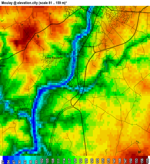
Below is the Elevation map of Moulay, which displays elevation range with different colors. Scale of the first map is from 81 to 159 m (266 to 522 ft) with average elevation of 122.6 meters (=402 ft) [note 1]
These maps also provides idea of topography and contour of this city, they are displayed at different zoom levels. More info about maps, scale and edge coordinates you can find below images.
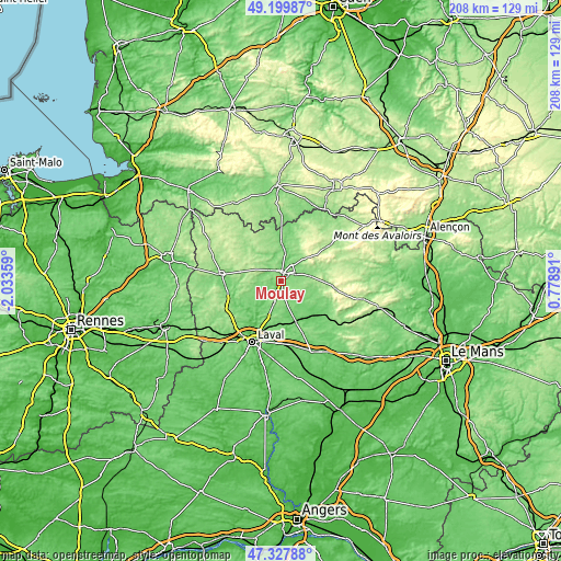
| \ | Map #1 | Topo.Map |
| Scale [m] | 81..159 m | × |
| Scale [ft] | 266..522 ft | × |
| Average | 122.6 m = 402 ft | × |
| Width | 6.5 km = 4 mi | 208.1 km = 129.3 mi |
| Height | 6.5 km = 4 mi | 208.1 km = 129.3 mi |
| ↑Max Latitude | 48.301691° | 49.19987° |
| Latitude at center | 48.27245° | 48.27245° |
| ↓Min Latitude | 48.243192° | 47.32788° |
| ← Min Longitude | -0.671285° | -2.03359° |
| Longitude center | -0.62734° | -0.62734° |
| →Max Longitude | -0.583395° | 0.77891° |
Nearby cities:
Cities around Moulay sort by population:
• Mayenne elevation 123 m
3.6 km,  16°
16°
• Louverné 112 m
18 km,  201°
201°
• Ambrières-les-Vallées 135 m
14.2 km,  358°
358°
• Andouillé 85 m
15.7 km,  227°
227°
• Montsûrs 75 m
16.1 km,  160°
160°
• Aron 128 m
5.7 km,  60°
60°
• Saint-Georges-Buttavent 152 m
6.5 km,  310°
310°
• Martigné-sur-Mayenne 162 m
8.6 km, 199°
• Saint-Jean-sur-Mayenne 95 m
18 km,  212°
212°
• Commer 134 m
4.4 km,  169°
169°
• Oisseau 156 m
9.8 km,  340°
340°
• Saint-Baudelle 122 m
1.2 km,  321°
321°
Multilingual:
 En español:
Moulay elevación 117 m.
 En France:
Moulay élévation 117 m.


Sources and notes:
- [note 1] Map square and city borders are not equal. Map elevation data is calculated only from area inside that square.
- [src 1] Elevation data from geonames database provided with same terms of usage.
- [src 2] The elevation map of Moulay is generated using elevation data from NASA's 3 arcsec (90m) resolution SRTM data.
- [src 3] Base (background) map © OpenStreetMap contributors tiles are generated by Geofabrik and OpenTopoMap.
Copyright & License:
This Moulay Elevation Map is licensed under CC BY-SA. You may reuse any part from this page, if you give a proper credit by linking to this URL:
 More info on terms of use page.