Fleurance elevation
Fleurance (Occitanie, Gers), France elevation is 104 meters and Fleurance elevation in feet is 341 ft above sea level [src 1]. Fleurance is a populated place (feature code) with elevation that is 70 meters (230 ft) smaller than average city elevation in France.
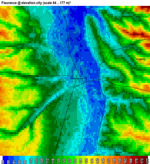
Below is the Elevation map of Fleurance, which displays elevation range with different colors. Scale of the first map is from 84 to 177 m (276 to 581 ft) with average elevation of 115.7 meters (=380 ft) [note 1]
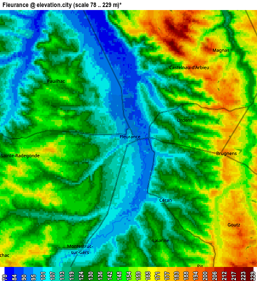
These maps also provides idea of topography and contour of this city, they are displayed at different zoom levels. More info about maps, scale and edge coordinates you can find below images.
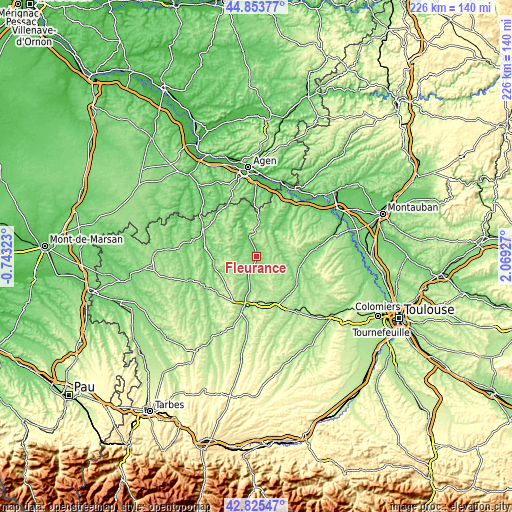
| \ | Map #1 | Map #2 | Topo.Map |
| Scale [m] | 84..177 m | 78..229 m | × |
| Scale [ft] | 276..581 ft | 256..751 ft | × |
| Average | 115.7 m = 380 ft | 135.2 m = 444 ft | × |
| Width | 7.05 km = 4.4 mi | 14.1 km = 8.8 mi | 225.5 km = 140.1 mi |
| Height | 7.05 km = 4.4 mi | 14.1 km = 8.8 mi | 225.5 km = 140.1 mi |
| ↑Max Latitude | 43.879924° | 43.911591° | 44.85377° |
| Latitude at center | 43.84824° | 43.84824° | 43.84824° |
| ↓Min Latitude | 43.816539° | 43.784822° | 42.82547° |
| ← Min Longitude | 0.619075° | 0.575129° | -0.74323° |
| Longitude center | 0.66302° | 0.66302° | 0.66302° |
| →Max Longitude | 0.706965° | 0.750911° | 2.06927° |
Nearby cities:
Cities around Fleurance sort by population:
• Auch elevation 136 m
23.3 km,  194°
194°
• Condom 91 m
26.3 km,  297°
297°
• Lectoure 181 m
10.2 km,  340°
340°
• Beaumont-de-Lomagne 121 m
26.3 km,  81°
81°
• Pavie 143 m
27.1 km, 192°
• Astaffort 82 m
24 km,  357°
357°
• Mauvezin 160 m
21.7 km,  127°
127°
• Lavit 221 m
23.9 km,  59°
59°
• Valence-sur-Baïse 119 m
22.9 km,  279°
279°
• Jegun 127 m
18.2 km,  240°
240°
• Aubiet 184 m
24.5 km,  156°
156°
• Preignan 136 m
15.5 km, 191°
Multilingual:
 En español:
Fleurance elevación 104 m.
 En France:
Fleurance élévation 104 m.
 Auf Deutsch:
Fleurance höhe über dem Meeresspiegel ist 104 m.

Sources and notes:
- [note 1] Map square and city borders are not equal. Map elevation data is calculated only from area inside that square.
- [src 1] Elevation data from geonames database provided with same terms of usage.
- [src 2] The elevation map of Fleurance is generated using elevation data from NASA's 3 arcsec (90m) resolution SRTM data.
- [src 3] Base (background) map © OpenStreetMap contributors tiles are generated by Geofabrik and OpenTopoMap.
Copyright & License:
This Fleurance Elevation Map is licensed under CC BY-SA. You may reuse any part from this page, if you give a proper credit by linking to this URL:
 More info on terms of use page.