Lectoure elevation
Lectoure (Occitanie, Gers), France elevation is 181 meters and Lectoure elevation in feet is 594 ft above sea level [src 1]. Lectoure is a populated place (feature code) with elevation that is 7 meters (23 ft) bigger than average city elevation in France.
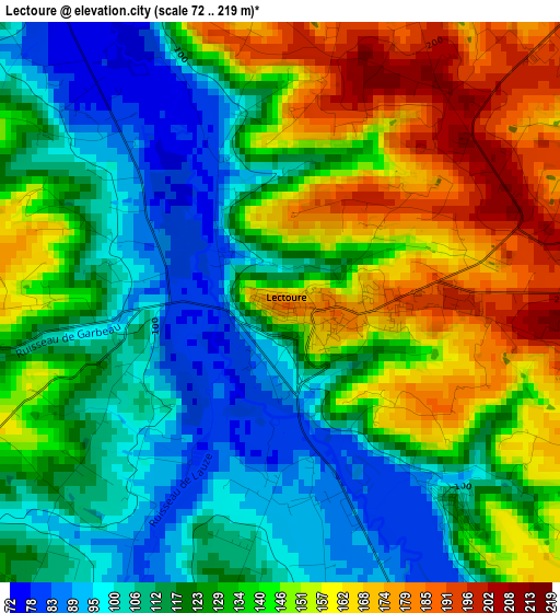
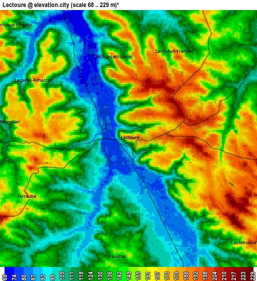
Below is the Elevation map of Lectoure, which displays elevation range with different colors. Scale of the first map is from 72 to 219 m (236 to 719 ft) with average elevation of 131.4 meters (=431 ft) [note 1]
These maps also provides idea of topography and contour of this city, they are displayed at different zoom levels. More info about maps, scale and edge coordinates you can find below images.
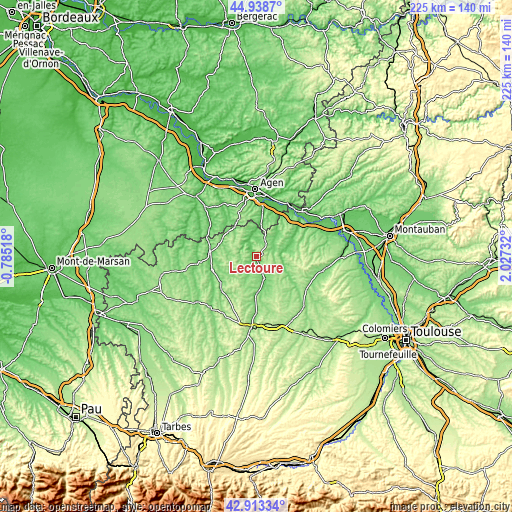
| \ | Map #1 | Map #2 | Topo.Map |
| Scale [m] | 72..219 m | 68..229 m | × |
| Scale [ft] | 236..719 ft | 223..751 ft | × |
| Average | 131.4 m = 431 ft | 136.9 m = 449 ft | × |
| Width | 7.04 km = 4.4 mi | 14.08 km = 8.7 mi | 225.2 km = 139.9 mi |
| Height | 7.04 km = 4.4 mi | 14.08 km = 8.7 mi | 225.2 km = 139.9 mi |
| ↑Max Latitude | 43.966278° | 43.997899° | 44.9387° |
| Latitude at center | 43.93464° | 43.93464° | 43.93464° |
| ↓Min Latitude | 43.902985° | 43.871313° | 42.91334° |
| ← Min Longitude | 0.577125° | 0.533179° | -0.78518° |
| Longitude center | 0.62107° | 0.62107° | 0.62107° |
| →Max Longitude | 0.665015° | 0.708961° | 2.02732° |
Nearby cities:
Cities around Lectoure sort by population:
• Condom elevation 91 m
20.1 km,  277°
277°
• Fleurance 104 m
10.2 km,  160°
160°
• Boé 45 m
25.1 km,  1°
1°
• Layrac 68 m
22.5 km,  8°
8°
• Astaffort 82 m
14.6 km, 9°
• Lavit 221 m
24.1 km,  84°
84°
• Estillac 159 m
25.2 km,  349°
349°
• Laplume 218 m
21.1 km,  339°
339°
• Lamagistère 55 m
26.7 km,  37°
37°
• Valence-sur-Baïse 119 m
20.1 km,  253°
253°
• Jegun 127 m
22.4 km,  213°
213°
• Preignan 136 m
24.8 km,  179°
179°
Multilingual:
 En español:
Lectoure elevación 181 m.
 En France:
Lectoure élévation 181 m.
 Auf Deutsch:
Lectoure höhe über dem Meeresspiegel ist 181 m.

Sources and notes:
- [note 1] Map square and city borders are not equal. Map elevation data is calculated only from area inside that square.
- [src 1] Elevation data from geonames database provided with same terms of usage.
- [src 2] The elevation map of Lectoure is generated using elevation data from NASA's 3 arcsec (90m) resolution SRTM data.
- [src 3] Base (background) map © OpenStreetMap contributors tiles are generated by Geofabrik and OpenTopoMap.
Copyright & License:
This Lectoure Elevation Map is licensed under CC BY-SA. You may reuse any part from this page, if you give a proper credit by linking to this URL:
 More info on terms of use page.