Condom elevation
Condom (Occitanie, Gers), France elevation is 91 meters and Condom elevation in feet is 299 ft above sea level [src 1]. Condom is a seat of a third-order administrative division (feature code) with elevation that is 83 meters (272 ft) smaller than average city elevation in France.
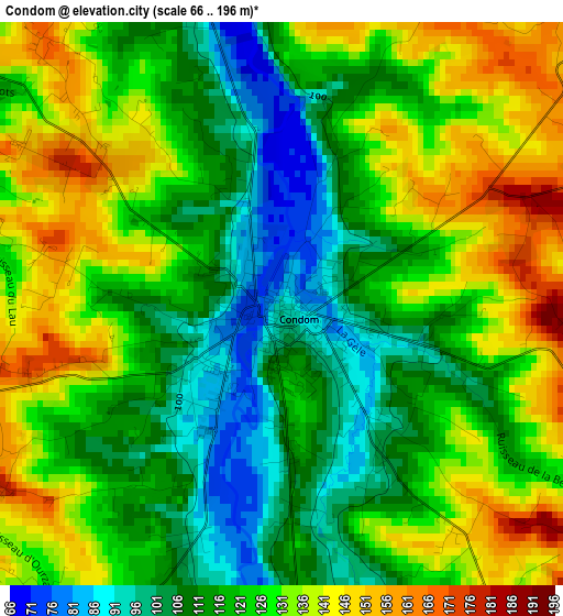
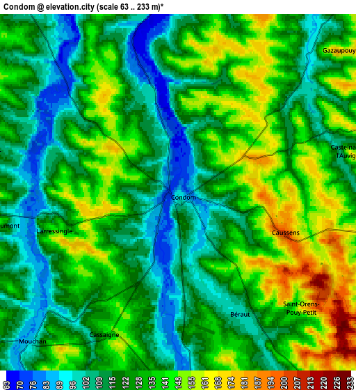
Below is the Elevation map of Condom, which displays elevation range with different colors. Scale of the first map is from 66 to 196 m (217 to 643 ft) with average elevation of 122.8 meters (=403 ft) [note 1]
These maps also provides idea of topography and contour of this city, they are displayed at different zoom levels. More info about maps, scale and edge coordinates you can find below images.
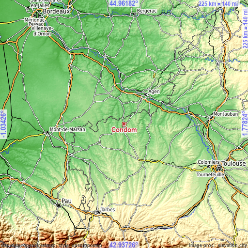
| \ | Map #1 | Map #2 | Topo.Map |
| Scale [m] | 66..196 m | 63..233 m | × |
| Scale [ft] | 217..643 ft | 207..764 ft | × |
| Average | 122.8 m = 403 ft | 126.8 m = 416 ft | × |
| Width | 7.03 km = 4.4 mi | 14.07 km = 8.7 mi | 225.1 km = 139.9 mi |
| Height | 7.03 km = 4.4 mi | 14.07 km = 8.7 mi | 225.1 km = 139.9 mi |
| ↑Max Latitude | 43.989785° | 44.021394° | 44.96182° |
| Latitude at center | 43.95816° | 43.95816° | 43.95816° |
| ↓Min Latitude | 43.926518° | 43.894859° | 42.93726° |
| ← Min Longitude | 0.328045° | 0.284099° | -1.03426° |
| Longitude center | 0.37199° | 0.37199° | 0.37199° |
| →Max Longitude | 0.415935° | 0.459881° | 1.77824° |
Nearby cities:
Cities around Condom sort by population:
• Nérac elevation 66 m
20 km,  352°
352°
• Lectoure 181 m
20.1 km,  97°
97°
• Eauze 166 m
24.2 km,  243°
243°
• Vic-Fezensac 135 m
21.2 km,  192°
192°
• Lavardac 55 m
25.1 km, 346°
• Barbaste 58 m
24.4 km,  343°
343°
• Mézin 118 m
14.2 km,  320°
320°
• Montréal 126 m
13.5 km,  266°
266°
• Laplume 218 m
21.3 km,  36°
36°
• Valence-sur-Baïse 119 m
8.4 km,  175°
175°
• Jegun 127 m
22.6 km,  160°
160°
• Gondrin 182 m
13.5 km,  232°
232°
Multilingual:
 En español:
Condom elevación 91 m.
 En France:
Condom élévation 91 m.


Sources and notes:
- [note 1] Map square and city borders are not equal. Map elevation data is calculated only from area inside that square.
- [src 1] Elevation data from geonames database provided with same terms of usage.
- [src 2] The elevation map of Condom is generated using elevation data from NASA's 3 arcsec (90m) resolution SRTM data.
- [src 3] Base (background) map © OpenStreetMap contributors tiles are generated by Geofabrik and OpenTopoMap.
Copyright & License:
This Condom Elevation Map is licensed under CC BY-SA. You may reuse any part from this page, if you give a proper credit by linking to this URL:
 More info on terms of use page.