Nérac elevation
Nérac (Nouvelle-Aquitaine, Département du Lot-et-Garonne), France elevation is 66 meters and Nérac elevation in feet is 217 ft above sea level [src 1]. Nérac is a seat of a third-order administrative division (feature code) with elevation that is 108 meters (354 ft) smaller than average city elevation in France.
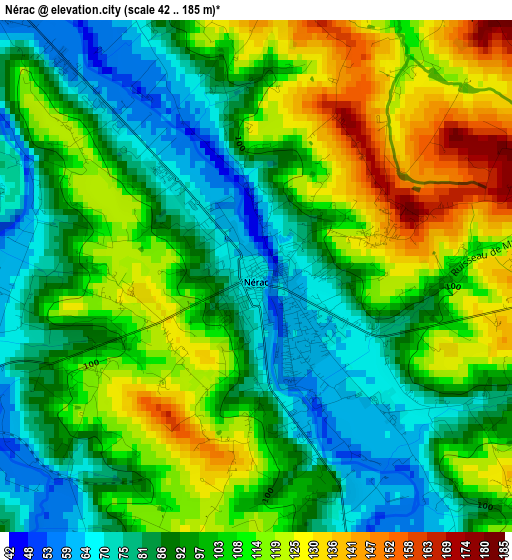
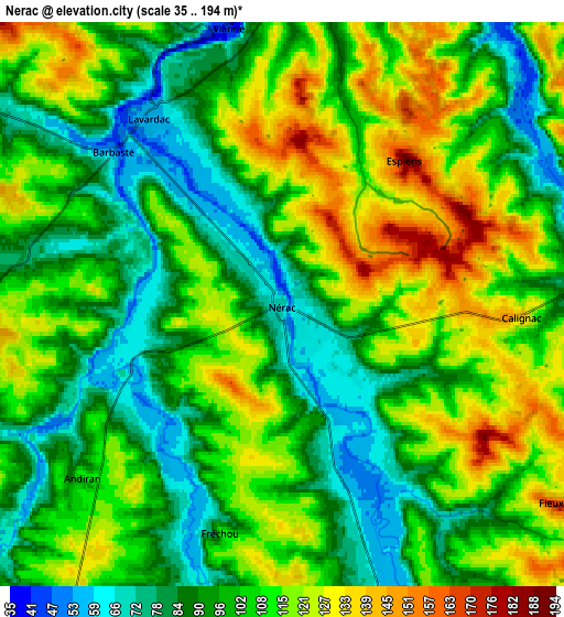
Below is the Elevation map of Nérac, which displays elevation range with different colors. Scale of the first map is from 42 to 185 m (138 to 607 ft) with average elevation of 98.9 meters (=324 ft) [note 1]
These maps also provides idea of topography and contour of this city, they are displayed at different zoom levels. More info about maps, scale and edge coordinates you can find below images.
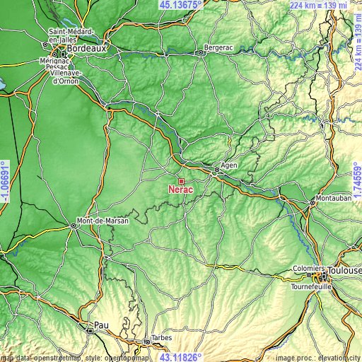
| \ | Map #1 | Map #2 | Topo.Map |
| Scale [m] | 42..185 m | 35..194 m | × |
| Scale [ft] | 138..607 ft | 115..636 ft | × |
| Average | 98.9 m = 324 ft | 103.7 m = 340 ft | × |
| Width | 7.01 km = 4.4 mi | 14.03 km = 8.7 mi | 224.4 km = 139.4 mi |
| Height | 7.01 km = 4.4 mi | 14.03 km = 8.7 mi | 224.4 km = 139.4 mi |
| ↑Max Latitude | 44.167661° | 44.199174° | 45.13675° |
| Latitude at center | 44.13613° | 44.13613° | 44.13613° |
| ↓Min Latitude | 44.104583° | 44.073018° | 43.11826° |
| ← Min Longitude | 0.295395° | 0.251449° | -1.06691° |
| Longitude center | 0.33934° | 0.33934° | 0.33934° |
| →Max Longitude | 0.383285° | 0.427231° | 1.74559° |
Nearby cities:
Cities around Nérac sort by population:
• Aiguillon elevation 45 m
18.1 km,  0°
0°
• Lavardac 55 m
5.7 km,  324°
324°
• Port-Sainte-Marie 55 m
13.5 km,  17°
17°
• Barbaste 58 m
5.6 km,  311°
311°
• Mézin 118 m
10.9 km,  216°
216°
• Sainte-Colombe-en-Bruilhois 161 m
14.8 km,  71°
71°
• Damazan 56 m
17.9 km,  343°
343°
• Estillac 159 m
18.1 km,  82°
82°
• Buzet-sur-Baïse 48 m
14 km,  346°
346°
• Vianne 44 m
6.9 km, 347°
• Laplume 218 m
15.4 km,  99°
99°
• Roquefort 72 m
18.2 km, 76°
Multilingual:
 En español:
Nérac elevación 66 m.
 En France:
Nérac élévation 66 m.


Sources and notes:
- [note 1] Map square and city borders are not equal. Map elevation data is calculated only from area inside that square.
- [src 1] Elevation data from geonames database provided with same terms of usage.
- [src 2] The elevation map of Nérac is generated using elevation data from NASA's 3 arcsec (90m) resolution SRTM data.
- [src 3] Base (background) map © OpenStreetMap contributors tiles are generated by Geofabrik and OpenTopoMap.
Copyright & License:
This Nérac Elevation Map is licensed under CC BY-SA. You may reuse any part from this page, if you give a proper credit by linking to this URL:
 More info on terms of use page.