La Ferrière elevation
La Ferrière (Pays de la Loire, Département de la Vendée), France elevation is 92 meters and La Ferrière elevation in feet is 302 ft above sea level [src 1]. La Ferrière is a populated place (feature code) with elevation that is 82 meters (269 ft) smaller than average city elevation in France.
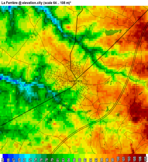
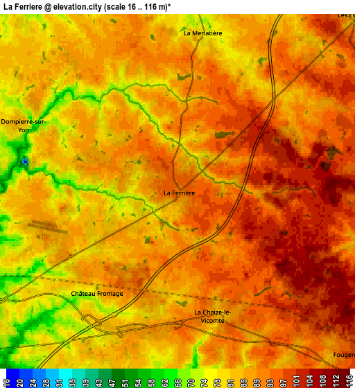
Below is the Elevation map of La Ferrière, which displays elevation range with different colors. Scale of the first map is from 64 to 108 m (210 to 354 ft) with average elevation of 89.5 meters (=294 ft) [note 1]
These maps also provides idea of topography and contour of this city, they are displayed at different zoom levels. More info about maps, scale and edge coordinates you can find below images.
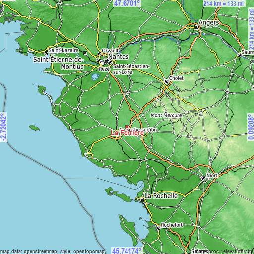
| \ | Map #1 | Map #2 | Topo.Map |
| Scale [m] | 64..108 m | 16..116 m | × |
| Scale [ft] | 210..354 ft | 52..381 ft | × |
| Average | 89.5 m = 294 ft | 87.5 m = 287 ft | × |
| Width | 6.7 km = 4.2 mi | 13.4 km = 8.3 mi | 214.4 km = 133.2 mi |
| Height | 6.7 km = 4.2 mi | 13.4 km = 8.3 mi | 214.4 km = 133.2 mi |
| ↑Max Latitude | 46.744652° | 46.774757° | 47.6701° |
| Latitude at center | 46.71453° | 46.71453° | 46.71453° |
| ↓Min Latitude | 46.684391° | 46.654236° | 45.74174° |
| ← Min Longitude | -1.358115° | -1.402061° | -2.72042° |
| Longitude center | -1.31417° | -1.31417° | -1.31417° |
| →Max Longitude | -1.270225° | -1.226279° | 0.09208° |
Nearby cities:
Cities around La Ferrière sort by population:
• La Roche-sur-Yon elevation 65 m
10.5 km,  239°
239°
• Les Essarts 84 m
9.3 km,  44°
44°
• Mouilleron-le-Captif 74 m
10.7 km,  272°
272°
• Dompierre-sur-Yon 76 m
6 km,  296°
296°
• Belleville-sur-Vie 71 m
11.7 km,  311°
311°
• La Chaize-le-Vicomte 82 m
5.1 km,  159°
159°
• Bournezeau 79 m
13.9 km,  128°
128°
• Saint-Florent-des-Bois 46 m
13.4 km,  180°
180°
• Saint-Martin-des-Noyers 86 m
10.5 km,  85°
85°
• Chauché 72 m
13.2 km,  14°
14°
• Saint-Denis-la-Chevasse 65 m
12.5 km,  344°
344°
• Saligny 69 m
13.5 km,  320°
320°
Multilingual:
 En español:
La Ferrière elevación 92 m.
 En France:
La Ferrière élévation 92 m.
 Auf Deutsch:
La Ferrière höhe über dem Meeresspiegel ist 92 m.

Sources and notes:
- [note 1] Map square and city borders are not equal. Map elevation data is calculated only from area inside that square.
- [src 1] Elevation data from geonames database provided with same terms of usage.
- [src 2] The elevation map of La Ferrière is generated using elevation data from NASA's 3 arcsec (90m) resolution SRTM data.
- [src 3] Base (background) map © OpenStreetMap contributors tiles are generated by Geofabrik and OpenTopoMap.
Copyright & License:
This La Ferrière Elevation Map is licensed under CC BY-SA. You may reuse any part from this page, if you give a proper credit by linking to this URL:
 More info on terms of use page.