Bournezeau elevation
Bournezeau (Pays de la Loire, Département de la Vendée), France elevation is 79 meters and Bournezeau elevation in feet is 259 ft above sea level [src 1]. Bournezeau is a populated place (feature code) with elevation that is 95 meters (312 ft) smaller than average city elevation in France.
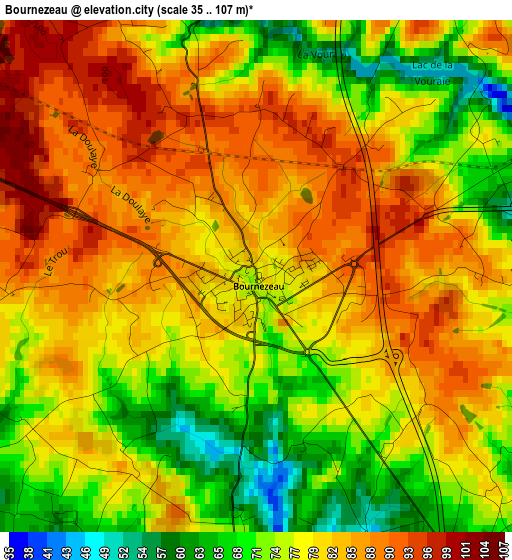
Below is the Elevation map of Bournezeau, which displays elevation range with different colors. Scale of the first map is from 35 to 107 m (115 to 351 ft) with average elevation of 79.4 meters (=260 ft) [note 1]
These maps also provides idea of topography and contour of this city, they are displayed at different zoom levels. More info about maps, scale and edge coordinates you can find below images.
| \ | Map #1 | Topo.Map |
| Scale [m] | 35..107 m | × |
| Scale [ft] | 115..351 ft | × |
| Average | 79.4 m = 260 ft | × |
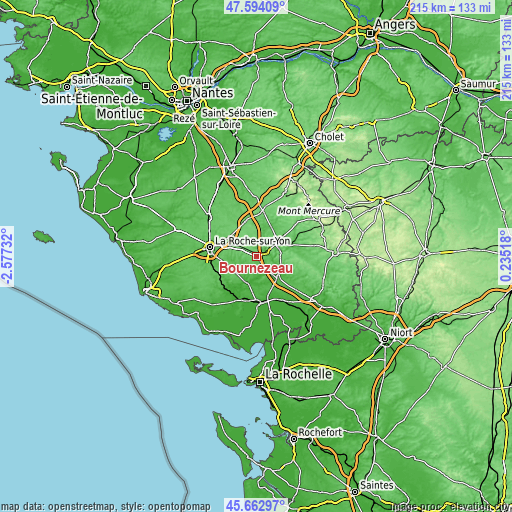
| Width | 6.71 km = 4.2 mi | 214.7 km = 133.4 mi |
| Height | 6.71 km = 4.2 mi | 214.7 km = 133.4 mi |
| ↑Max Latitude | 46.667305° | 47.59409° |
| Latitude at center | 46.63714° | 46.63714° |
| ↓Min Latitude | 46.606958° | 45.66297° |
| ← Min Longitude | -1.215015° | -2.57732° |
| Longitude center | -1.17107° | -1.17107° |
| →Max Longitude | -1.127125° | 0.23518° |
Nearby cities:
Cities around Bournezeau sort by population:
• Chantonnay elevation 61 m
10.8 km,  58°
58°
• Les Essarts 84 m
15.9 km,  344°
344°
• La Ferrière 92 m
13.9 km,  308°
308°
• La Chaize-le-Vicomte 82 m
9.9 km,  292°
292°
• Saint-Florent-des-Bois 46 m
12.1 km,  246°
246°
• Mareuil-sur-Lay-Dissais 6 m
12.5 km,  202°
202°
• Sainte-Hermine 35 m
12.6 km,  135°
135°
• Saint-Martin-des-Noyers 86 m
9.5 km,  357°
357°
• Les Magnils-Reigniers 21 m
17.5 km,  191°
191°
• Sainte-Cécile 54 m
12.5 km,  20°
20°
• Saint-Germain-de-Prinçay 74 m
14.7 km,  50°
50°
• Château-Guibert 43 m
8 km,  218°
218°
Multilingual:
 En español:
Bournezeau elevación 79 m.
 En France:
Bournezeau élévation 79 m.
 Auf Deutsch:
Bournezeau höhe über dem Meeresspiegel ist 79 m.

Sources and notes:
- [note 1] Map square and city borders are not equal. Map elevation data is calculated only from area inside that square.
- [src 1] Elevation data from geonames database provided with same terms of usage.
- [src 2] The elevation map of Bournezeau is generated using elevation data from NASA's 3 arcsec (90m) resolution SRTM data.
- [src 3] Base (background) map © OpenStreetMap contributors tiles are generated by Geofabrik and OpenTopoMap.
Copyright & License:
This Bournezeau Elevation Map is licensed under CC BY-SA. You may reuse any part from this page, if you give a proper credit by linking to this URL:
 More info on terms of use page.