Chauché elevation
Chauché (Pays de la Loire, Département de la Vendée), France elevation is 72 meters and Chauché elevation in feet is 236 ft above sea level [src 1]. Chauché is a populated place (feature code) with elevation that is 102 meters (335 ft) smaller than average city elevation in France.
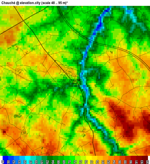
Below is the Elevation map of Chauché, which displays elevation range with different colors. Scale of the first map is from 48 to 95 m (157 to 312 ft) with average elevation of 73.8 meters (=242 ft) [note 1]
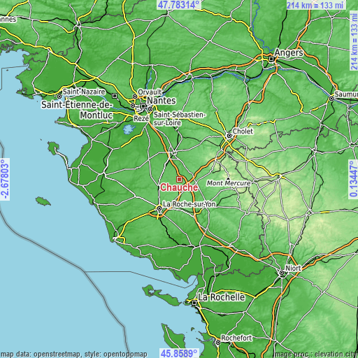
These maps also provides idea of topography and contour of this city, they are displayed at different zoom levels. More info about maps, scale and edge coordinates you can find below images.
| \ | Map #1 | Topo.Map |
| Scale [m] | 48..95 m | × |
| Scale [ft] | 157..312 ft | × |
| Average | 73.8 m = 242 ft | × |
| Width | 6.69 km = 4.2 mi | 214 km = 133 mi |
| Height | 6.69 km = 4.2 mi | 213.9 km = 132.9 mi |
| ↑Max Latitude | 46.859688° | 47.78314° |
| Latitude at center | 46.82963° | 46.82963° |
| ↓Min Latitude | 46.799556° | 45.8589° |
| ← Min Longitude | -1.315725° | -2.67803° |
| Longitude center | -1.27178° | -1.27178° |
| →Max Longitude | -1.227835° | 0.13447° |
Nearby cities:
Cities around Chauché sort by population:
• Les Essarts elevation 84 m
7 km,  151°
151°
• La Ferrière 92 m
13.2 km,  194°
194°
• Saint-Georges-de-Montaigu 54 m
13.1 km,  353°
353°
• Dompierre-sur-Yon 76 m
13.3 km,  220°
220°
• Saint-Fulgent 83 m
7.6 km,  70°
70°
• Belleville-sur-Vie 71 m
13 km,  246°
246°
• Chavagnes-en-Paillers 65 m
7.1 km,  12°
12°
• Les Brouzils 65 m
7.3 km,  329°
329°
• Saint-Martin-des-Noyers 86 m
13.9 km, 148°
• Saint-Denis-la-Chevasse 65 m
6.6 km,  263°
263°
• Saligny 69 m
12.1 km, 258°
• Vendrennes 86 m
11.3 km,  92°
92°
Multilingual:
 En español:
Chauché elevación 72 m.
 En France:
Chauché élévation 72 m.


Sources and notes:
- [note 1] Map square and city borders are not equal. Map elevation data is calculated only from area inside that square.
- [src 1] Elevation data from geonames database provided with same terms of usage.
- [src 2] The elevation map of Chauché is generated using elevation data from NASA's 3 arcsec (90m) resolution SRTM data.
- [src 3] Base (background) map © OpenStreetMap contributors tiles are generated by Geofabrik and OpenTopoMap.
Copyright & License:
This Chauché Elevation Map is licensed under CC BY-SA. You may reuse any part from this page, if you give a proper credit by linking to this URL:
 More info on terms of use page.