Ornans elevation
Ornans (Bourgogne-Franche-Comté, Doubs), France elevation is 337 meters and Ornans elevation in feet is 1106 ft above sea level [src 1]. Ornans is a populated place (feature code) with elevation that is 163 meters (535 ft) bigger than average city elevation in France.
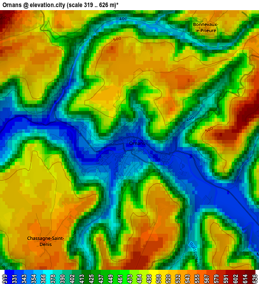
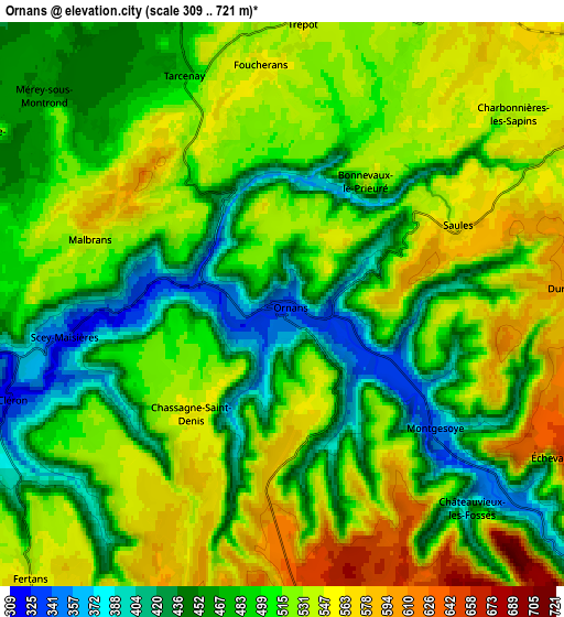
Below is the Elevation map of Ornans, which displays elevation range with different colors. Scale of the first map is from 319 to 626 m (1047 to 2054 ft) with average elevation of 458.8 meters (=1505 ft) [note 1]
These maps also provides idea of topography and contour of this city, they are displayed at different zoom levels. More info about maps, scale and edge coordinates you can find below images.
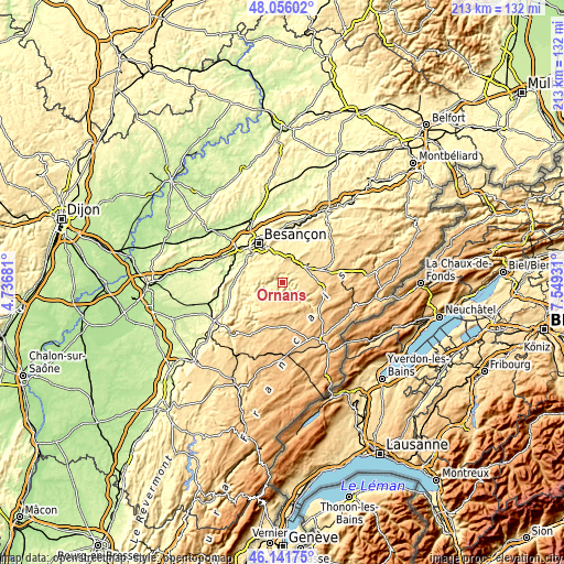
| \ | Map #1 | Map #2 | Topo.Map |
| Scale [m] | 319..626 m | 309..721 m | × |
| Scale [ft] | 1047..2054 ft | 1014..2365 ft | × |
| Average | 458.8 m = 1505 ft | 501.3 m = 1645 ft | × |
| Width | 6.65 km = 4.1 mi | 13.3 km = 8.3 mi | 212.8 km = 132.2 mi |
| Height | 6.65 km = 4.1 mi | 13.3 km = 8.3 mi | 212.8 km = 132.2 mi |
| ↑Max Latitude | 47.137392° | 47.167277° | 48.05602° |
| Latitude at center | 47.10749° | 47.10749° | 47.10749° |
| ↓Min Latitude | 47.077571° | 47.047636° | 46.14175° |
| ← Min Longitude | 6.099115° | 6.055169° | 4.73681° |
| Longitude center | 6.14306° | 6.14306° | 6.14306° |
| →Max Longitude | 6.187005° | 6.230951° | 7.54931° |
Nearby cities:
Cities around Ornans sort by population:
• Besançon elevation 300 m
18.3 km,  328°
328°
• Valdahon 664 m
16.4 km,  73°
73°
• Saône 401 m
13 km,  351°
351°
• Levier 716 m
17.3 km,  185°
185°
• Avanne-Aveney 234 m
16.8 km,  307°
307°
• Montferrand-le-Château 254 m
18.8 km,  293°
293°
• Mamirolle 469 m
10.2 km,  6°
6°
• Montfaucon 522 m
15 km,  341°
341°
• Beure 251 m
15.2 km,  316°
316°
• Morre 451 m
14.1 km, 338°
• Nancray 410 m
15.6 km, 11°
• Étalans 596 m
11 km,  63°
63°
Multilingual:
 En español:
Ornans elevación 337 m.
 En France:
Ornans élévation 337 m.


Sources and notes:
- [note 1] Map square and city borders are not equal. Map elevation data is calculated only from area inside that square.
- [src 1] Elevation data from geonames database provided with same terms of usage.
- [src 2] The elevation map of Ornans is generated using elevation data from NASA's 3 arcsec (90m) resolution SRTM data.
- [src 3] Base (background) map © OpenStreetMap contributors tiles are generated by Geofabrik and OpenTopoMap.
Copyright & License:
This Ornans Elevation Map is licensed under CC BY-SA. You may reuse any part from this page, if you give a proper credit by linking to this URL:
 More info on terms of use page.