Étalans elevation
Étalans (Bourgogne-Franche-Comté, Doubs), France elevation is 596 meters and Étalans elevation in feet is 1955 ft above sea level [src 1]. Étalans is a populated place (feature code) with elevation that is 422 meters (1385 ft) bigger than average city elevation in France.
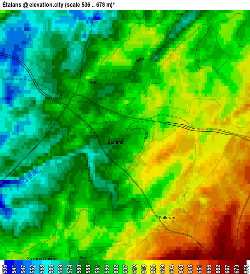
Below is the Elevation map of Étalans, which displays elevation range with different colors. Scale of the first map is from 536 to 678 m (1759 to 2224 ft) with average elevation of 599.6 meters (=1967 ft) [note 1]
These maps also provides idea of topography and contour of this city, they are displayed at different zoom levels. More info about maps, scale and edge coordinates you can find below images.
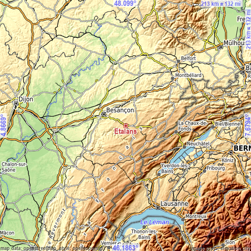
| \ | Map #1 | Topo.Map |
| Scale [m] | 536..678 m | × |
| Scale [ft] | 1759..2224 ft | × |
| Average | 599.6 m = 1967 ft | × |
| Width | 6.65 km = 4.1 mi | 212.7 km = 132.2 mi |
| Height | 6.65 km = 4.1 mi | 212.7 km = 132.2 mi |
| ↑Max Latitude | 47.181127° | 48.099° |
| Latitude at center | 47.15125° | 47.15125° |
| ↓Min Latitude | 47.121356° | 46.1863° |
| ← Min Longitude | 6.229205° | 4.8669° |
| Longitude center | 6.27315° | 6.27315° |
| →Max Longitude | 6.317095° | 7.6794° |
Nearby cities:
Cities around Étalans sort by population:
• Valdahon elevation 664 m
5.8 km,  91°
91°
• Ornans 337 m
11 km,  243°
243°
• Saône 401 m
14.3 km,  304°
304°
• Roche-lez-Beaupré 264 m
18.9 km,  321°
321°
• Mamirolle 469 m
10.1 km, 301°
• Orchamps-Vennes 757 m
19.2 km,  96°
96°
• Novillars 264 m
18.4 km, 323°
• Montfaucon 522 m
17.2 km, 302°
• Vercel-Villedieu-le-Camp 658 m
10.3 km,  69°
69°
• Morre 451 m
17.1 km, 299°
• Nancray 410 m
12.5 km,  326°
326°
• Roulans 347 m
18.6 km,  349°
349°
Multilingual:
 En español:
Étalans elevación 596 m.
 En France:
Étalans élévation 596 m.


Sources and notes:
- [note 1] Map square and city borders are not equal. Map elevation data is calculated only from area inside that square.
- [src 1] Elevation data from geonames database provided with same terms of usage.
- [src 2] The elevation map of Étalans is generated using elevation data from NASA's 3 arcsec (90m) resolution SRTM data.
- [src 3] Base (background) map © OpenStreetMap contributors tiles are generated by Geofabrik and OpenTopoMap.
Copyright & License:
This Étalans Elevation Map is licensed under CC BY-SA. You may reuse any part from this page, if you give a proper credit by linking to this URL:
 More info on terms of use page.