Segré elevation
Segré (Pays de la Loire, Département de Maine-et-Loire), France elevation is 47 meters and Segré elevation in feet is 154 ft above sea level [src 1]. Segré is a seat of a third-order administrative division (feature code) with elevation that is 127 meters (417 ft) smaller than average city elevation in France.
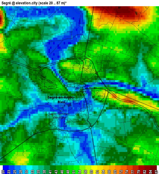
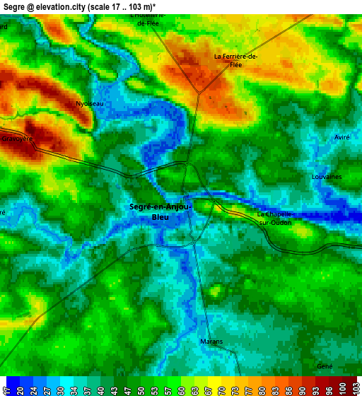
Below is the Elevation map of Segré, which displays elevation range with different colors. Scale of the first map is from 20 to 87 m (66 to 285 ft) with average elevation of 41.8 meters (=137 ft) [note 1]
These maps also provides idea of topography and contour of this city, they are displayed at different zoom levels. More info about maps, scale and edge coordinates you can find below images.
| \ | Map #1 | Map #2 | Topo.Map |
| Scale [m] | 20..87 m | 17..103 m | × |
| Scale [ft] | 66..285 ft | 56..338 ft | × |
| Average | 41.8 m = 137 ft | 49.8 m = 163 ft | × |
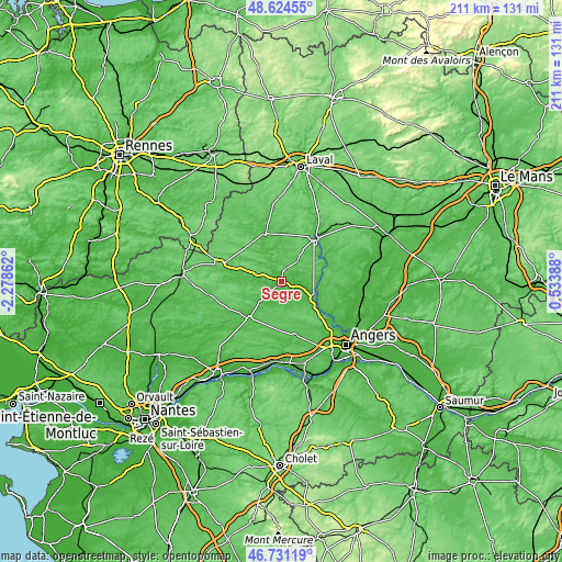
| Width | 6.58 km = 4.1 mi | 13.16 km = 8.2 mi | 210.5 km = 130.8 mi |
| Height | 6.58 km = 4.1 mi | 13.16 km = 8.2 mi | 210.5 km = 130.8 mi |
| ↑Max Latitude | 47.716035° | 47.745593° | 48.62455° |
| Latitude at center | 47.68646° | 47.68646° | 47.68646° |
| ↓Min Latitude | 47.656868° | 47.62726° | 46.73119° |
| ← Min Longitude | -0.916315° | -0.960261° | -2.27862° |
| Longitude center | -0.87237° | -0.87237° | -0.87237° |
| →Max Longitude | -0.828425° | -0.784479° | 0.53388° |
Nearby cities:
Cities around Segré sort by population:
• Craon elevation 53 m
18.7 km,  342°
342°
• Renazé 72 m
18.1 km,  311°
311°
• Candé 47 m
18.5 km,  221°
221°
• Combrée 55 m
12 km,  279°
279°
• Le Louroux-Béconnais 76 m
18.3 km,  183°
183°
• Vern-d’Anjou 46 m
9.9 km,  162°
162°
• Noyant-la-Gravoyère 95 m
6.6 km,  286°
286°
• Saint-Fort 67 m
16.9 km,  42°
42°
• Nyoiseau 43 m
4.7 km,  315°
315°
• La Pouëze 68 m
15.5 km, 162°
• Grez-Neuville 27 m
17 km,  123°
123°
• Chemazé 88 m
13.3 km,  33°
33°
Multilingual:
 En español:
Segré elevación 47 m.
 En France:
Segré élévation 47 m.


Sources and notes:
- [note 1] Map square and city borders are not equal. Map elevation data is calculated only from area inside that square.
- [src 1] Elevation data from geonames database provided with same terms of usage.
- [src 2] The elevation map of Segré is generated using elevation data from NASA's 3 arcsec (90m) resolution SRTM data.
- [src 3] Base (background) map © OpenStreetMap contributors tiles are generated by Geofabrik and OpenTopoMap.
Copyright & License:
This Segré Elevation Map is licensed under CC BY-SA. You may reuse any part from this page, if you give a proper credit by linking to this URL:
 More info on terms of use page.