Saint-Fort elevation
Saint-Fort (Pays de la Loire, Mayenne), France elevation is 67 meters and Saint-Fort elevation in feet is 220 ft above sea level [src 1]. Saint-Fort is a populated place (feature code) with elevation that is 107 meters (351 ft) smaller than average city elevation in France.
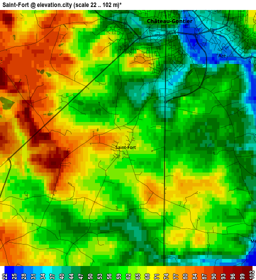
Below is the Elevation map of Saint-Fort, which displays elevation range with different colors. Scale of the first map is from 22 to 102 m (72 to 335 ft) with average elevation of 61.4 meters (=201 ft) [note 1]
These maps also provides idea of topography and contour of this city, they are displayed at different zoom levels. More info about maps, scale and edge coordinates you can find below images.
| \ | Map #1 | Topo.Map |
| Scale [m] | 22..102 m | × |
| Scale [ft] | 72..335 ft | × |
| Average | 61.4 m = 201 ft | × |
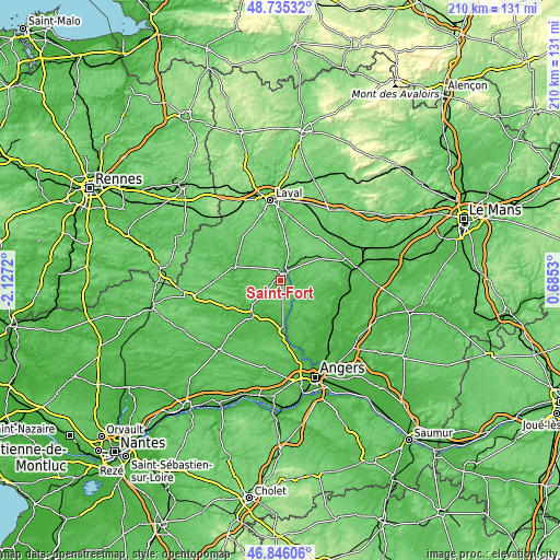
| Width | 6.56 km = 4.1 mi | 210.1 km = 130.5 mi |
| Height | 6.56 km = 4.1 mi | 210.1 km = 130.5 mi |
| ↑Max Latitude | 47.828791° | 48.73532° |
| Latitude at center | 47.79928° | 47.79928° |
| ↓Min Latitude | 47.769752° | 46.84606° |
| ← Min Longitude | -0.764895° | -2.1272° |
| Longitude center | -0.72095° | -0.72095° |
| →Max Longitude | -0.677005° | 0.6853° |
Nearby cities:
Cities around Saint-Fort sort by population:
• Château-Gontier elevation 39 m
3.5 km,  22°
22°
• Segré 47 m
16.9 km,  222°
222°
• Craon 53 m
17.8 km,  287°
287°
• Azé 45 m
3.8 km,  47°
47°
• Meslay-du-Maine 90 m
21 km,  36°
36°
• Quelaines-Saint-Gault 81 m
16 km,  338°
338°
• Noyant-la-Gravoyère 95 m
20.6 km,  238°
238°
• Champigné 38 m
18.8 km,  143°
143°
• Nyoiseau 43 m
17.3 km, 237°
• Nuillé-sur-Vicoin 62 m
21.2 km,  347°
347°
• Chemazé 88 m
4.3 km,  251°
251°
• Miré 48 m
17.8 km,  105°
105°
Multilingual:
 En español:
Saint-Fort elevación 67 m.
 En France:
Saint-Fort élévation 67 m.
 Auf Deutsch:
Saint-Fort höhe über dem Meeresspiegel ist 67 m.

Sources and notes:
- [note 1] Map square and city borders are not equal. Map elevation data is calculated only from area inside that square.
- [src 1] Elevation data from geonames database provided with same terms of usage.
- [src 2] The elevation map of Saint-Fort is generated using elevation data from NASA's 3 arcsec (90m) resolution SRTM data.
- [src 3] Base (background) map © OpenStreetMap contributors tiles are generated by Geofabrik and OpenTopoMap.
Copyright & License:
This Saint-Fort Elevation Map is licensed under CC BY-SA. You may reuse any part from this page, if you give a proper credit by linking to this URL:
 More info on terms of use page.