Villars-les-Dombes elevation
Villars-les-Dombes (Auvergne-Rhône-Alpes, Département de l'Ain), France elevation is 280 meters and Villars-les-Dombes elevation in feet is 919 ft above sea level [src 1]. Villars-les-Dombes is a populated place (feature code) with elevation that is 106 meters (348 ft) bigger than average city elevation in France.
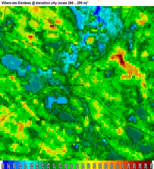
Below is the Elevation map of Villars-les-Dombes, which displays elevation range with different colors. Scale of the first map is from 266 to 299 m (873 to 981 ft) with average elevation of 279.4 meters (=917 ft) [note 1]
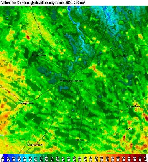
These maps also provides idea of topography and contour of this city, they are displayed at different zoom levels. More info about maps, scale and edge coordinates you can find below images.
| \ | Map #1 | Map #2 | Topo.Map |
| Scale [m] | 266..299 m | 259..310 m | × |
| Scale [ft] | 873..981 ft | 850..1017 ft | × |
| Average | 279.4 m = 917 ft | 281.1 m = 922 ft | × |
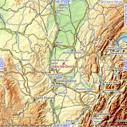
| Width | 6.79 km = 4.2 mi | 13.58 km = 8.4 mi | 217.2 km = 135 mi |
| Height | 6.79 km = 4.2 mi | 13.58 km = 8.4 mi | 217.2 km = 135 mi |
| ↑Max Latitude | 46.032597° | 46.063098° | 46.97029° |
| Latitude at center | 46.00208° | 46.00208° | 46.00208° |
| ↓Min Latitude | 45.971546° | 45.940995° | 45.01663° |
| ← Min Longitude | 4.988535° | 4.944589° | 3.62623° |
| Longitude center | 5.03248° | 5.03248° | 5.03248° |
| →Max Longitude | 5.076425° | 5.120371° | 6.43873° |
Nearby cities:
Cities around Villars-les-Dombes sort by population:
• Châtillon-sur-Chalaronne elevation 242 m
14.2 km,  335°
335°
• Saint-André-de-Corcy 298 m
10.5 km,  216°
216°
• Mionnay 277 m
14.1 km,  214°
214°
• Chalamont 285 m
10.5 km,  92°
92°
• Saint-Trivier-sur-Moignans 256 m
13 km,  306°
306°
• Tramoyes 300 m
15 km,  200°
200°
• Ambérieux-en-Dombes 297 m
10.1 km,  268°
268°
• Civrieux 287 m
14.7 km,  232°
232°
• Saint-Paul-de-Varax 263 m
12.9 km,  35°
35°
• Pérouges 229 m
15.6 km,  134°
134°
• Dompierre-sur-Veyle 283 m
15.2 km,  59°
59°
• Villeneuve 266 m
15.3 km,  277°
277°
Multilingual:
 En español:
Villars-les-Dombes elevación 280 m.
 En France:
Villars-les-Dombes élévation 280 m.
 Auf Deutsch:
Villars-les-Dombes höhe über dem Meeresspiegel ist 280 m.
 На русском:
Villars-les-Dombes высота над уровнем моря 280 м
Sources and notes:
- [note 1] Map square and city borders are not equal. Map elevation data is calculated only from area inside that square.
- [src 1] Elevation data from geonames database provided with same terms of usage.
- [src 2] The elevation map of Villars-les-Dombes is generated using elevation data from NASA's 3 arcsec (90m) resolution SRTM data.
- [src 3] Base (background) map © OpenStreetMap contributors tiles are generated by Geofabrik and OpenTopoMap.
Copyright & License:
This Villars-les-Dombes Elevation Map is licensed under CC BY-SA. You may reuse any part from this page, if you give a proper credit by linking to this URL:
 More info on terms of use page.