Châtillon-sur-Chalaronne elevation
Châtillon-sur-Chalaronne (Auvergne-Rhône-Alpes, Département de l'Ain), France elevation is 242 meters and Châtillon-sur-Chalaronne elevation in feet is 794 ft above sea level [src 1]. Châtillon-sur-Chalaronne is a populated place (feature code) with elevation that is 68 meters (223 ft) bigger than average city elevation in France.
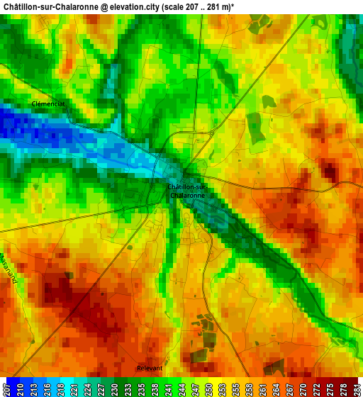
Below is the Elevation map of Châtillon-sur-Chalaronne, which displays elevation range with different colors. Scale of the first map is from 207 to 281 m (679 to 922 ft) with average elevation of 250.2 meters (=821 ft) [note 1]
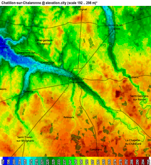
These maps also provides idea of topography and contour of this city, they are displayed at different zoom levels. More info about maps, scale and edge coordinates you can find below images.
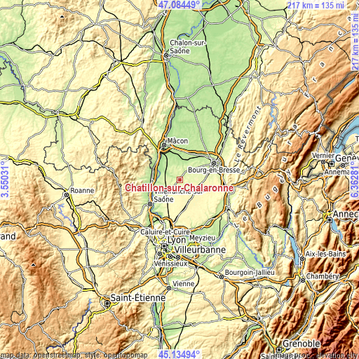
| \ | Map #1 | Map #2 | Topo.Map |
| Scale [m] | 207..281 m | 192..298 m | × |
| Scale [ft] | 679..922 ft | 630..978 ft | × |
| Average | 250.2 m = 821 ft | 252.1 m = 827 ft | × |
| Width | 6.77 km = 4.2 mi | 13.55 km = 8.4 mi | 216.8 km = 134.7 mi |
| Height | 6.77 km = 4.2 mi | 13.55 km = 8.4 mi | 216.8 km = 134.7 mi |
| ↑Max Latitude | 46.148793° | 46.17923° | 47.08449° |
| Latitude at center | 46.11834° | 46.11834° | 46.11834° |
| ↓Min Latitude | 46.08787° | 46.057383° | 45.13494° |
| ← Min Longitude | 4.912615° | 4.868669° | 3.55031° |
| Longitude center | 4.95656° | 4.95656° | 4.95656° |
| →Max Longitude | 5.000505° | 5.044451° | 6.36281° |
Nearby cities:
Cities around Châtillon-sur-Chalaronne sort by population:
• Villars-les-Dombes elevation 280 m
14.2 km,  155°
155°
• Vonnas 190 m
11.3 km,  14°
14°
• Saint-Didier-sur-Chalaronne 179 m
12.6 km,  301°
301°
• Saint-Trivier-sur-Moignans 256 m
6.9 km,  221°
221°
• Ambérieux-en-Dombes 297 m
13.9 km,  197°
197°
• Thoissey 175 m
13.3 km, 296°
• Neuville-les-Dames 244 m
6.2 km,  38°
38°
• Saint-Paul-de-Varax 263 m
13.5 km,  100°
100°
• Saint-Étienne-sur-Chalaronne 207 m
7.3 km, 296°
• Guéreins 181 m
14.3 km,  263°
263°
• Francheleins 217 m
12.4 km,  246°
246°
• Villeneuve 266 m
14.3 km, 220°
Multilingual:
 En español:
Châtillon-sur-Chalaronne elevación 242 m.
 En France:
Châtillon-sur-Chalaronne élévation 242 m.
 Auf Deutsch:
Châtillon-sur-Chalaronne höhe über dem Meeresspiegel ist 242 m.
 На русском:
Шатийон-сюр-Шаларон высота над уровнем моря 242 м
Sources and notes:
- [note 1] Map square and city borders are not equal. Map elevation data is calculated only from area inside that square.
- [src 1] Elevation data from geonames database provided with same terms of usage.
- [src 2] The elevation map of Châtillon-sur-Chalaronne is generated using elevation data from NASA's 3 arcsec (90m) resolution SRTM data.
- [src 3] Base (background) map © OpenStreetMap contributors tiles are generated by Geofabrik and OpenTopoMap.
Copyright & License:
This Châtillon-sur-Chalaronne Elevation Map is licensed under CC BY-SA. You may reuse any part from this page, if you give a proper credit by linking to this URL:
 More info on terms of use page.