Dompierre-sur-Veyle elevation
Dompierre-sur-Veyle (Auvergne-Rhône-Alpes, Département de l'Ain), France elevation is 283 meters and Dompierre-sur-Veyle elevation in feet is 928 ft above sea level [src 1]. Dompierre-sur-Veyle is a populated place (feature code) with elevation that is 109 meters (358 ft) bigger than average city elevation in France.
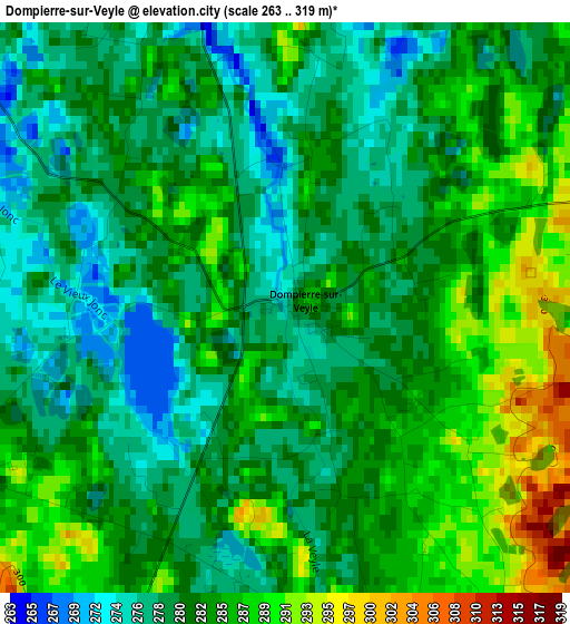
Below is the Elevation map of Dompierre-sur-Veyle, which displays elevation range with different colors. Scale of the first map is from 263 to 319 m (863 to 1047 ft) with average elevation of 282.3 meters (=926 ft) [note 1]
These maps also provides idea of topography and contour of this city, they are displayed at different zoom levels. More info about maps, scale and edge coordinates you can find below images.
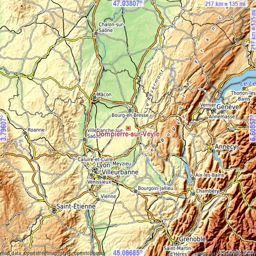
| \ | Map #1 | Topo.Map |
| Scale [m] | 263..319 m | × |
| Scale [ft] | 863..1047 ft | × |
| Average | 282.3 m = 926 ft | × |
| Width | 6.78 km = 4.2 mi | 217 km = 134.8 mi |
| Height | 6.78 km = 4.2 mi | 216.9 km = 134.8 mi |
| ↑Max Latitude | 46.101559° | 47.03807° |
| Latitude at center | 46.07108° | 46.07108° |
| ↓Min Latitude | 46.040584° | 45.08685° |
| ← Min Longitude | 5.158375° | 3.79607° |
| Longitude center | 5.20232° | 5.20232° |
| →Max Longitude | 5.246265° | 6.60857° |
Nearby cities:
Cities around Dompierre-sur-Veyle sort by population:
• Péronnas elevation 240 m
12.5 km,  2°
2°
• Pont-d’Ain 270 m
10.7 km,  99°
99°
• Chalamont 285 m
8.6 km,  197°
197°
• Saint-Martin-du-Mont 360 m
9.3 km,  71°
71°
• Certines 247 m
8.4 km,  35°
35°
• Châtillon-la-Palud 221 m
11.7 km,  160°
160°
• Saint-Paul-de-Varax 263 m
6.3 km,  297°
297°
• Priay 233 m
10.1 km,  139°
139°
• Lent 256 m
5.5 km,  352°
352°
• Tossiat 260 m
11.4 km,  47°
47°
• Servas 268 m
7.5 km,  337°
337°
• Saint-André-sur-Vieux-Jonc 249 m
10.6 km, 336°
Multilingual:
 En español:
Dompierre-sur-Veyle elevación 283 m.
 En France:
Dompierre-sur-Veyle élévation 283 m.
 Auf Deutsch:
Dompierre-sur-Veyle höhe über dem Meeresspiegel ist 283 m.
 На русском:
Dompierre-sur-Veyle высота над уровнем моря 283 м
Sources and notes:
- [note 1] Map square and city borders are not equal. Map elevation data is calculated only from area inside that square.
- [src 1] Elevation data from geonames database provided with same terms of usage.
- [src 2] The elevation map of Dompierre-sur-Veyle is generated using elevation data from NASA's 3 arcsec (90m) resolution SRTM data.
- [src 3] Base (background) map © OpenStreetMap contributors tiles are generated by Geofabrik and OpenTopoMap.
Copyright & License:
This Dompierre-sur-Veyle Elevation Map is licensed under CC BY-SA. You may reuse any part from this page, if you give a proper credit by linking to this URL:
 More info on terms of use page.