Péronnas elevation
Péronnas (Auvergne-Rhône-Alpes, Département de l'Ain), France elevation is 240 meters and Péronnas elevation in feet is 787 ft above sea level [src 1]. Péronnas is a populated place (feature code) with elevation that is 66 meters (217 ft) bigger than average city elevation in France.
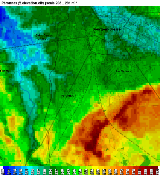
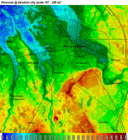
Below is the Elevation map of Péronnas, which displays elevation range with different colors. Scale of the first map is from 208 to 291 m (682 to 955 ft) with average elevation of 244.7 meters (=803 ft) [note 1]
These maps also provides idea of topography and contour of this city, they are displayed at different zoom levels. More info about maps, scale and edge coordinates you can find below images.
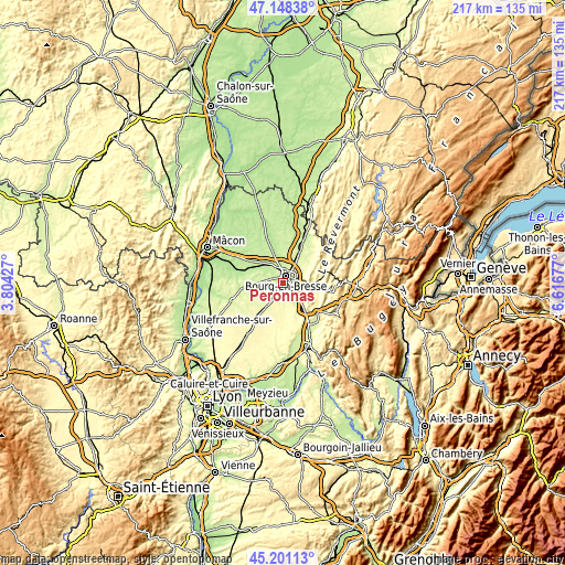
| \ | Map #1 | Map #2 | Topo.Map |
| Scale [m] | 208..291 m | 197..298 m | × |
| Scale [ft] | 682..955 ft | 646..978 ft | × |
| Average | 244.7 m = 803 ft | 244.4 m = 802 ft | × |
| Width | 6.77 km = 4.2 mi | 13.53 km = 8.4 mi | 216.5 km = 134.5 mi |
| Height | 6.77 km = 4.2 mi | 13.53 km = 8.4 mi | 216.5 km = 134.5 mi |
| ↑Max Latitude | 46.213797° | 46.244198° | 47.14838° |
| Latitude at center | 46.18338° | 46.18338° | 46.18338° |
| ↓Min Latitude | 46.152946° | 46.122495° | 45.20113° |
| ← Min Longitude | 5.166575° | 5.122629° | 3.80427° |
| Longitude center | 5.21052° | 5.21052° | 5.21052° |
| →Max Longitude | 5.254465° | 5.298411° | 6.61677° |
Nearby cities:
Cities around Péronnas sort by population:
• Bourg-en-Bresse elevation 231 m
2.8 km,  25°
25°
• Viriat 227 m
8 km,  2°
2°
• Saint-Denis-lès-Bourg 235 m
2.7 km,  321°
321°
• Ceyzériat 325 m
8.4 km,  91°
91°
• Buellas 222 m
6.8 km,  297°
297°
• Montagnat 245 m
6.2 km,  106°
106°
• Certines 247 m
7.1 km,  143°
143°
• Jasseron 294 m
9.5 km,  69°
69°
• Lent 256 m
7.1 km,  190°
190°
• Tossiat 260 m
9.2 km,  121°
121°
• Servas 268 m
6.6 km,  212°
212°
• Saint-André-sur-Vieux-Jonc 249 m
5.6 km,  240°
240°
Multilingual:
 En español:
Péronnas elevación 240 m.
 En France:
Péronnas élévation 240 m.
 Auf Deutsch:
Péronnas höhe über dem Meeresspiegel ist 240 m.

Sources and notes:
- [note 1] Map square and city borders are not equal. Map elevation data is calculated only from area inside that square.
- [src 1] Elevation data from geonames database provided with same terms of usage.
- [src 2] The elevation map of Péronnas is generated using elevation data from NASA's 3 arcsec (90m) resolution SRTM data.
- [src 3] Base (background) map © OpenStreetMap contributors tiles are generated by Geofabrik and OpenTopoMap.
Copyright & License:
This Péronnas Elevation Map is licensed under CC BY-SA. You may reuse any part from this page, if you give a proper credit by linking to this URL:
 More info on terms of use page.