Mionnay elevation
Mionnay (Auvergne-Rhône-Alpes, Département de l'Ain), France elevation is 277 meters and Mionnay elevation in feet is 909 ft above sea level [src 1]. Mionnay is a populated place (feature code) with elevation that is 103 meters (338 ft) bigger than average city elevation in France.
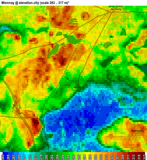
Below is the Elevation map of Mionnay, which displays elevation range with different colors. Scale of the first map is from 263 to 317 m (863 to 1040 ft) with average elevation of 288.9 meters (=948 ft) [note 1]
These maps also provides idea of topography and contour of this city, they are displayed at different zoom levels. More info about maps, scale and edge coordinates you can find below images.
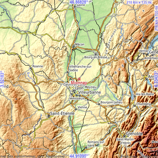
| \ | Map #1 | Topo.Map |
| Scale [m] | 263..317 m | × |
| Scale [ft] | 863..1040 ft | × |
| Average | 288.9 m = 948 ft | × |
| Width | 6.8 km = 4.2 mi | 217.6 km = 135.2 mi |
| Height | 6.8 km = 4.2 mi | 217.6 km = 135.2 mi |
| ↑Max Latitude | 45.928815° | 46.86828° |
| Latitude at center | 45.89824° | 45.89824° |
| ↓Min Latitude | 45.867649° | 44.91095° |
| ← Min Longitude | 4.884135° | 3.52183° |
| Longitude center | 4.92808° | 4.92808° |
| →Max Longitude | 4.972025° | 6.33433° |
Nearby cities:
Cities around Mionnay sort by population:
• Neuville-sur-Saône elevation 200 m
7.2 km,  249°
249°
• Genay 248 m
6.7 km,  268°
268°
• Saint-Maurice-de-Beynost 199 m
8.1 km,  151°
151°
• Saint-André-de-Corcy 298 m
3.6 km,  30°
30°
• Albigny-sur-Saône 171 m
8.1 km,  244°
244°
• Montanay 306 m
5.5 km, 247°
• Massieux 232 m
7.5 km,  279°
279°
• Cailloux-sur-Fontaines 261 m
6.5 km,  219°
219°
• Tramoyes 300 m
3.8 km,  130°
130°
• Fleurieu-sur-Saône 262 m
7.6 km, 236°
• Civrieux 287 m
4.3 km,  305°
305°
• Rochetaillée-sur-Saône 235 m
8.1 km,  228°
228°
Multilingual:
 En español:
Mionnay elevación 277 m.
 En France:
Mionnay élévation 277 m.


Sources and notes:
- [note 1] Map square and city borders are not equal. Map elevation data is calculated only from area inside that square.
- [src 1] Elevation data from geonames database provided with same terms of usage.
- [src 2] The elevation map of Mionnay is generated using elevation data from NASA's 3 arcsec (90m) resolution SRTM data.
- [src 3] Base (background) map © OpenStreetMap contributors tiles are generated by Geofabrik and OpenTopoMap.
Copyright & License:
This Mionnay Elevation Map is licensed under CC BY-SA. You may reuse any part from this page, if you give a proper credit by linking to this URL:
 More info on terms of use page.