Villefranche-de-Rouergue elevation
Villefranche-de-Rouergue (Occitanie, Département de l'Aveyron), France elevation is 269 meters and Villefranche-de-Rouergue elevation in feet is 883 ft above sea level [src 1]. Villefranche-de-Rouergue is a seat of a third-order administrative division (feature code) with elevation that is 95 meters (312 ft) bigger than average city elevation in France.
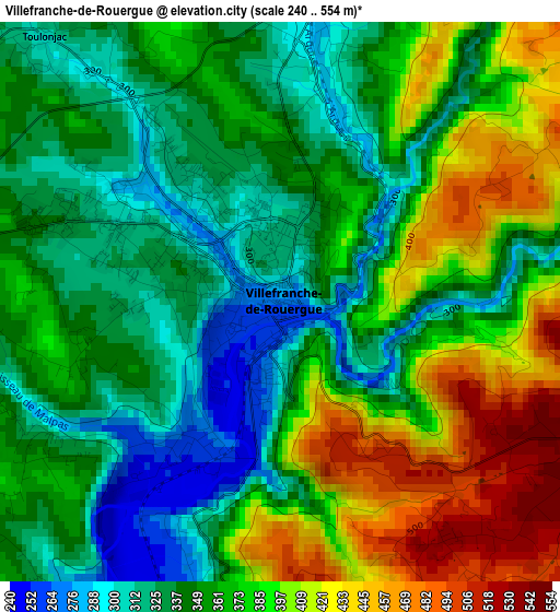
Below is the Elevation map of Villefranche-de-Rouergue, which displays elevation range with different colors. Scale of the first map is from 240 to 554 m (787 to 1818 ft) with average elevation of 364.7 meters (=1197 ft) [note 1]
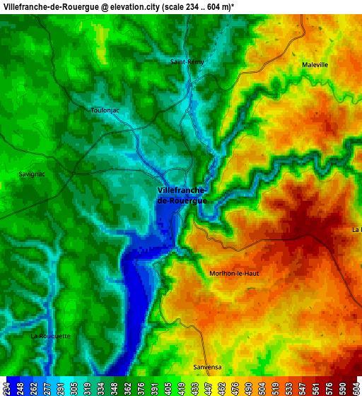
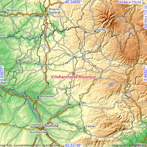
These maps also provides idea of topography and contour of this city, they are displayed at different zoom levels. More info about maps, scale and edge coordinates you can find below images.
| \ | Map #1 | Map #2 | Topo.Map |
| Scale [m] | 240..554 m | 234..604 m | × |
| Scale [ft] | 787..1818 ft | 768..1982 ft | × |
| Average | 364.7 m = 1197 ft | 404.2 m = 1326 ft | × |
| Width | 6.99 km = 4.3 mi | 13.98 km = 8.7 mi | 223.6 km = 138.9 mi |
| Height | 6.99 km = 4.3 mi | 13.98 km = 8.7 mi | 223.6 km = 138.9 mi |
| ↑Max Latitude | 44.383075° | 44.414474° | 45.34859° |
| Latitude at center | 44.35166° | 44.35166° | 44.35166° |
| ↓Min Latitude | 44.320228° | 44.288779° | 43.33748° |
| ← Min Longitude | 1.993075° | 1.949129° | 0.63077° |
| Longitude center | 2.03702° | 2.03702° | 2.03702° |
| →Max Longitude | 2.080965° | 2.124911° | 3.44327° |
Nearby cities:
Cities around Villefranche-de-Rouergue sort by population:
• Aubin elevation 247 m
25.6 km,  40°
40°
• Villeneuve 382 m
9.1 km,  358°
358°
• Rieupeyroux 711 m
16.7 km,  106°
106°
• Rignac 501 m
21.1 km,  72°
72°
• Caylus 231 m
24.7 km,  238°
238°
• Montbazens 464 m
20.8 km,  47°
47°
• Cajarc 158 m
21.4 km,  313°
313°
• La Salvetat-Peyralès 531 m
19.8 km,  138°
138°
• La Fouillade 418 m
13.4 km,  179°
179°
• Capdenac-Gare 177 m
25.1 km,  7°
7°
• Mirandol-Bourgnounac 403 m
25.5 km,  155°
155°
• Colombiès 697 m
23.9 km,  92°
92°
Multilingual:
 En español:
Villefranche-de-Rouergue elevación 269 m.
 En France:
Villefranche-de-Rouergue élévation 269 m.
 Auf Deutsch:
Villefranche-de-Rouergue höhe über dem Meeresspiegel ist 269 m.
 На русском:
Вильфранш-де-Руэрг высота над уровнем моря 269 м
Sources and notes:
- [note 1] Map square and city borders are not equal. Map elevation data is calculated only from area inside that square.
- [src 1] Elevation data from geonames database provided with same terms of usage.
- [src 2] The elevation map of Villefranche-de-Rouergue is generated using elevation data from NASA's 3 arcsec (90m) resolution SRTM data.
- [src 3] Base (background) map © OpenStreetMap contributors tiles are generated by Geofabrik and OpenTopoMap.
Copyright & License:
This Villefranche-de-Rouergue Elevation Map is licensed under CC BY-SA. You may reuse any part from this page, if you give a proper credit by linking to this URL:
 More info on terms of use page.