Ajalvir elevation
Ajalvir (Madrid, Provincia de Madrid), Spain elevation is 666 meters and Ajalvir elevation in feet is 2185 ft above sea level [src 1]. Ajalvir is a seat of a third-order administrative division (feature code) with elevation that is 63 meters (207 ft) bigger than average city elevation in Spain.
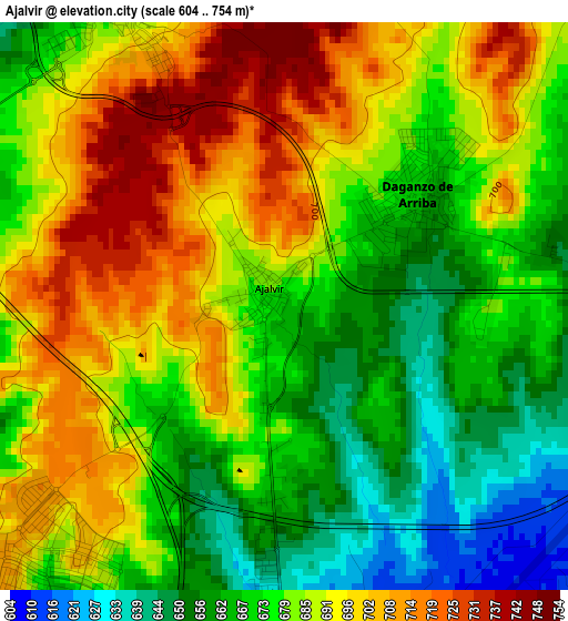
Below is the Elevation map of Ajalvir, which displays elevation range with different colors. Scale of the first map is from 604 to 754 m (1982 to 2474 ft) with average elevation of 682 meters (=2238 ft) [note 1]
These maps also provides idea of topography and contour of this city, they are displayed at different zoom levels. More info about maps, scale and edge coordinates you can find below images.
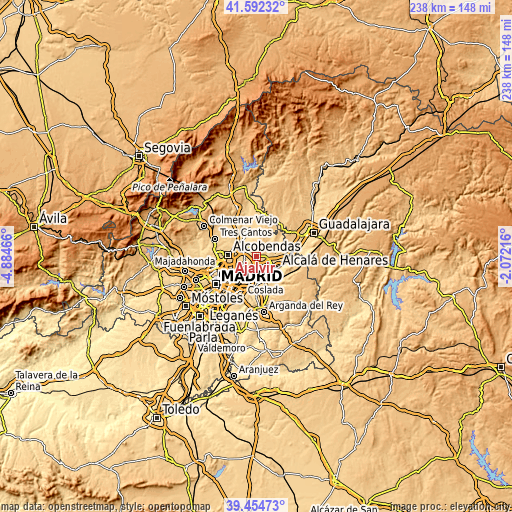
| \ | Map #1 | Topo.Map |
| Scale [m] | 604..754 m | × |
| Scale [ft] | 1982..2474 ft | × |
| Average | 682 m = 2238 ft | × |
| Width | 7.43 km = 4.6 mi | 237.7 km = 147.7 mi |
| Height | 7.43 km = 4.6 mi | 237.7 km = 147.7 mi |
| ↑Max Latitude | 40.565442° | 41.59232° |
| Latitude at center | 40.53205° | 40.53205° |
| ↓Min Latitude | 40.498641° | 39.45473° |
| ← Min Longitude | -3.522355° | -4.88466° |
| Longitude center | -3.47841° | -3.47841° |
| →Max Longitude | -3.434465° | -2.07216° |
Nearby cities:
Cities around Ajalvir sort by population:
• Alcalá de Henares elevation 597 m
11.5 km,  119°
119°
• Torrejón de Ardoz 588 m
8.6 km,  175°
175°
• Barajas de Madrid 625 m
10.6 km,  232°
232°
• Algete 721 m
7.4 km,  347°
347°
• Paracuellos de Jarama 695 m
5.2 km, 232°
• Meco 664 m
12.8 km,  79°
79°
• Daganzo de Arriba 662 m
2.3 km,  59°
59°
• Fuente el Saz 642 m
11.5 km, 345°
• Camarma de Esteruelas 644 m
9.1 km, 77°
• Cobeña 682 m
4.3 km,  334°
334°
• Valdeolmos 702 m
11.9 km,  11°
11°
• Fresno de Torote 654 m
8.7 km,  41°
41°
Multilingual:
 En español:
Ajalvir elevación 666 m.
 En France:
Ajalvir élévation 666 m.


Sources and notes:
- [note 1] Map square and city borders are not equal. Map elevation data is calculated only from area inside that square.
- [src 1] Elevation data from geonames database provided with same terms of usage.
- [src 2] The elevation map of Ajalvir is generated using elevation data from NASA's 3 arcsec (90m) resolution SRTM data.
- [src 3] Base (background) map © OpenStreetMap contributors tiles are generated by Geofabrik and OpenTopoMap.
Copyright & License:
This Ajalvir Elevation Map is licensed under CC BY-SA. You may reuse any part from this page, if you give a proper credit by linking to this URL:
 More info on terms of use page.