Borriol elevation
Borriol (Valencia, Província de Castelló), Spain elevation is 199 meters and Borriol elevation in feet is 653 ft above sea level [src 1]. Borriol is a seat of a third-order administrative division (feature code) with elevation that is 404 meters (1325 ft) smaller than average city elevation in Spain.
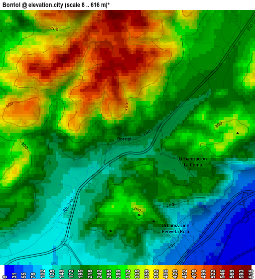
Below is the Elevation map of Borriol, which displays elevation range with different colors. Scale of the first map is from 8 to 616 m (26 to 2021 ft) with average elevation of 258.7 meters (=849 ft) [note 1]
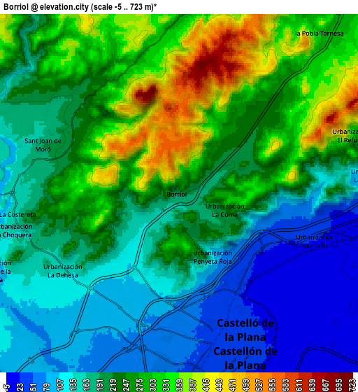
These maps also provides idea of topography and contour of this city, they are displayed at different zoom levels. More info about maps, scale and edge coordinates you can find below images.
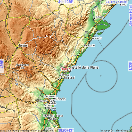
| \ | Map #1 | Map #2 | Topo.Map |
| Scale [m] | 8..616 m | -5..723 m | × |
| Scale [ft] | 26..2021 ft | -16..2372 ft | × |
| Average | 258.7 m = 849 ft | 217.9 m = 715 ft | × |
| Width | 7.48 km = 4.6 mi | 14.96 km = 9.3 mi | 239.4 km = 148.8 mi |
| Height | 7.48 km = 4.6 mi | 14.96 km = 9.3 mi | 239.4 km = 148.8 mi |
| ↑Max Latitude | 40.076125° | 40.109743° | 41.11055° |
| Latitude at center | 40.04249° | 40.04249° | 40.04249° |
| ↓Min Latitude | 40.008839° | 39.975171° | 38.95743° |
| ← Min Longitude | -0.114195° | -0.158141° | -1.4765° |
| Longitude center | -0.07025° | -0.07025° | -0.07025° |
| →Max Longitude | -0.026305° | 0.017641° | 1.336° |
Nearby cities:
Cities around Borriol sort by population:
• Castelló de la Plana elevation 37 m
6.6 km,  164°
164°
• Vila-real 48 m
11.9 km,  192°
192°
• Almassora 37 m
10.6 km,  176°
176°
• Benicàssim 12 m
11.7 km,  85°
85°
• El Grao 6 m
10.4 km,  137°
137°
• l'Alcora 236 m
11.4 km,  283°
283°
• Betxí 96 m
16.4 km,  222°
222°
• Cabanes 276 m
15.9 km,  37°
37°
• San Juan de Moró 192 m
6 km,  288°
288°
• Villafamés 284 m
8.4 km,  11°
11°
• Figueroles 360 m
16.1 km,  300°
300°
• Costur 472 m
12.3 km,  314°
314°
Multilingual:
 En español:
Borriol elevación 199 m.
 En France:
Borriol élévation 199 m.


Sources and notes:
- [note 1] Map square and city borders are not equal. Map elevation data is calculated only from area inside that square.
- [src 1] Elevation data from geonames database provided with same terms of usage.
- [src 2] The elevation map of Borriol is generated using elevation data from NASA's 3 arcsec (90m) resolution SRTM data.
- [src 3] Base (background) map © OpenStreetMap contributors tiles are generated by Geofabrik and OpenTopoMap.
Copyright & License:
This Borriol Elevation Map is licensed under CC BY-SA. You may reuse any part from this page, if you give a proper credit by linking to this URL:
 More info on terms of use page.