l'Alcora elevation
l'Alcora (Valencia, Província de Castelló), Spain elevation is 236 meters and l'Alcora elevation in feet is 774 ft above sea level [src 1]. l'Alcora is a populated place (feature code) with elevation that is 367 meters (1204 ft) smaller than average city elevation in Spain.
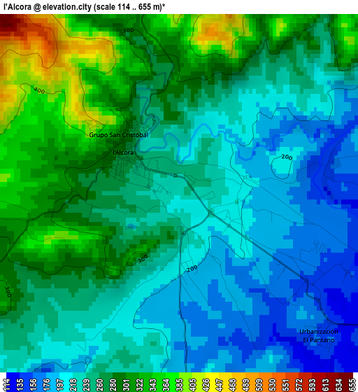
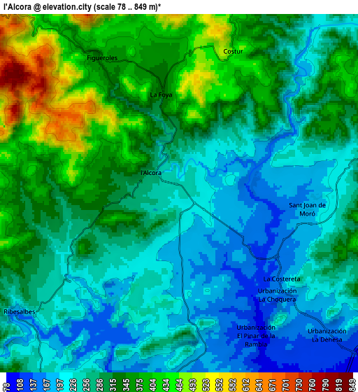
Below is the Elevation map of l'Alcora, which displays elevation range with different colors. Scale of the first map is from 114 to 655 m (374 to 2149 ft) with average elevation of 255.8 meters (=839 ft) [note 1]
These maps also provides idea of topography and contour of this city, they are displayed at different zoom levels. More info about maps, scale and edge coordinates you can find below images.
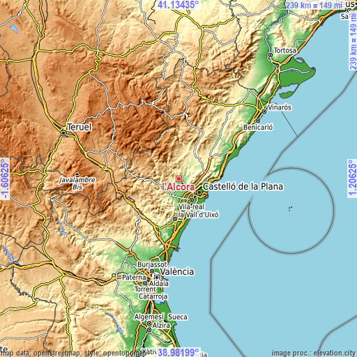
| \ | Map #1 | Map #2 | Topo.Map |
| Scale [m] | 114..655 m | 78..849 m | × |
| Scale [ft] | 374..2149 ft | 256..2785 ft | × |
| Average | 255.8 m = 839 ft | 292.9 m = 961 ft | × |
| Width | 7.48 km = 4.6 mi | 14.96 km = 9.3 mi | 239.3 km = 148.7 mi |
| Height | 7.48 km = 4.6 mi | 14.96 km = 9.3 mi | 239.3 km = 148.7 mi |
| ↑Max Latitude | 40.100293° | 40.133899° | 41.13435° |
| Latitude at center | 40.06667° | 40.06667° | 40.06667° |
| ↓Min Latitude | 40.033031° | 39.999374° | 38.98199° |
| ← Min Longitude | -0.243945° | -0.287891° | -1.60625° |
| Longitude center | -0.2° | -0.2° | -0.2° |
| →Max Longitude | -0.156055° | -0.112109° | 1.20625° |
Nearby cities:
Cities around l'Alcora sort by population:
• Onda elevation 192 m
12.4 km,  204°
204°
• Borriol 199 m
11.4 km,  103°
103°
• San Juan de Moró 192 m
5.4 km, 97°
• Villafamés 284 m
13.9 km,  66°
66°
• Lucena del Cid 623 m
10.3 km,  316°
316°
• Ribesalbes 199 m
7.9 km,  225°
225°
• Figueroles 360 m
6.2 km,  332°
332°
• Costur 472 m
6.3 km,  20°
20°
• Fanzara 217 m
11.4 km,  240°
240°
• Argelita 291 m
12.9 km,  261°
261°
• Toga 401 m
14.3 km, 262°
• Espadilla 250 m
13.3 km,  253°
253°
Multilingual:
 En español:
Alcora elevación 236 m.
 En France:
l'Alcora élévation 236 m.
 Auf Deutsch:
l'Alcora höhe über dem Meeresspiegel ist 236 m.

Sources and notes:
- [note 1] Map square and city borders are not equal. Map elevation data is calculated only from area inside that square.
- [src 1] Elevation data from geonames database provided with same terms of usage.
- [src 2] The elevation map of l'Alcora is generated using elevation data from NASA's 3 arcsec (90m) resolution SRTM data.
- [src 3] Base (background) map © OpenStreetMap contributors tiles are generated by Geofabrik and OpenTopoMap.
Copyright & License:
This l'Alcora Elevation Map is licensed under CC BY-SA. You may reuse any part from this page, if you give a proper credit by linking to this URL:
 More info on terms of use page.