Benicàssim elevation
Benicàssim (Valencia, Província de Castelló), Spain elevation is 12 meters and Benicàssim elevation in feet is 39 ft above sea level [src 1]. Benicàssim is a populated place (feature code) with elevation that is 591 meters (1939 ft) smaller than average city elevation in Spain.
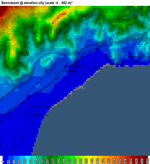
Below is the Elevation map of Benicàssim, which displays elevation range with different colors. Scale of the first map is from -4 to 682 m (-13 to 2238 ft) with average elevation of 133.4 meters (=438 ft) [note 1]
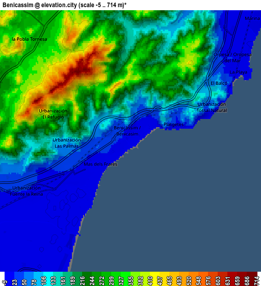
These maps also provides idea of topography and contour of this city, they are displayed at different zoom levels. More info about maps, scale and edge coordinates you can find below images.
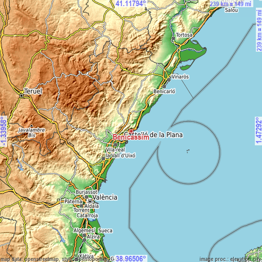
| \ | Map #1 | Map #2 | Topo.Map |
| Scale [m] | -4..682 m | -5..714 m | × |
| Scale [ft] | -13..2238 ft | -16..2343 ft | × |
| Average | 133.4 m = 438 ft | 181.4 m = 595 ft | × |
| Width | 7.48 km = 4.6 mi | 14.96 km = 9.3 mi | 239.4 km = 148.8 mi |
| Height | 7.48 km = 4.6 mi | 14.96 km = 9.3 mi | 239.4 km = 148.8 mi |
| ↑Max Latitude | 40.083631° | 40.117246° | 41.11794° |
| Latitude at center | 40.05° | 40.05° | 40.05° |
| ↓Min Latitude | 40.016352° | 39.982688° | 38.96506° |
| ← Min Longitude | 0.022725° | -0.021221° | -1.33958° |
| Longitude center | 0.06667° | 0.06667° | 0.06667° |
| →Max Longitude | 0.110615° | 0.154561° | 1.47292° |
Nearby cities:
Cities around Benicàssim sort by population:
• Castelló de la Plana elevation 37 m
12.2 km,  234°
234°
• Vila-real 48 m
18.9 km, 228°
• Almassora 37 m
15.9 km,  224°
224°
• El Grao 6 m
9.7 km,  208°
208°
• Oropesa del Mar 4 m
7.8 km,  54°
54°
• Torreblanca 30 m
21.9 km,  30°
30°
• Borriol 199 m
11.7 km,  265°
265°
• Cabanes 276 m
12 km,  350°
350°
• San Juan de Moró 192 m
17.4 km, 273°
• Villafamés 284 m
12.4 km,  306°
306°
• Benlloch 317 m
18.2 km, 349°
• Costur 472 m
21.9 km,  290°
290°
Multilingual:
 En español:
Benicásim elevación 12 m.
 En France:
Benicàssim élévation 12 m.
 Auf Deutsch:
Benicàssim höhe über dem Meeresspiegel ist 12 m.

Sources and notes:
- [note 1] Map square and city borders are not equal. Map elevation data is calculated only from area inside that square.
- [src 1] Elevation data from geonames database provided with same terms of usage.
- [src 2] The elevation map of Benicàssim is generated using elevation data from NASA's 3 arcsec (90m) resolution SRTM data.
- [src 3] Base (background) map © OpenStreetMap contributors tiles are generated by Geofabrik and OpenTopoMap.
Copyright & License:
This Benicàssim Elevation Map is licensed under CC BY-SA. You may reuse any part from this page, if you give a proper credit by linking to this URL:
 More info on terms of use page.