Camaleño elevation
Camaleño (Cantabria, Provincia de Cantabria), Spain elevation is 424 meters and Camaleño elevation in feet is 1391 ft above sea level [src 1]. Camaleño is a seat of a third-order administrative division (feature code) with elevation that is 179 meters (587 ft) smaller than average city elevation in Spain.
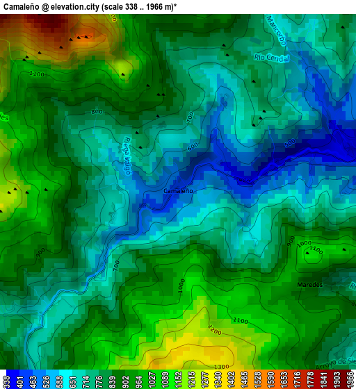
Below is the Elevation map of Camaleño, which displays elevation range with different colors. Scale of the first map is from 338 to 1966 m (1109 to 6450 ft) with average elevation of 833.2 meters (=2734 ft) [note 1]
These maps also provides idea of topography and contour of this city, they are displayed at different zoom levels. More info about maps, scale and edge coordinates you can find below images.
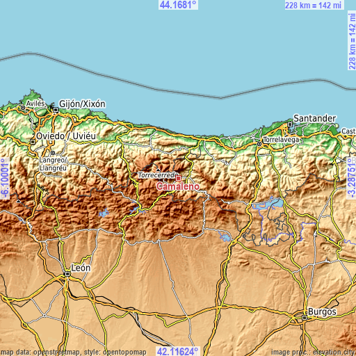
| \ | Map #1 | Topo.Map |
| Scale [m] | 338..1966 m | × |
| Scale [ft] | 1109..6450 ft | × |
| Average | 833.2 m = 2734 ft | × |
| Width | 7.13 km = 4.4 mi | 228.1 km = 141.7 mi |
| Height | 7.13 km = 4.4 mi | 228.1 km = 141.7 mi |
| ↑Max Latitude | 43.182832° | 44.1681° |
| Latitude at center | 43.15078° | 43.15078° |
| ↓Min Latitude | 43.118711° | 42.11624° |
| ← Min Longitude | -4.737705° | -6.10001° |
| Longitude center | -4.69376° | -4.69376° |
| →Max Longitude | -4.649815° | -3.28751° |
Nearby cities:
Cities around Camaleño sort by population:
• Llanes elevation 13 m
30.3 km,  350°
350°
• Carreña 188 m
22.3 km,  326°
326°
• Potes 307 m
6 km,  85°
85°
• Boca de Huérgano 1112 m
27.2 km,  223°
223°
• Riaño 1126 m
31.7 km,  232°
232°
• Posada de Valdeón 914 m
18.4 km,  270°
270°
• Burón 1107 m
32.2 km,  244°
244°
• Oseja de Sajambre 759 m
28 km, 266°
• Triollo 1300 m
25.2 km,  177°
177°
• Polentinos 1272 m
27.1 km,  150°
150°
• Tresviso 886 m
12.1 km,  10°
10°
• Cabezón de Liébana 354 m
9.7 km,  100°
100°
Multilingual:
 En español:
Camaleño elevación 424 m.
 En France:
Camaleño élévation 424 m.
 Auf Deutsch:
Camaleño höhe über dem Meeresspiegel ist 424 m.

Sources and notes:
- [note 1] Map square and city borders are not equal. Map elevation data is calculated only from area inside that square.
- [src 1] Elevation data from geonames database provided with same terms of usage.
- [src 2] The elevation map of Camaleño is generated using elevation data from NASA's 3 arcsec (90m) resolution SRTM data.
- [src 3] Base (background) map © OpenStreetMap contributors tiles are generated by Geofabrik and OpenTopoMap.
Copyright & License:
This Camaleño Elevation Map is licensed under CC BY-SA. You may reuse any part from this page, if you give a proper credit by linking to this URL:
 More info on terms of use page.