Tresviso elevation
Tresviso (Cantabria, Provincia de Cantabria), Spain elevation is 886 meters and Tresviso elevation in feet is 2907 ft above sea level [src 1]. Tresviso is a seat of a third-order administrative division (feature code) with elevation that is 283 meters (928 ft) bigger than average city elevation in Spain.
Below is the Elevation map of Tresviso, which displays elevation range with different colors. Scale of the first map is from 56 to 1640 m (184 to 5381 ft) with average elevation of 865.5 meters (=2840 ft) [note 1]
These maps also provides idea of topography and contour of this city, they are displayed at different zoom levels. More info about maps, scale and edge coordinates you can find below images.
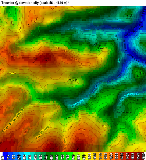
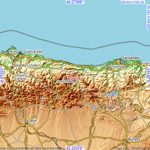
| \ | Map #1 | Topo.Map |
| Scale [m] | 56..1640 m | × |
| Scale [ft] | 184..5381 ft | × |
| Average | 865.5 m = 2840 ft | × |
| Width | 7.12 km = 4.4 mi | 227.7 km = 141.5 mi |
| Height | 7.12 km = 4.4 mi | 227.7 km = 141.5 mi |
| ↑Max Latitude | 43.289526° | 44.27306° |
| Latitude at center | 43.25753° | 43.25753° |
| ↓Min Latitude | 43.225517° | 42.22478° |
| ← Min Longitude | -4.711625° | -6.07393° |
| Longitude center | -4.66768° | -4.66768° |
| →Max Longitude | -4.623735° | -3.26143° |
Nearby cities:
Cities around Tresviso sort by population:
• Llanes elevation 13 m
19.4 km,  338°
338°
• Cabezón de la Sal 130 m
35.4 km,  80°
80°
• San Vicente de la Barquera 10 m
25.9 km,  56°
56°
• Comillas 25 m
33.6 km, 64°
• Carreña 188 m
15.9 km,  294°
294°
• Potes 307 m
12.1 km,  161°
161°
• Ruente 189 m
32.4 km,  89°
89°
• Amieva 599 m
33 km,  267°
267°
• Posada de Valdeón 914 m
23.7 km,  240°
240°
• Oseja de Sajambre 759 m
32.9 km,  245°
245°
• Cabezón de Liébana 354 m
15.6 km,  151°
151°
• Camaleño 424 m
12.1 km,  190°
190°
Multilingual:
 En español:
Tresviso elevación 886 m.
 En France:
Tresviso élévation 886 m.
 Auf Deutsch:
Tresviso höhe über dem Meeresspiegel ist 886 m.

Sources and notes:
- [note 1] Map square and city borders are not equal. Map elevation data is calculated only from area inside that square.
- [src 1] Elevation data from geonames database provided with same terms of usage.
- [src 2] The elevation map of Tresviso is generated using elevation data from NASA's 3 arcsec (90m) resolution SRTM data.
- [src 3] Base (background) map © OpenStreetMap contributors tiles are generated by Geofabrik and OpenTopoMap.
Copyright & License:
This Tresviso Elevation Map is licensed under CC BY-SA. You may reuse any part from this page, if you give a proper credit by linking to this URL:
 More info on terms of use page.