Potes elevation
Potes (Cantabria, Provincia de Cantabria), Spain elevation is 307 meters and Potes elevation in feet is 1007 ft above sea level [src 1]. Potes is a seat of a third-order administrative division (feature code) with elevation that is 296 meters (971 ft) smaller than average city elevation in Spain.
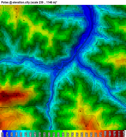
Below is the Elevation map of Potes, which displays elevation range with different colors. Scale of the first map is from 239 to 1146 m (784 to 3760 ft) with average elevation of 550.9 meters (=1807 ft) [note 1]
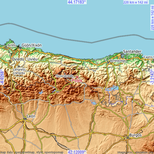
These maps also provides idea of topography and contour of this city, they are displayed at different zoom levels. More info about maps, scale and edge coordinates you can find below images.
| \ | Map #1 | Topo.Map |
| Scale [m] | 239..1146 m | × |
| Scale [ft] | 784..3760 ft | × |
| Average | 550.9 m = 1807 ft | × |
| Width | 7.13 km = 4.4 mi | 228.1 km = 141.7 mi |
| Height | 7.13 km = 4.4 mi | 228.1 km = 141.7 mi |
| ↑Max Latitude | 43.18662° | 44.17183° |
| Latitude at center | 43.15457° | 43.15457° |
| ↓Min Latitude | 43.122503° | 42.12009° |
| ← Min Longitude | -4.664495° | -6.0268° |
| Longitude center | -4.62055° | -4.62055° |
| →Max Longitude | -4.576605° | -3.2143° |
Nearby cities:
Cities around Potes sort by population:
• Llanes elevation 13 m
31.4 km,  339°
339°
• San Vicente de la Barquera 10 m
31.3 km,  34°
34°
• Carreña 188 m
25.7 km,  314°
314°
• Ruesga 1044 m
33.1 km,  167°
167°
• Ruente 189 m
30.8 km,  68°
68°
• Boca de Huérgano 1112 m
31.9 km,  230°
230°
• Posada de Valdeón 914 m
24.4 km,  269°
269°
• Triollo 1300 m
26 km,  190°
190°
• Polentinos 1272 m
25.1 km,  162°
162°
• Tresviso 886 m
12.1 km, 341°
• Camaleño 424 m
6 km, 265°
• Cabezón de Liébana 354 m
4.2 km,  122°
122°
Multilingual:
 En español:
Potes elevación 307 m.
 En France:
Potes élévation 307 m.


Sources and notes:
- [note 1] Map square and city borders are not equal. Map elevation data is calculated only from area inside that square.
- [src 1] Elevation data from geonames database provided with same terms of usage.
- [src 2] The elevation map of Potes is generated using elevation data from NASA's 3 arcsec (90m) resolution SRTM data.
- [src 3] Base (background) map © OpenStreetMap contributors tiles are generated by Geofabrik and OpenTopoMap.
Copyright & License:
This Potes Elevation Map is licensed under CC BY-SA. You may reuse any part from this page, if you give a proper credit by linking to this URL:
 More info on terms of use page.