Gordoncillo elevation
Gordoncillo (Castille and León, Provincia de León), Spain elevation is 753 meters and Gordoncillo elevation in feet is 2470 ft above sea level [src 1]. Gordoncillo is a seat of a third-order administrative division (feature code) with elevation that is 150 meters (492 ft) bigger than average city elevation in Spain.
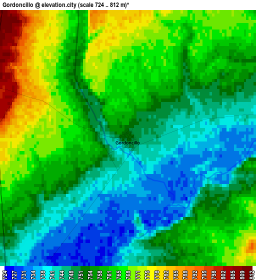
Below is the Elevation map of Gordoncillo, which displays elevation range with different colors. Scale of the first map is from 724 to 812 m (2375 to 2664 ft) with average elevation of 756.2 meters (=2481 ft) [note 1]
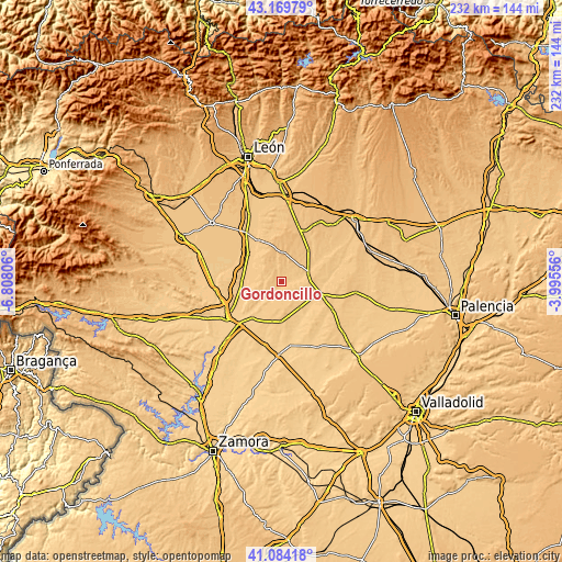
These maps also provides idea of topography and contour of this city, they are displayed at different zoom levels. More info about maps, scale and edge coordinates you can find below images.
| \ | Map #1 | Topo.Map |
| Scale [m] | 724..812 m | × |
| Scale [ft] | 2375..2664 ft | × |
| Average | 756.2 m = 2481 ft | × |
| Width | 7.25 km = 4.5 mi | 231.9 km = 144.1 mi |
| Height | 7.25 km = 4.5 mi | 231.9 km = 144.1 mi |
| ↑Max Latitude | 42.16815° | 43.16979° |
| Latitude at center | 42.13557° | 42.13557° |
| ↓Min Latitude | 42.102974° | 41.08418° |
| ← Min Longitude | -5.445755° | -6.80806° |
| Longitude center | -5.40181° | -5.40181° |
| →Max Longitude | -5.357865° | -3.99556° |
Nearby cities:
Cities around Gordoncillo sort by population:
• Valderas elevation 755 m
7.2 km,  208°
208°
• Mayorga 780 m
12 km,  73°
73°
• Izagre 785 m
15.5 km,  50°
50°
• Valdunquillo 739 m
12.7 km,  144°
144°
• Valdescorriel 736 m
15.4 km,  215°
215°
• Campazas 775 m
7.6 km,  275°
275°
• Urones de Castroponce 751 m
10.7 km,  112°
112°
• Villabraz 847 m
12.9 km,  343°
343°
• Castrobol 771 m
7.2 km,  88°
88°
• Valdemora 779 m
7 km, 342°
• Castilfalé 828 m
9.5 km,  350°
350°
• Fuentes de Carbajal 809 m
5.9 km,  322°
322°
Multilingual:
 En español:
Gordoncillo elevación 753 m.
 En France:
Gordoncillo élévation 753 m.
 Auf Deutsch:
Gordoncillo höhe über dem Meeresspiegel ist 753 m.

Sources and notes:
- [note 1] Map square and city borders are not equal. Map elevation data is calculated only from area inside that square.
- [src 1] Elevation data from geonames database provided with same terms of usage.
- [src 2] The elevation map of Gordoncillo is generated using elevation data from NASA's 3 arcsec (90m) resolution SRTM data.
- [src 3] Base (background) map © OpenStreetMap contributors tiles are generated by Geofabrik and OpenTopoMap.
Copyright & License:
This Gordoncillo Elevation Map is licensed under CC BY-SA. You may reuse any part from this page, if you give a proper credit by linking to this URL:
 More info on terms of use page.