Labuerda elevation
Labuerda (Aragon, Provincia de Huesca), Spain elevation is 565 meters and Labuerda elevation in feet is 1854 ft above sea level [src 1]. Labuerda is a seat of a third-order administrative division (feature code) with elevation that is 38 meters (125 ft) smaller than average city elevation in Spain.
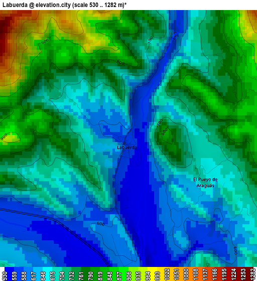
Below is the Elevation map of Labuerda, which displays elevation range with different colors. Scale of the first map is from 530 to 1282 m (1739 to 4206 ft) with average elevation of 708.2 meters (=2323 ft) [note 1]
These maps also provides idea of topography and contour of this city, they are displayed at different zoom levels. More info about maps, scale and edge coordinates you can find below images.
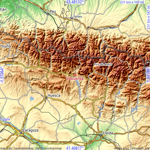
| \ | Map #1 | Topo.Map |
| Scale [m] | 530..1282 m | × |
| Scale [ft] | 1739..4206 ft | × |
| Average | 708.2 m = 2323 ft | × |
| Width | 7.21 km = 4.5 mi | 230.7 km = 143.4 mi |
| Height | 7.21 km = 4.5 mi | 230.7 km = 143.4 mi |
| ↑Max Latitude | 42.484756° | 43.48132° |
| Latitude at center | 42.45234° | 42.45234° |
| ↓Min Latitude | 42.419907° | 41.40617° |
| ← Min Longitude | 0.091665° | -1.27064° |
| Longitude center | 0.13561° | 0.13561° |
| →Max Longitude | 0.179555° | 1.54186° |
Nearby cities:
Cities around Labuerda sort by population:
• Aínsa elevation 576 m
4.1 km,  174°
174°
• Boltaña 654 m
5.6 km,  262°
262°
• Bielsa 1034 m
21.3 km,  18°
18°
• Plan 1123 m
21.9 km,  49°
49°
• Fiscal 767 m
21.6 km,  282°
282°
• Laspuña 714 m
5.9 km, 15°
• Puértolas 1157 m
10.6 km,  358°
358°
• Gistaín 1406 m
22.5 km, 46°
• Abizanda 627 m
23.9 km, 167°
• Bárcabo 720 m
24 km,  193°
193°
• Palo 705 m
16.9 km,  148°
148°
• Campo 691 m
21.9 km,  102°
102°
Multilingual:
 En español:
Labuerda elevación 565 m.
 En France:
Labuerda élévation 565 m.
 Auf Deutsch:
Labuerda höhe über dem Meeresspiegel ist 565 m.

Sources and notes:
- [note 1] Map square and city borders are not equal. Map elevation data is calculated only from area inside that square.
- [src 1] Elevation data from geonames database provided with same terms of usage.
- [src 2] The elevation map of Labuerda is generated using elevation data from NASA's 3 arcsec (90m) resolution SRTM data.
- [src 3] Base (background) map © OpenStreetMap contributors tiles are generated by Geofabrik and OpenTopoMap.
Copyright & License:
This Labuerda Elevation Map is licensed under CC BY-SA. You may reuse any part from this page, if you give a proper credit by linking to this URL:
 More info on terms of use page.