Bárcabo elevation
Bárcabo (Aragon, Provincia de Huesca), Spain elevation is 720 meters and Bárcabo elevation in feet is 2362 ft above sea level [src 1]. Bárcabo is a seat of a third-order administrative division (feature code) with elevation that is 117 meters (384 ft) bigger than average city elevation in Spain.
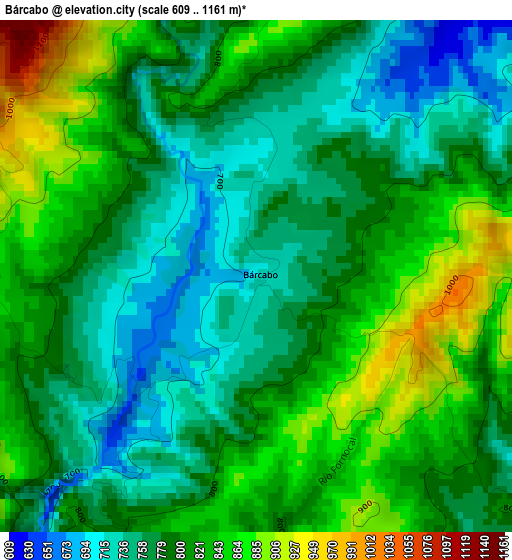
Below is the Elevation map of Bárcabo, which displays elevation range with different colors. Scale of the first map is from 609 to 1161 m (1998 to 3809 ft) with average elevation of 798.1 meters (=2618 ft) [note 1]
These maps also provides idea of topography and contour of this city, they are displayed at different zoom levels. More info about maps, scale and edge coordinates you can find below images.
| \ | Map #1 | Topo.Map |
| Scale [m] | 609..1161 m | × |
| Scale [ft] | 1998..3809 ft | × |
| Average | 798.1 m = 2618 ft | × |
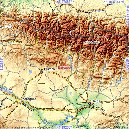
| Width | 7.23 km = 4.5 mi | 231.5 km = 143.8 mi |
| Height | 7.23 km = 4.5 mi | 231.5 km = 143.8 mi |
| ↑Max Latitude | 42.274715° | 43.27465° |
| Latitude at center | 42.24219° | 42.24219° |
| ↓Min Latitude | 42.209648° | 41.19255° |
| ← Min Longitude | 0.025395° | -1.33691° |
| Longitude center | 0.06934° | 0.06934° |
| →Max Longitude | 0.113285° | 1.47559° |
Nearby cities:
Cities around Bárcabo sort by population:
• Salas Altas elevation 503 m
14.2 km,  180°
180°
• Alquézar 637 m
8.5 km,  204°
204°
• Naval 630 m
8.6 km,  127°
127°
• Abiego 539 m
17.6 km,  220°
220°
• Bierge 593 m
15.4 km,  234°
234°
• Pozán de Vero 412 m
18.1 km,  190°
190°
• Adahuesca 618 m
12.4 km,  210°
210°
• Salas Bajas 460 m
15.8 km, 175°
• Secastilla 610 m
17.7 km,  112°
112°
• Colungo 621 m
7.9 km, 180°
• Abizanda 627 m
10.5 km,  89°
89°
• Palo 705 m
16.9 km,  58°
58°
Multilingual:
 En español:
Bárcabo elevación 720 m.
 En France:
Bárcabo élévation 720 m.


Sources and notes:
- [note 1] Map square and city borders are not equal. Map elevation data is calculated only from area inside that square.
- [src 1] Elevation data from geonames database provided with same terms of usage.
- [src 2] The elevation map of Bárcabo is generated using elevation data from NASA's 3 arcsec (90m) resolution SRTM data.
- [src 3] Base (background) map © OpenStreetMap contributors tiles are generated by Geofabrik and OpenTopoMap.
Copyright & License:
This Bárcabo Elevation Map is licensed under CC BY-SA. You may reuse any part from this page, if you give a proper credit by linking to this URL:
 More info on terms of use page.