Llimiana elevation
Llimiana (Catalonia, Província de Lleida), Spain elevation is 784 meters and Llimiana elevation in feet is 2572 ft above sea level [src 1]. Llimiana is a seat of a third-order administrative division (feature code) with elevation that is 181 meters (594 ft) bigger than average city elevation in Spain.
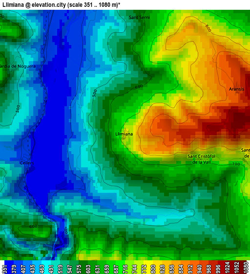
Below is the Elevation map of Llimiana, which displays elevation range with different colors. Scale of the first map is from 351 to 1080 m (1152 to 3543 ft) with average elevation of 597.1 meters (=1959 ft) [note 1]
These maps also provides idea of topography and contour of this city, they are displayed at different zoom levels. More info about maps, scale and edge coordinates you can find below images.
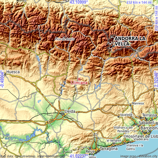
| \ | Map #1 | Topo.Map |
| Scale [m] | 351..1080 m | × |
| Scale [ft] | 1152..3543 ft | × |
| Average | 597.1 m = 1959 ft | × |
| Width | 7.25 km = 4.5 mi | 232.1 km = 144.2 mi |
| Height | 7.25 km = 4.5 mi | 232.1 km = 144.2 mi |
| ↑Max Latitude | 42.107371° | 43.10999° |
| Latitude at center | 42.07476° | 42.07476° |
| ↓Min Latitude | 42.042132° | 41.02237° |
| ← Min Longitude | 0.872265° | -0.49004° |
| Longitude center | 0.91621° | 0.91621° |
| →Max Longitude | 0.960155° | 2.32246° |
Nearby cities:
Cities around Llimiana sort by population:
• Tremp elevation 475 m
10.4 km,  350°
350°
• Artesa de Segre 333 m
22.7 km,  151°
151°
• Ponts 364 m
28.4 km,  128°
128°
• Camarasa 294 m
22.4 km,  188°
188°
• Os de Balaguer 462 m
27.7 km,  215°
215°
• Àger 579 m
14.9 km,  236°
236°
• Cubells 493 m
25.2 km,  171°
171°
• Castigaleu 835 m
31.3 km,  297°
297°
• Tiurana 645 m
30.2 km,  111°
111°
• Sopeira 714 m
30.3 km,  332°
332°
• Senterada 733 m
27.9 km,  3°
3°
• Areny de Noguera / Arén 710 m
26 km,  321°
321°
Multilingual:
 En español:
Llimiana elevación 784 m.
 En France:
Llimiana élévation 784 m.
 Auf Deutsch:
Llimiana höhe über dem Meeresspiegel ist 784 m.

Sources and notes:
- [note 1] Map square and city borders are not equal. Map elevation data is calculated only from area inside that square.
- [src 1] Elevation data from geonames database provided with same terms of usage.
- [src 2] The elevation map of Llimiana is generated using elevation data from NASA's 3 arcsec (90m) resolution SRTM data.
- [src 3] Base (background) map © OpenStreetMap contributors tiles are generated by Geofabrik and OpenTopoMap.
Copyright & License:
This Llimiana Elevation Map is licensed under CC BY-SA. You may reuse any part from this page, if you give a proper credit by linking to this URL:
 More info on terms of use page.