Lodosa elevation
Lodosa (Navarre, Provincia de Navarra), Spain elevation is 321 meters and Lodosa elevation in feet is 1053 ft above sea level [src 1]. Lodosa is a seat of a third-order administrative division (feature code) with elevation that is 282 meters (925 ft) smaller than average city elevation in Spain.
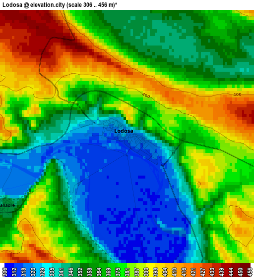
Below is the Elevation map of Lodosa, which displays elevation range with different colors. Scale of the first map is from 306 to 456 m (1004 to 1496 ft) with average elevation of 366 meters (=1201 ft) [note 1]
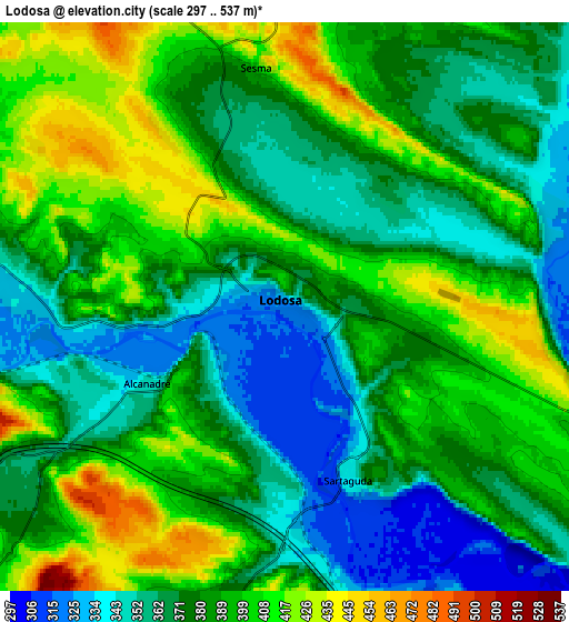
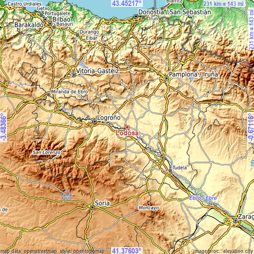
These maps also provides idea of topography and contour of this city, they are displayed at different zoom levels. More info about maps, scale and edge coordinates you can find below images.
| \ | Map #1 | Map #2 | Topo.Map |
| Scale [m] | 306..456 m | 297..537 m | × |
| Scale [ft] | 1004..1496 ft | 974..1762 ft | × |
| Average | 366 m = 1201 ft | 381.8 m = 1253 ft | × |
| Width | 7.21 km = 4.5 mi | 14.43 km = 9 mi | 230.8 km = 143.4 mi |
| Height | 7.21 km = 4.5 mi | 14.43 km = 9 mi | 230.8 km = 143.4 mi |
| ↑Max Latitude | 42.455122° | 42.487536° | 43.45217° |
| Latitude at center | 42.42269° | 42.42269° | 42.42269° |
| ↓Min Latitude | 42.390242° | 42.357777° | 41.37603° |
| ← Min Longitude | -2.121355° | -2.165301° | -3.48366° |
| Longitude center | -2.07741° | -2.07741° | -2.07741° |
| →Max Longitude | -2.033465° | -1.989519° | -0.67116° |
Nearby cities:
Cities around Lodosa sort by population:
• Mendavia elevation 352 m
10.4 km,  282°
282°
• Pradejón 364 m
9.8 km,  175°
175°
• Lerín 442 m
11 km,  52°
52°
• Sesma 431 m
6.1 km,  355°
355°
• Sartaguda 338 m
4.7 km,  159°
159°
• Cárcar 401 m
8.7 km,  112°
112°
• Ausejo 526 m
11.6 km,  219°
219°
• Alcanadre 348 m
4.1 km,  240°
240°
• Arrúbal 356 m
14.3 km, 275°
• Tudelilla 544 m
14 km,  193°
193°
• Corera 527 m
14.7 km,  233°
233°
• Andosilla 316 m
12.2 km, 114°
Multilingual:
 En español:
Lodosa elevación 321 m.
 En France:
Lodosa élévation 321 m.


Sources and notes:
- [note 1] Map square and city borders are not equal. Map elevation data is calculated only from area inside that square.
- [src 1] Elevation data from geonames database provided with same terms of usage.
- [src 2] The elevation map of Lodosa is generated using elevation data from NASA's 3 arcsec (90m) resolution SRTM data.
- [src 3] Base (background) map © OpenStreetMap contributors tiles are generated by Geofabrik and OpenTopoMap.
Copyright & License:
This Lodosa Elevation Map is licensed under CC BY-SA. You may reuse any part from this page, if you give a proper credit by linking to this URL:
 More info on terms of use page.