Majadahonda elevation
Majadahonda (Madrid, Provincia de Madrid), Spain elevation is 743 meters and Majadahonda elevation in feet is 2438 ft above sea level [src 1]. Majadahonda is a seat of a third-order administrative division (feature code) with elevation that is 140 meters (459 ft) bigger than average city elevation in Spain.
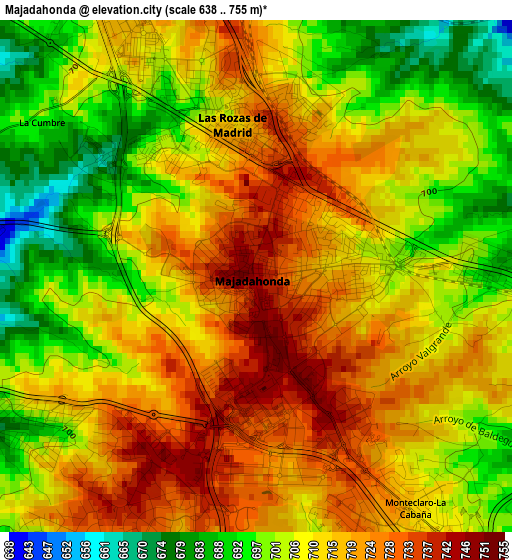
Below is the Elevation map of Majadahonda, which displays elevation range with different colors. Scale of the first map is from 638 to 755 m (2093 to 2477 ft) with average elevation of 710.3 meters (=2330 ft) [note 1]
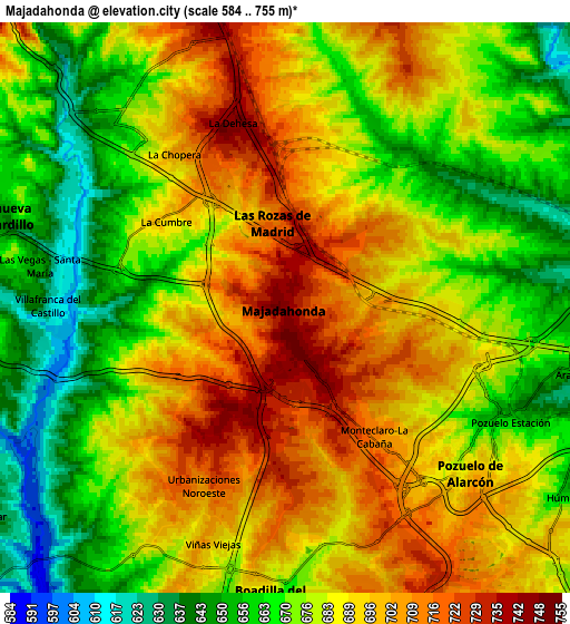
These maps also provides idea of topography and contour of this city, they are displayed at different zoom levels. More info about maps, scale and edge coordinates you can find below images.
| \ | Map #1 | Map #2 | Topo.Map |
| Scale [m] | 638..755 m | 584..755 m | × |
| Scale [ft] | 2093..2477 ft | 1916..2477 ft | × |
| Average | 710.3 m = 2330 ft | 682.6 m = 2240 ft | × |
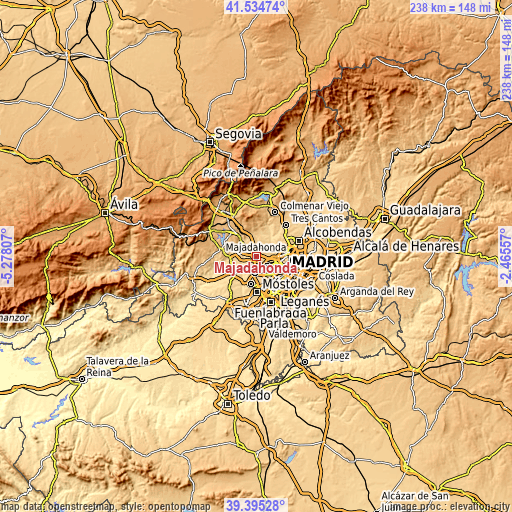
| Width | 7.43 km = 4.6 mi | 14.87 km = 9.2 mi | 237.9 km = 147.8 mi |
| Height | 7.43 km = 4.6 mi | 14.87 km = 9.2 mi | 237.9 km = 147.8 mi |
| ↑Max Latitude | 40.506951° | 40.540356° | 41.53474° |
| Latitude at center | 40.47353° | 40.47353° | 40.47353° |
| ↓Min Latitude | 40.440092° | 40.406638° | 39.39528° |
| ← Min Longitude | -3.915765° | -3.959711° | -5.27807° |
| Longitude center | -3.87182° | -3.87182° | -3.87182° |
| →Max Longitude | -3.827875° | -3.783929° | -2.46557° |
Nearby cities:
Cities around Majadahonda sort by population:
• Fuencarral-El Pardo elevation 687 m
12.2 km,  76°
76°
• Moncloa-Aravaca 615 m
12.6 km,  109°
109°
• Las Rozas de Madrid 718 m
2.2 km,  355°
355°
• Pozuelo de Alarcón 704 m
6.7 km,  132°
132°
• Boadilla del Monte 678 m
7.6 km,  184°
184°
• Villaviciosa de Odón 648 m
13.1 km,  192°
192°
• Torrelodones 856 m
12.4 km,  337°
337°
• Villanueva de la Cañada 655 m
11.6 km,  255°
255°
• Villanueva del Pardillo 654 m
8 km,  283°
283°
• Las Matas 736 m
9.5 km,  349°
349°
• Brunete 654 m
13.1 km,  234°
234°
• El Pardo 609 m
9.6 km,  61°
61°
Multilingual:
 En español:
Majadahonda elevación 743 m.
 En France:
Majadahonda élévation 743 m.
 Auf Deutsch:
Majadahonda höhe über dem Meeresspiegel ist 743 m.

Sources and notes:
- [note 1] Map square and city borders are not equal. Map elevation data is calculated only from area inside that square.
- [src 1] Elevation data from geonames database provided with same terms of usage.
- [src 2] The elevation map of Majadahonda is generated using elevation data from NASA's 3 arcsec (90m) resolution SRTM data.
- [src 3] Base (background) map © OpenStreetMap contributors tiles are generated by Geofabrik and OpenTopoMap.
Copyright & License:
This Majadahonda Elevation Map is licensed under CC BY-SA. You may reuse any part from this page, if you give a proper credit by linking to this URL:
 More info on terms of use page.