Brunete elevation
Brunete (Madrid, Provincia de Madrid), Spain elevation is 654 meters and Brunete elevation in feet is 2146 ft above sea level [src 1]. Brunete is a seat of a third-order administrative division (feature code) with elevation that is 51 meters (167 ft) bigger than average city elevation in Spain.
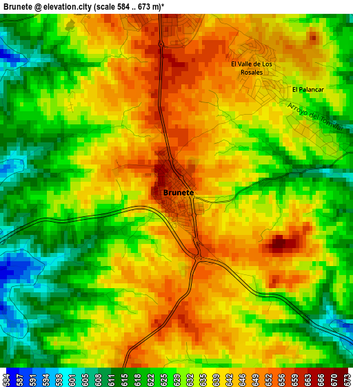
Below is the Elevation map of Brunete, which displays elevation range with different colors. Scale of the first map is from 584 to 673 m (1916 to 2208 ft) with average elevation of 633.6 meters (=2079 ft) [note 1]
These maps also provides idea of topography and contour of this city, they are displayed at different zoom levels. More info about maps, scale and edge coordinates you can find below images.
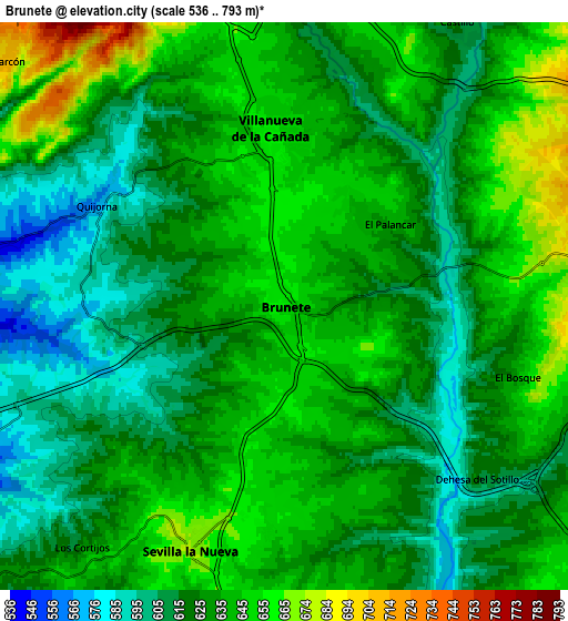
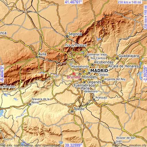
| \ | Map #1 | Map #2 | Topo.Map |
| Scale [m] | 584..673 m | 536..793 m | × |
| Scale [ft] | 1916..2208 ft | 1759..2602 ft | × |
| Average | 633.6 m = 2079 ft | 629.5 m = 2065 ft | × |
| Width | 7.44 km = 4.6 mi | 14.88 km = 9.2 mi | 238.1 km = 147.9 mi |
| Height | 7.44 km = 4.6 mi | 14.88 km = 9.2 mi | 238.1 km = 147.9 mi |
| ↑Max Latitude | 40.438775° | 40.472214° | 41.46761° |
| Latitude at center | 40.40532° | 40.40532° | 40.40532° |
| ↓Min Latitude | 40.371848° | 40.33836° | 39.32599° |
| ← Min Longitude | -4.042445° | -4.086391° | -5.40475° |
| Longitude center | -3.9985° | -3.9985° | -3.9985° |
| →Max Longitude | -3.954555° | -3.910609° | -2.59225° |
Nearby cities:
Cities around Brunete sort by population:
• Majadahonda elevation 743 m
13.1 km,  54°
54°
• Boadilla del Monte 678 m
10.2 km,  90°
90°
• Villaviciosa de Odón 648 m
9.6 km,  123°
123°
• Navalcarnero 663 m
13 km,  185°
185°
• Villanueva de la Cañada 655 m
4.6 km,  353°
353°
• Villanueva del Pardillo 654 m
9.9 km,  17°
17°
• Valdemorillo 811 m
12.1 km,  331°
331°
• Sevilla La Nueva 675 m
6.8 km,  200°
200°
• Quijorna 572 m
5.5 km,  296°
296°
• Navalagamella 760 m
12.7 km, 303°
• Villanueva de Perales 592 m
10.8 km,  231°
231°
• Villamantilla 550 m
13.4 km,  236°
236°
Multilingual:
 En español:
Brunete elevación 654 m.
 En France:
Brunete élévation 654 m.


Sources and notes:
- [note 1] Map square and city borders are not equal. Map elevation data is calculated only from area inside that square.
- [src 1] Elevation data from geonames database provided with same terms of usage.
- [src 2] The elevation map of Brunete is generated using elevation data from NASA's 3 arcsec (90m) resolution SRTM data.
- [src 3] Base (background) map © OpenStreetMap contributors tiles are generated by Geofabrik and OpenTopoMap.
Copyright & License:
This Brunete Elevation Map is licensed under CC BY-SA. You may reuse any part from this page, if you give a proper credit by linking to this URL:
 More info on terms of use page.