Miengo elevation
Miengo (Cantabria, Provincia de Cantabria), Spain elevation is 25 meters and Miengo elevation in feet is 82 ft above sea level [src 1]. Miengo is a seat of a third-order administrative division (feature code) with elevation that is 578 meters (1896 ft) smaller than average city elevation in Spain.
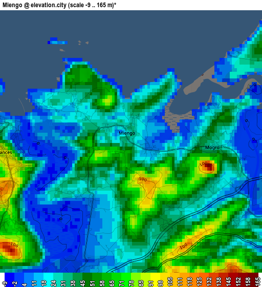
Below is the Elevation map of Miengo, which displays elevation range with different colors. Scale of the first map is from -9 to 165 m (-30 to 541 ft) with average elevation of 34.4 meters (=113 ft) [note 1]
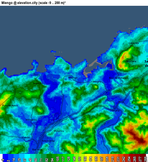
These maps also provides idea of topography and contour of this city, they are displayed at different zoom levels. More info about maps, scale and edge coordinates you can find below images.
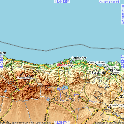
| \ | Map #1 | Map #2 | Topo.Map |
| Scale [m] | -9..165 m | -9..288 m | × |
| Scale [ft] | -30..541 ft | -30..945 ft | × |
| Average | 34.4 m = 113 ft | 60.5 m = 198 ft | × |
| Width | 7.1 km = 4.4 mi | 14.19 km = 8.8 mi | 227.1 km = 141.1 mi |
| Height | 7.1 km = 4.4 mi | 14.19 km = 8.8 mi | 227.1 km = 141.1 mi |
| ↑Max Latitude | 43.460516° | 43.492405° | 44.44125° |
| Latitude at center | 43.42861° | 43.42861° | 43.42861° |
| ↓Min Latitude | 43.396687° | 43.364747° | 42.39874° |
| ← Min Longitude | -4.042605° | -4.086551° | -5.40491° |
| Longitude center | -3.99866° | -3.99866° | -3.99866° |
| →Max Longitude | -3.954715° | -3.910769° | -2.59241° |
Nearby cities:
Cities around Miengo sort by population:
• Santander elevation 28 m
16.2 km,  75°
75°
• Torrelavega 31 m
9.7 km,  204°
204°
• Camargo 32 m
9.5 km,  104°
104°
• El Astillero 33 m
14.7 km, 102°
• Santa Cruz de Bezana 44 m
7.9 km, 77°
• Reocín 105 m
12.6 km,  217°
217°
• Suances 7 m
3.7 km,  278°
278°
• Santillana 84 m
9.9 km,  243°
243°
• Cartes 36 m
12.7 km,  206°
206°
• Puente Viesgo 83 m
14.7 km,  170°
170°
• Penagos 134 m
17.2 km,  119°
119°
• Polanco 53 m
5 km, 196°
Multilingual:
 En español:
Miengo elevación 25 m.
 En France:
Miengo élévation 25 m.


Sources and notes:
- [note 1] Map square and city borders are not equal. Map elevation data is calculated only from area inside that square.
- [src 1] Elevation data from geonames database provided with same terms of usage.
- [src 2] The elevation map of Miengo is generated using elevation data from NASA's 3 arcsec (90m) resolution SRTM data.
- [src 3] Base (background) map © OpenStreetMap contributors tiles are generated by Geofabrik and OpenTopoMap.
Copyright & License:
This Miengo Elevation Map is licensed under CC BY-SA. You may reuse any part from this page, if you give a proper credit by linking to this URL:
 More info on terms of use page.