Outeiro elevation
Outeiro (Galicia, Provincia de Lugo), Spain elevation is 553 meters and Outeiro elevation in feet is 1814 ft above sea level [src 1]. Outeiro is a populated place (feature code) with elevation that is 50 meters (164 ft) smaller than average city elevation in Spain.
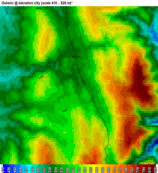
Below is the Elevation map of Outeiro, which displays elevation range with different colors. Scale of the first map is from 410 to 826 m (1345 to 2710 ft) with average elevation of 612.1 meters (=2008 ft) [note 1]
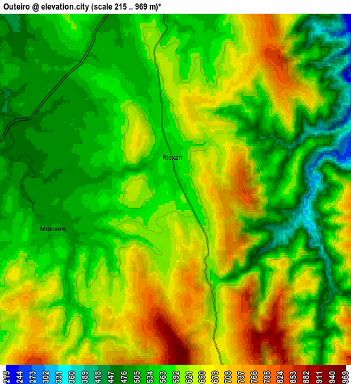
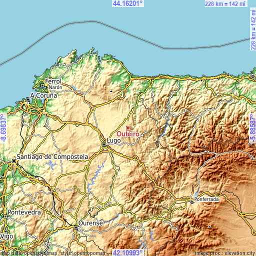
These maps also provides idea of topography and contour of this city, they are displayed at different zoom levels. More info about maps, scale and edge coordinates you can find below images.
| \ | Map #1 | Map #2 | Topo.Map |
| Scale [m] | 410..826 m | 215..969 m | × |
| Scale [ft] | 1345..2710 ft | 705..3179 ft | × |
| Average | 612.1 m = 2008 ft | 591 m = 1939 ft | × |
| Width | 7.13 km = 4.4 mi | 14.26 km = 8.9 mi | 228.2 km = 141.8 mi |
| Height | 7.13 km = 4.4 mi | 14.26 km = 8.9 mi | 228.2 km = 141.8 mi |
| ↑Max Latitude | 43.176635° | 43.208674° | 44.16201° |
| Latitude at center | 43.14458° | 43.14458° | 43.14458° |
| ↓Min Latitude | 43.112508° | 43.080419° | 42.10993° |
| ← Min Longitude | -7.336065° | -7.380011° | -8.69837° |
| Longitude center | -7.29212° | -7.29212° | -7.29212° |
| →Max Longitude | -7.248175° | -7.204229° | -5.88587° |
Nearby cities:
Cities around Outeiro sort by population:
• Lugo elevation 465 m
26.1 km,  235°
235°
• Mos 400 m
21 km,  273°
273°
• Castro de Rei 435 m
11.3 km,  309°
309°
• Fonsagrada 962 m
18.3 km,  97°
97°
• Corgo 441 m
25 km,  206°
206°
• Castroverde 580 m
13 km,  191°
191°
• Puente Nuevo 117 m
24.1 km,  19°
19°
• O Páramo 704 m
21.6 km,  181°
181°
• Meira 483 m
7.6 km,  359°
359°
• Ríotorto 163 m
23.3 km,  11°
11°
• Santa Eulalia de Oscos 558 m
25.6 km,  60°
60°
• Pol 506 m
3.1 km,  278°
278°
Multilingual:
 En español:
Outeiro elevación 553 m.
 En France:
Outeiro élévation 553 m.


Sources and notes:
- [note 1] Map square and city borders are not equal. Map elevation data is calculated only from area inside that square.
- [src 1] Elevation data from geonames database provided with same terms of usage.
- [src 2] The elevation map of Outeiro is generated using elevation data from NASA's 3 arcsec (90m) resolution SRTM data.
- [src 3] Base (background) map © OpenStreetMap contributors tiles are generated by Geofabrik and OpenTopoMap.
Copyright & License:
This Outeiro Elevation Map is licensed under CC BY-SA. You may reuse any part from this page, if you give a proper credit by linking to this URL:
 More info on terms of use page.